
Burra Korain Western Pass
Burra Korain is one of the lesser travelled ridges. The track is indistinct in places and has a couple of options to miss the main ridge and follow a side ridge. This half day trip visited the nose and descended the cliff face on the western side close to the nose to find a new pass. The return to the plateau was via the previously visited nose chimney.
Overview
Burra Korain is one of the lesser travelled ridges in the upper blue mountains. After leaving the fire trail, the single track footpad is indistinct in places and has a couple of options to miss the main ridge and follow a side ridge. This half day trip visited the nose and then descended the cliff face on the western side close to the nose to find a new pass. After contouring North and East, the return to the plateau was via the previously visited nose chimney.
As the pass was more straight forward than expected, we visited Reinets Coalmine on the return trip.
Aerial View
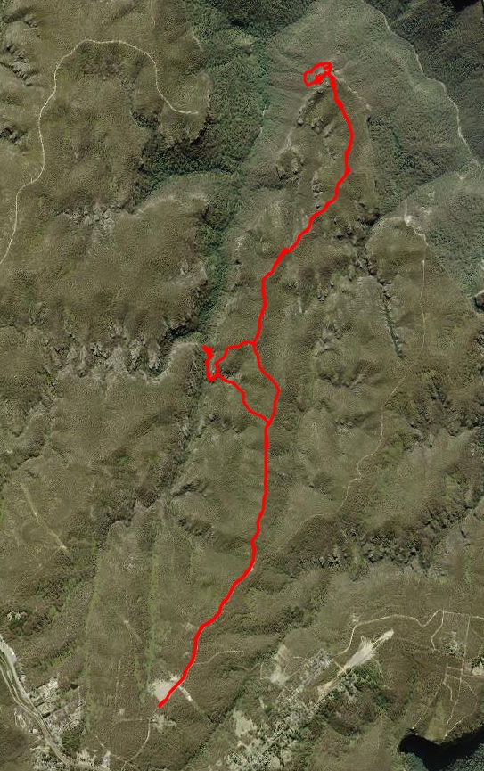
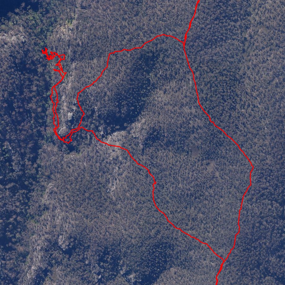
The route starts at the familiar Hanging Rock car park on Ridgewell Road. After 1.5km of firetrail, a further 5-6km of footpad gets to the nose of Burra Korain. After backtracking slightly, we then descended the new pass to the west right down to the talus, and then countoured north to the nose where we ascended the known chimney to loop back to the plateau.
Returning via the same ridge, we took a small detout to visit Reinets Mineshaft in Victoria Creek. After leaving it, rather than return to the same spot where we left the ridge, we headed SE to reach the ridge track about 700m closer to the carpark.
Route
The route starts at the familiar Hanging Rock car park on Ridgewell Road. After 1.5km of firetrail the 2nd gate 5m after the 2nd gate leave the firetrail and head more northerly along a good footpad.
This good footpad lasts for a few km, before becoming vague in places. Fallen trees post the 2019 fires have made it a bit harder to follow especially the last couple of km before the nose. Care is needed at various points to avoid heading off on a side ridge.
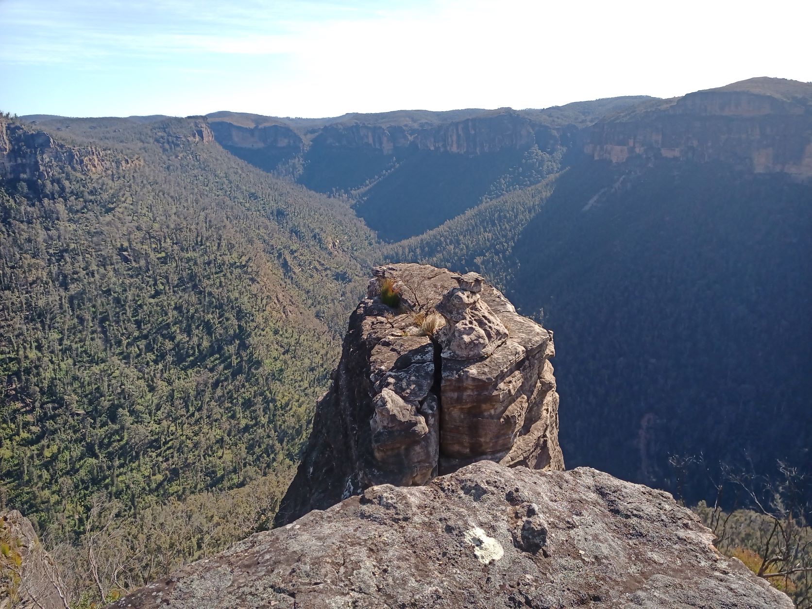
We reached the nose after about an hour of trotting, and took the obligatory photo of the prominent pagoda. Looking back from this pagoda towards Victoria Falls Lookout we could see where the route down the cliff started.
Plan
On a previous visit to Victoria Falls Lookout I had taken a long range photo of Burra Korain head across the valley and marked a rough route down through the cliff lines to the talus. Todays plan was to see if it was possible to find a way through them. It’s usually easier and lower risk to ascend rather than descend. So we planned to descend the known nose route, head West and then South contouring across the talus to approach from below the cliff lines.
The Descent
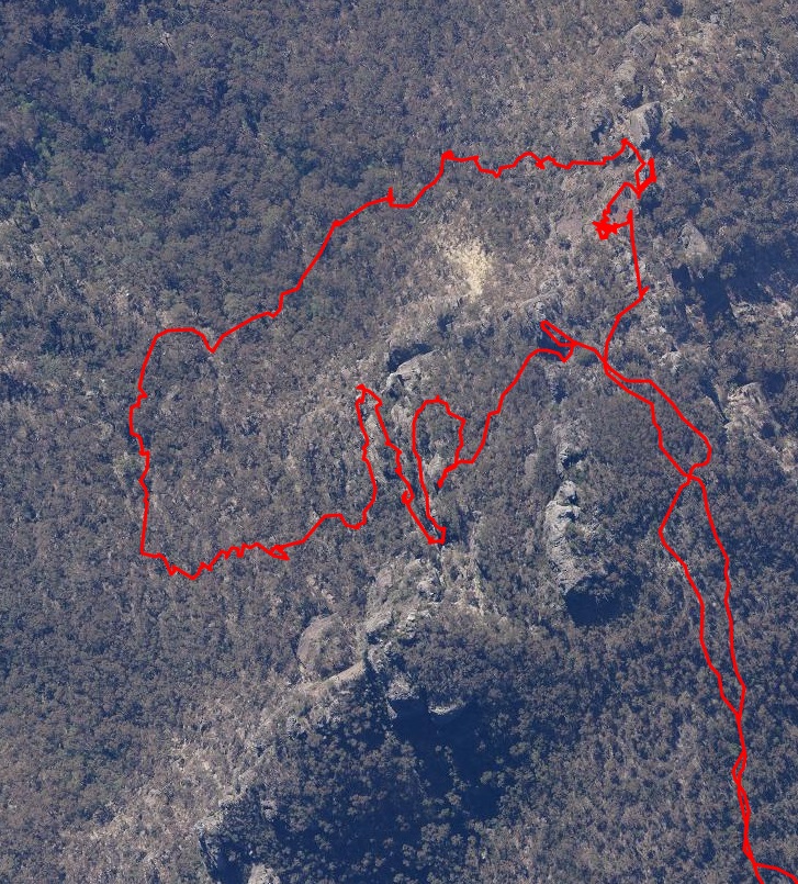
We had planned to approach the cliff from the base. However, the crux appeared to be close to the top, so rather than descend, contour and routefind our way up, we decided to briefly investigate the top section.
The right bit of cliff edge was visible only 120m from the prominent nose pagoda. So we headed over to scope it out. It looked easy to get to the next level with no obvious obstacles beyond… so headed steeply down to try and find anything insurmountable.
We explored a little to the North, but hit a 3m drop we’d be unable to reascend, and besides it looked like another bigger drop a little further down.
So we headed South across the steep talus to approach a narrowish ledge.
It proved straightfoward with only trivial exposure. Looking back it seems as though it doesn’t go anywhere.
We left a v. small cairn on the ledge.
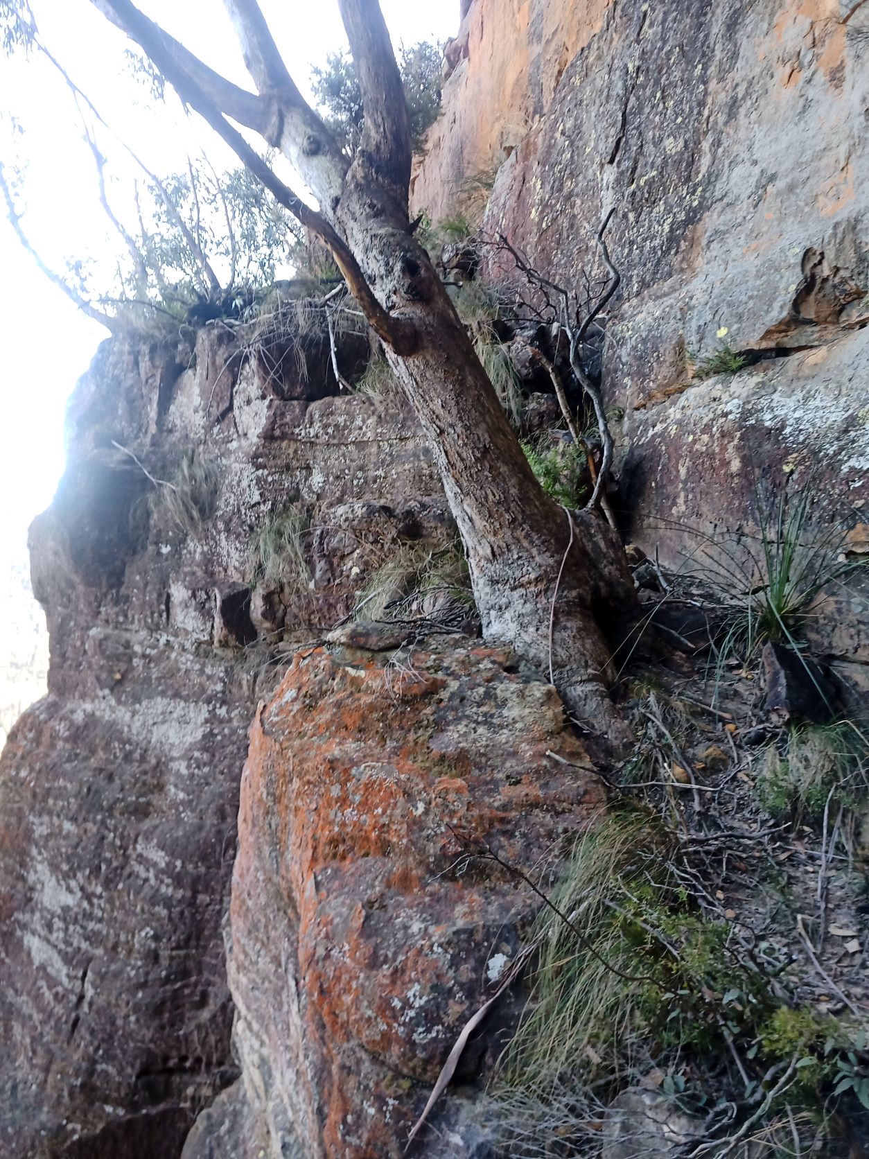
And immediately after that a pair of chutes. The one to the right of this buttress was sandier & steeper.
After consulting a long range photo taken previously from Victoria Falls Lookout, we continued down the talus to avoid potential bluffs.
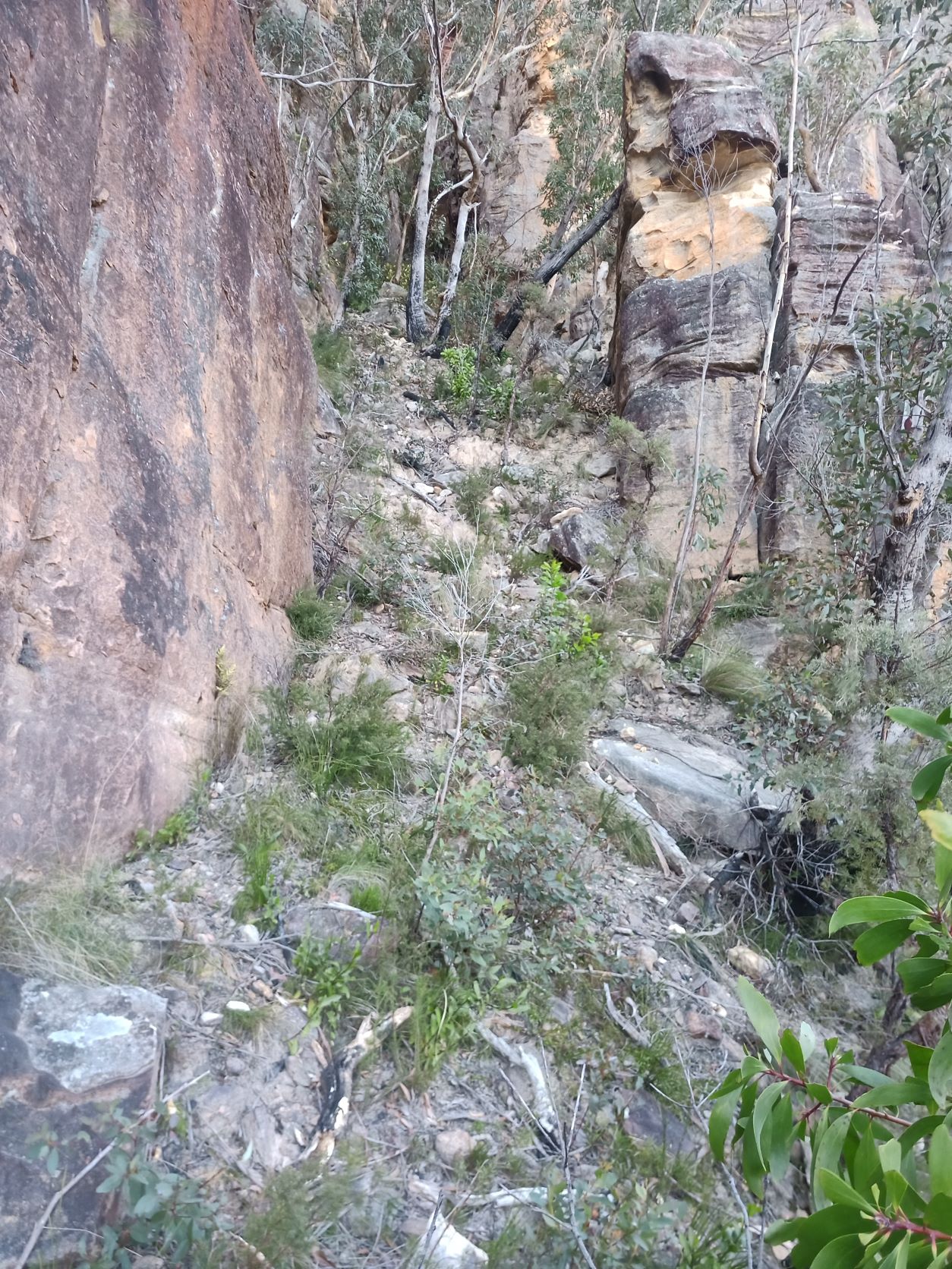
We descended to 150m below the plateau and started to head North through moderate vegetation. From here it was a matter of contouring along talus wherever it was doable.
This talus bashing was suprisingly easy compared to most others in th Grose. It was steep and loose, but there was just enough vegetation to provide handhold and also to stabilise the ground - no more no less.
The Nose
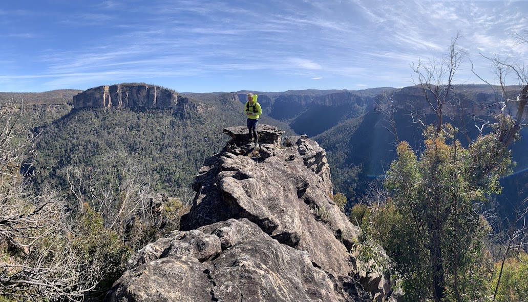
After contouring relatively easily for 30 minutes to the North we began to face Asgard Head rather than Vic Falls LO. From there we tending towards ascending and the two prominent rocks appeared suprisingly close on the skyline. I’ve only ever traversed on the Eastern side of the rocks so ascending from the West would save a hundred meters or so of contouring around the nose.
It proved straightforward with only minor rock scrambles.
The blade of pagoda below the nose is easily accessible - probably a better experience on a less windy day. The cliff on the skyline is Asgard Head with Asgard Mine at the low point near my right elbow.
From the end of the blade the Orphan Rock is framed by Upper Grose River.
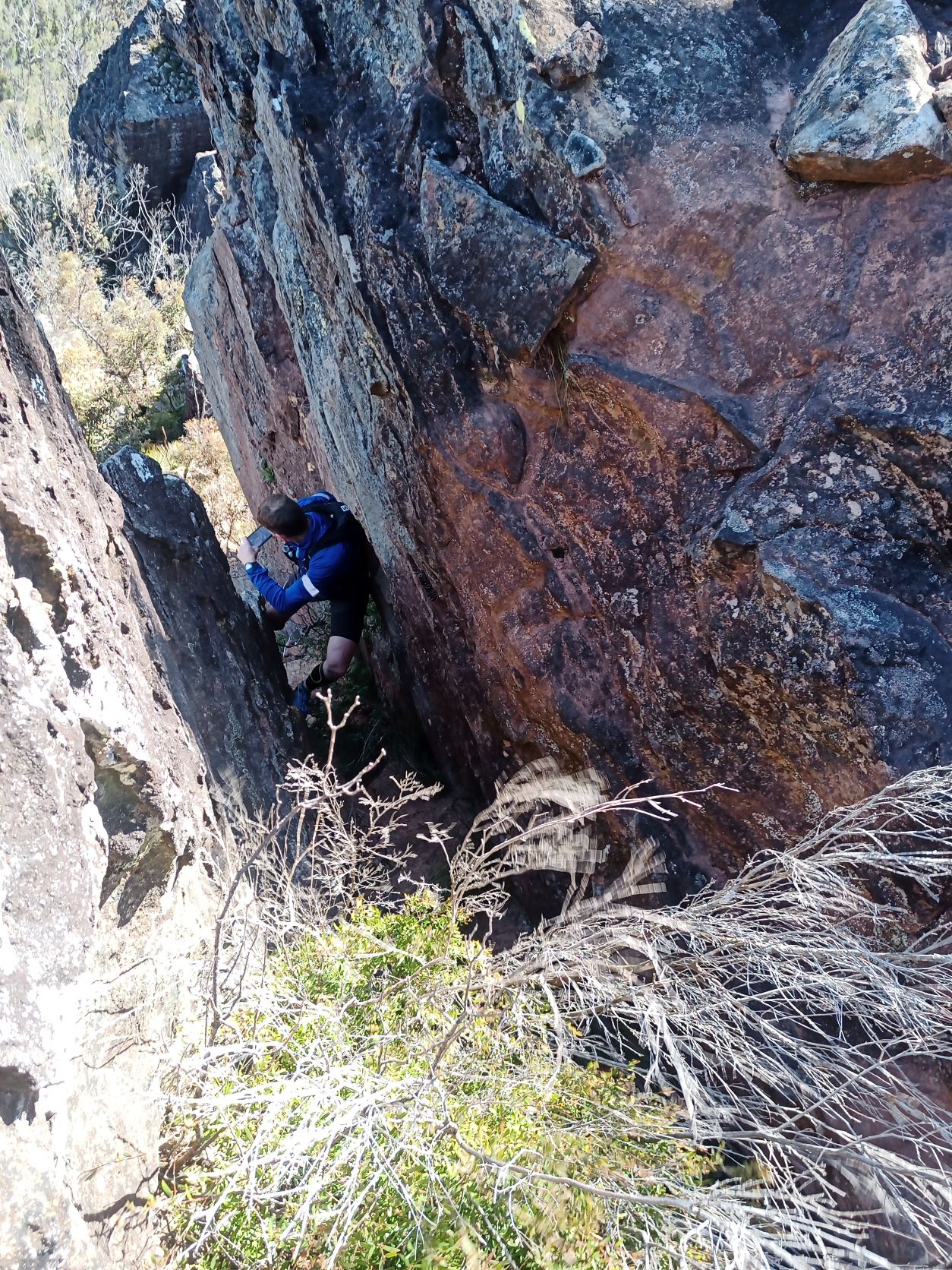
Ascent of the Nose
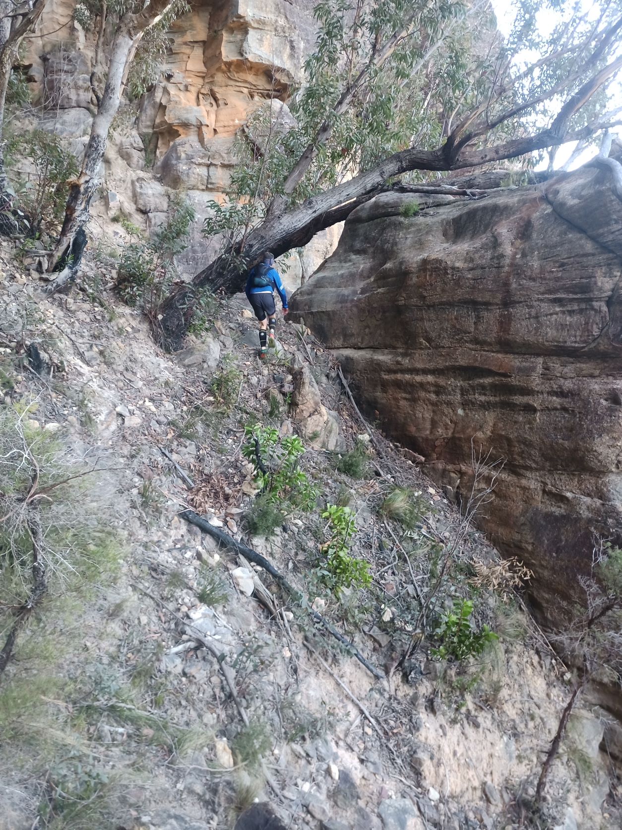
Immediately South is the 20m slab that marks the start of the exit to the plateau. We followed the thin ledge at the base around to the West avoiding the grass trees. Climbing slightly until we could go no further.
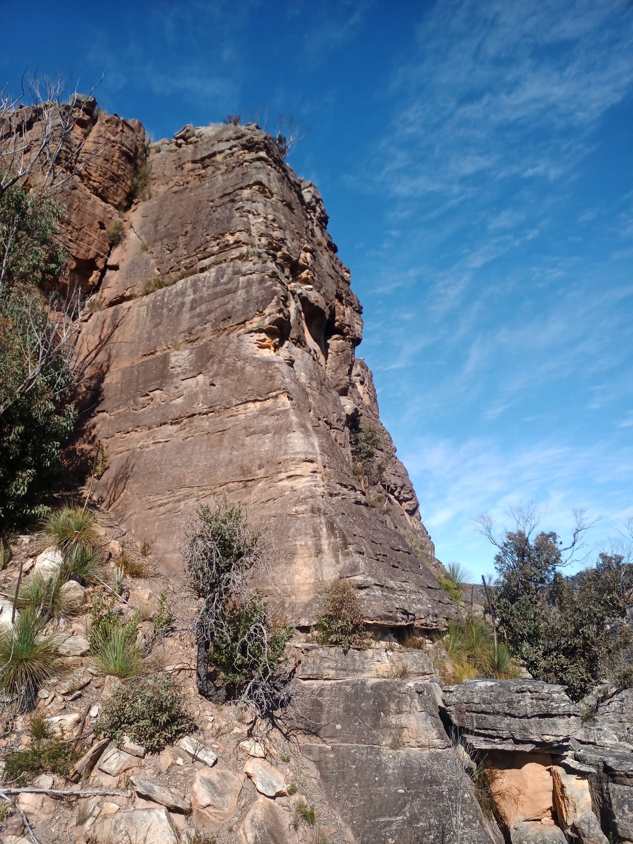
The pleasant chimney backed by blue sky is obvious. It’s perfect width for climbing, with good holds that aren’t really essential. There’s a useful platform halfway to pause and admire the view.
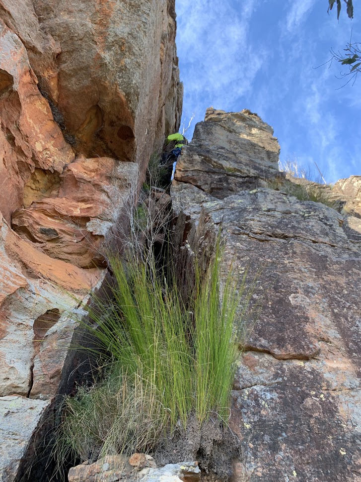
From the edge of the plateau it looks a bit more daunting, but the exposure level is mostly trivial.
Side trip to Reinets Mineshaft
The trip so far had taken about 3 hours, so we had plenty of time for a side trip to visit Reinets Mineshaft in Victoria Creek.
There is an easily missable cairn to mark the Westerly ridge down towards Victoria Creek. Then bearing South a wide ramp leads down to mostly grassy with a pretty creek and small green swamp and waterfall. The obvious good ledge around the base of the cliff is easy to spot. Then we immediately headed for the large tree that assists with a step down to the talus.
We followed the easy narrow footpad along the base of the cliff for 200m passing a swampy section under a drip. Then at the smooth and slightly knobbly pale wall another barely visible cairn marks the route straight down the talus.
The last 10m into the creek is scrubby, bonus points if you find the tree roots to assist the final few steps. And within 15m on level dark rock the shaft appears behind a few ferns.
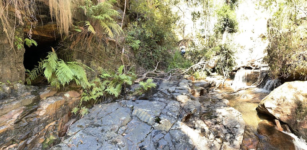
The creek is pretty - low cascades interspersed with flat shallow water. Keeping feet dry is easy provided you hit the creek at exactly the right spot. Hit it too far downstream and it’s an impossible 10m cliff directly above the shaft to reach the creek, hit it too high and it’s a choice between a couple of wades or a squeeze behind a massive boulder on the true right.
The shaft is low with mostly ankle deep water. It is dead straight and goes horizontally for 30m. The coal seems to be low grade - maybe why there are no side tunnels. Or maybe the difficulty of getting it out to the townships was the reason it wasn’t bigger ?.
Exit
After retracing our steps back to the ledge and the pretty side creek, we contoured around the bowl, crossed the creek easily past the noisy frogs and followed the gentle ridge back up to the trail. It’s easy nav along the ridge - a much better way to get directly to the mineshaft than following the main trail right to the cairn.
Stats
A little under 5 Hours
Distance 17km
Ascent 700m