Longer Runs in Blue Mountains
A collection of longer runs around the Blue Mountains, including UTA options, Hanging Rock, Grand Canyon, Narrowneck, a few around the Grose Valley.
Note that often NPWS close tracks at short notice, especially if heavy rain is expected.
They mostly close the passes and any touristy descents into the valleys.
Many of these runs are currently closed (Winter 2022). Check NPWS Alerts Page before heading out.
Routes
Various Trail Running Routes in the Upper Blue Mountains.
A few require a car shuffle or pick up, but most are out & back or a loop.
…or consider linking up with another of these runs.
Grand Canyon Loop
Not really a long run distance-wise, but there’s plenty of (both varieties of) stairs and lots of photo stops.
Approx 7km circuit starting on Evans Lookout Rd. Keen runners can then immediately reverse it. Or it’s easy to combine it with a cliff top run to Govetts, or a Braeside loop.
Can be done in either direction starting at any of the three NPWS car parks.
Best done so you finish by 9AM or start after 4PM to avoid the tourists.
50 minutes for the loop is a cracking pace, but there’s plenty of opportunity to go slow and take some photos.
Hanging Rock Out and Back
Easy rolling fire trail for 5km each way, the only two hills are short and steep. Start at the car park in Ridgewell Road, Blackheath.
Great views at the end.
Worth taking a camera and heading left for 50m down the slope when you get the the cliff.
First half of UTA 50
The 3rd biggest trail run in the world. The 50km course is open to the public every day.
The first 25km follows the cliff tops (with one descent to the valley floor) and lots of smaller descents into creeks. Then continues to the UTA22 course.
Spectacular views from much of the course
Note that the UTA changes the courses most years for various reasons, so this is unlikely to be the current course.
UTA 22 (2020 Course)
It starts at the fork in the road at old Queen Victoria Hospital on Kedumba, where there’s plenty of parking.
The 3rd biggest trail run in the world. The 22km course is open to the public every day.
Starts with 2-3km of mostly flat, followed by a quad-busting 800m descent over 5km of fire trail. And it gets worse from there…
Spectacular views above you from much of the course

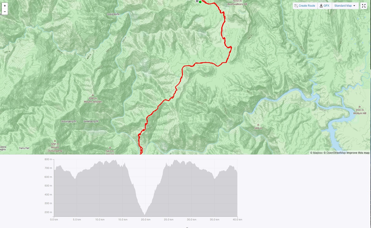
Megalong Mega Out and Back
This starts on Megalong Road and follows the Six Foot Track all the way to Jenolan. Good running over fire trails and single track. If the Coxs is in flood, use the swing bridge (one at once).
As it’s an out & back, the distance is anything up to 50km return. The swing bridge is about 7km into it. The alternative is the river crossing - a further 1km.
From the river crossing it’s a looong and uninspiring uphill grind.
Grose Triple Out and Back
Three classic ascents & descents of the Grose Valley - Govetts Leap, Lockleys Pylon and Perrys Lookdown. Park at any of them and do them in any order as many or as few times as you like.
As an aside, doing just Perrys is about 2.7km and 600m of ascent. It’s anything from 75 minutes to three hours return trip… might be a candidate for an Everest. That’s about 15 ascents to make the 8800m.
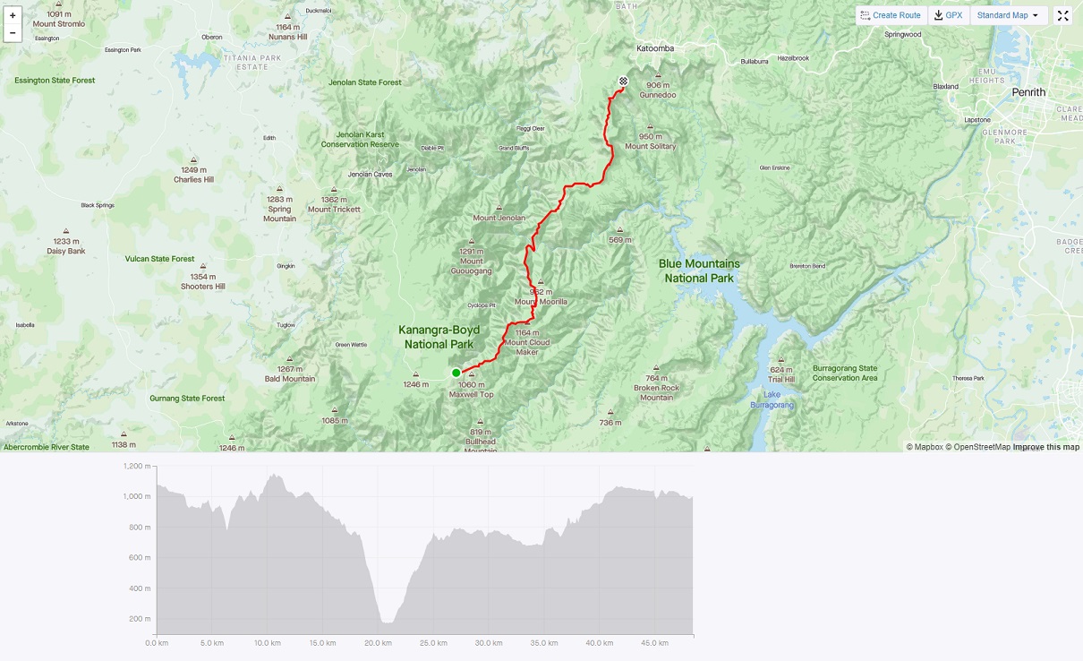
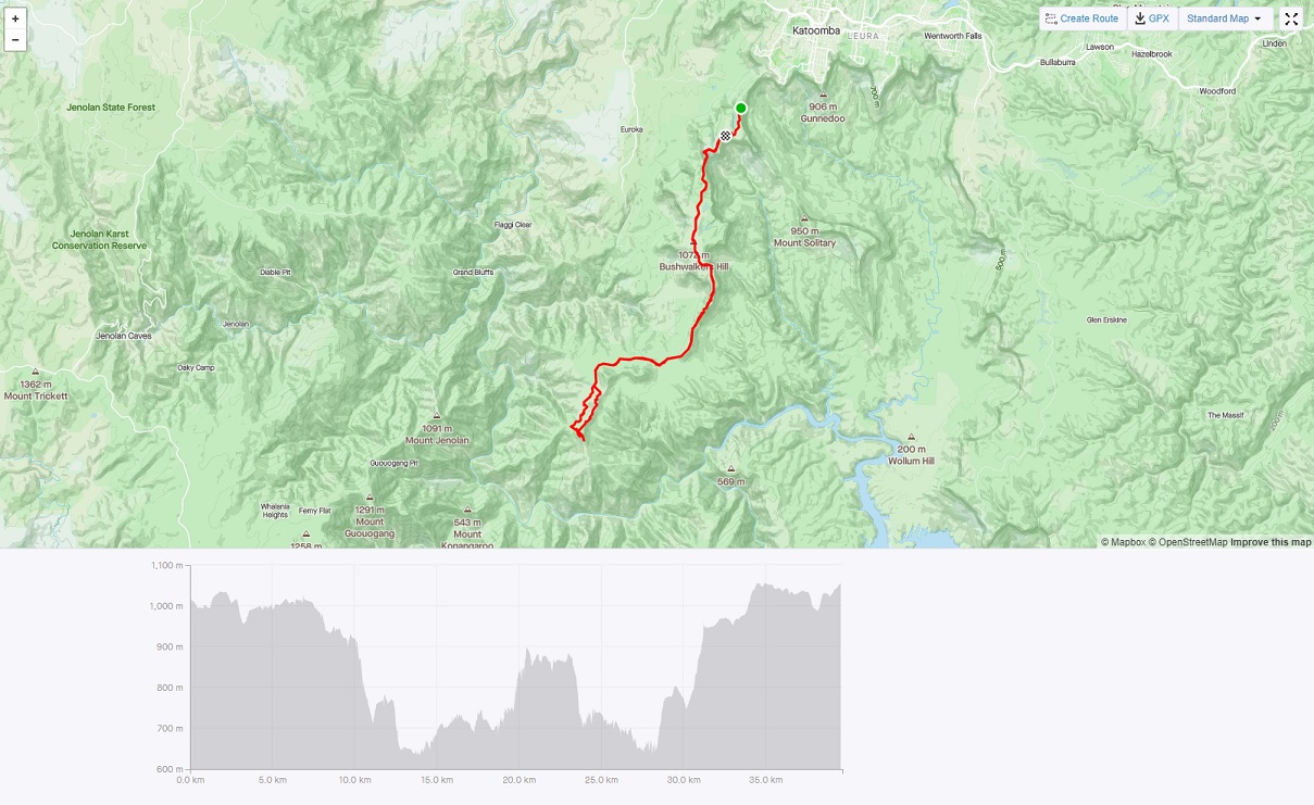
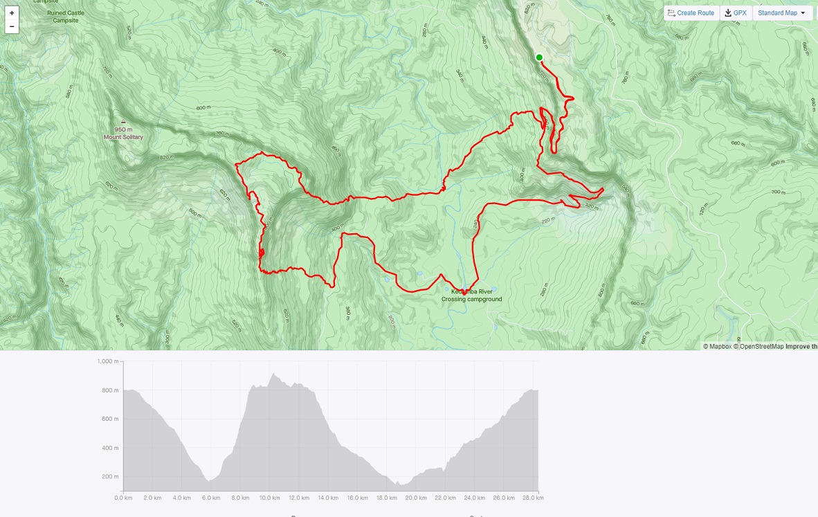
Kanangra to Katoomba (K2K)
50km one way. Tricky navigation, solid wilderness, lots of vert, little chance of meeting anyone, very occasional phone reception. Normally a 3 day walk, expect to take 12+ hours if running the few runnable bits. A classic Blue Mountains adventure.
For the masochists the K2K2K is exactly double that, and doesn’t require a car shuffle!
Narrowneck to Spendour Rock Out and Back
Trailrunners classic. 40km - half on firetrail, half on single track with some rough climbs, but mostly undulating. Excellent views for much of it. Ends at the Bushwalkers memorial at Splendour Rock, which has views and then more views.
A slightly shorter alternative with less vert is to start at Dunphys campsite.
Wolgan River Out and Back
Out and back along fire trail. A few river crossings. Remote. Anything up to 40km with little vert. And a few historical ruins near the start.
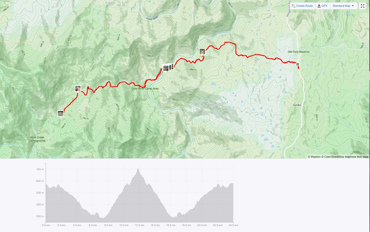
Dunphys Campsite to Coxs River Out and Back
Out and back along half fire trail and half single track. Not a lot of vert, except for the optional 600m descent/ascent to Coxs River. Good running in a remote area.
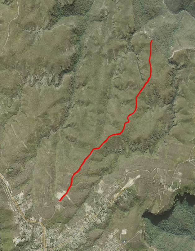
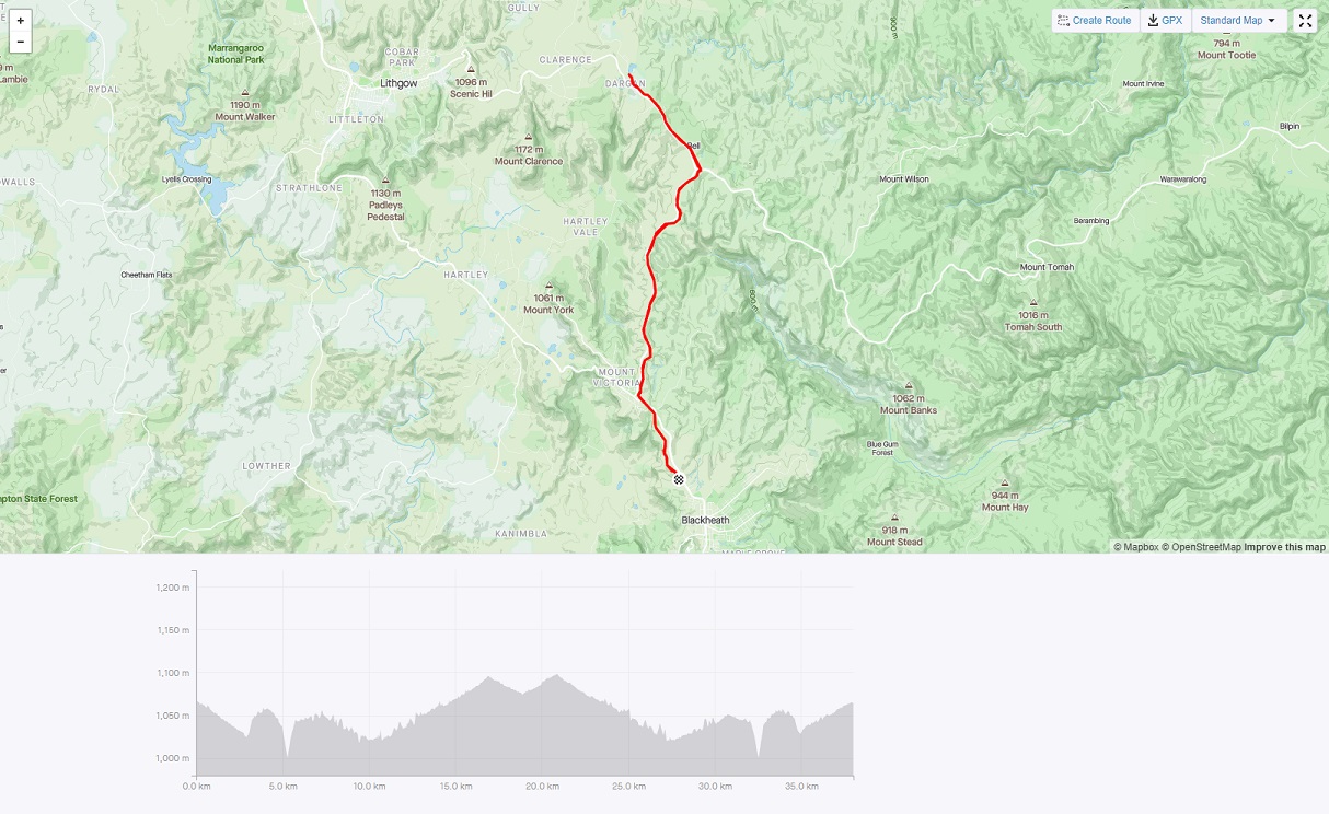
Rail Trail from Blackheath to Bell Out and Back
Follow the railway tracks as far as you like and return. Not especially inspiring, but mostly level, some views from Darling Causeway. There’s one 300m section on Darling Causeway where there’s no track alongside the railway, so either follow the road, or stay on the narrow embankment & duck when the coal tains pass!
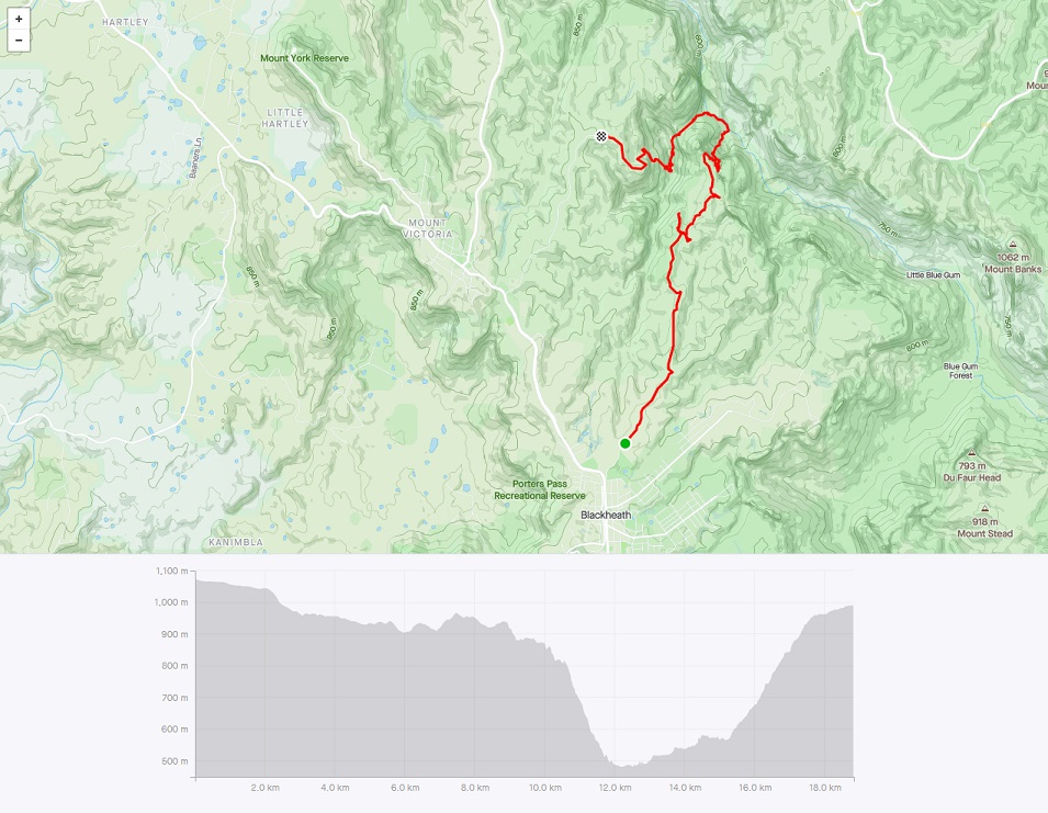
Mt Vic to Bell via Ikara Head Loop
Starting along Victoria Falls Road take the Ikara Head pad for excellent running along the ridge. Expect fields of wildflowers from November. Then take the gully E of Ikara Head into the upper reaches of the Grose. It’s tricky routefinding and rough walking 50m above the river to Surveyors Gully where the ascent leads to the Darling Causeway. Turn right for an out & back to Bell & beyond, or left to complete the loop.
Katoomba to Blackheath via Megalong Valley
Descend either Devils Holes or Nellies Glen and continue to Megalong Road, then it’s a long slog up the road to Blackheath. Both are good technical descents, but the return is all on the tarmac.
A better alternative may be an out and back - to descend to the tarmac then return to the start via the other pass. Or do the run below instead.
Explorers Tree to Megalong Rd, returning via Mitchells Creek
22km almost all on quiet firetrail and single track, with a lot of steps at the start and end.
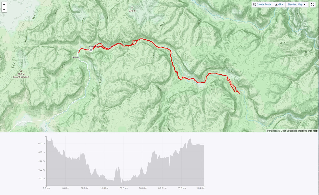
Dunphys Campsite to Kelpie Point Out and Back
All firetrail, big descent at the end. Optionally cross the Coxs River and ascend Mt Cookem. Or for the really keen, continue for a further ~100km to Mittagong.
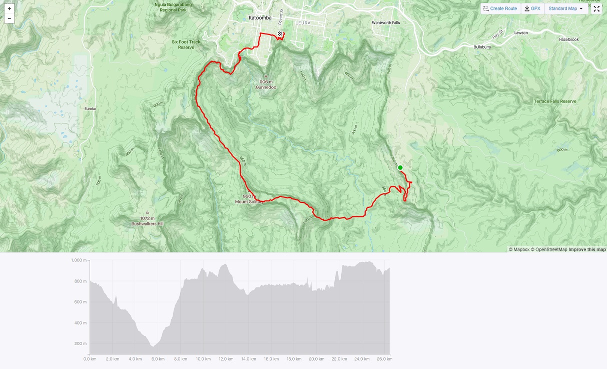
Classic Mount Solitary Traverse
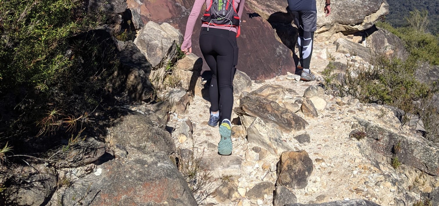
One of the best runs on the Blue Mountains. Spectacular views, good single track for 80%, good firetrail for the rest. Lots of ascent & descent, lots of technical, only a little nav, a real wilderness feel. 25km+ depending where you start - Scenic World, Golden Stairs or any of the Katoomba or Leura Passes down to Federal Pass.
Start at either end - Queen Victoria Hospital or the vicinity of Leura/Katoomba and the pickup is the other one.
A further 20km can be added by doing the UTA22 to return to the start point.
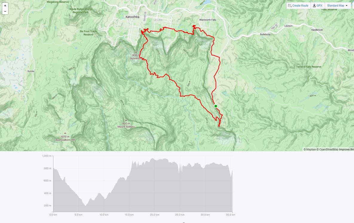
UTA 35 Loop
Most of the UTA 50 course, starting at Queen Vic Hospital and exiting the course early at Leura Cascades to complete the loop.
Point Repulse Out and Back
Lots of running, but lots of bushbashing on Mt Solitary to get to Point Repulse and then down the talus to get back to a runnable fire trial. Expect to take closer to 8 hours than 4 even if you run the runnable sections. The ledge at Point Repulse needs a good head for heights - exposure++.
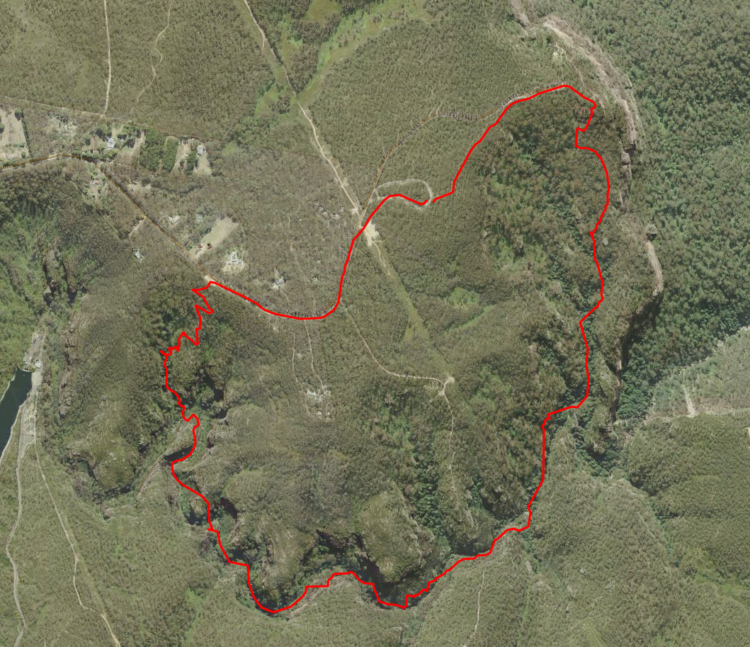
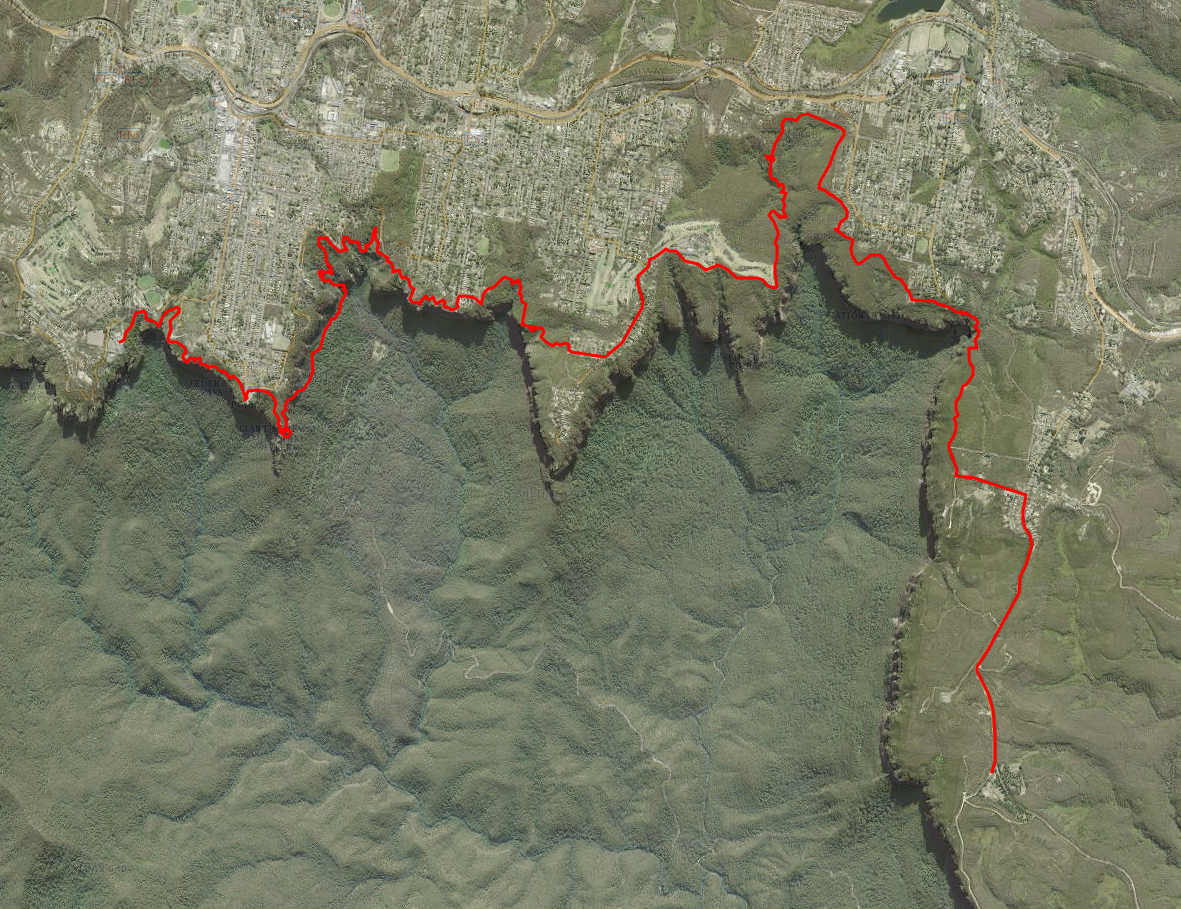
Blackheath Passes Loop
Amazing cliff top views, steep technical ascents/descents, Grand Canyon scenery, a classic run into the Grose.
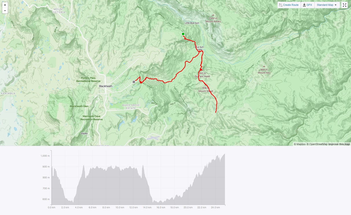
Grose Valley Double Out and Back
Starting at Perrys descend 600m to the Grose River, ascend Shortridge Pass for 600m to reach Lockleys Pylon, and then do it all backwards. A level extension gives an extra 4km each way of good running to Mount Hay Road, or arrange a pickup there.
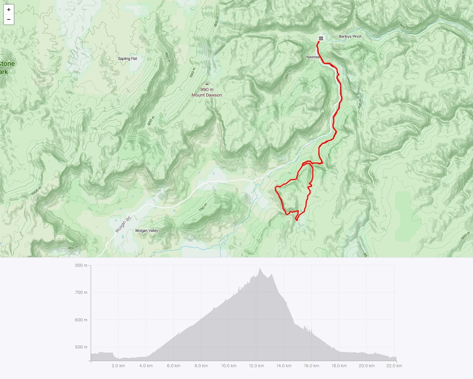
Glowworm Tunnel - Newnes Out and Back with a Loop
A 22km loop along a gentle incline that follows the route of the 1900’s coaltrain track. Then a 400m tunnel (torch mandatory, a phone torch won’t cut it) with bats and glowworms above, before completing the loop and returning to Newnes.
Burra Korain Out and Back
Burra Korain provides good running, but trickyish nav. It’s best to do it as 14km out & back. There are passes off the end to get to the Grose, but they are hard to find.
The alternative is to reverse the route and start at Victoria Falls, descend steeply to Burra Korain campsite and follow the mostly runnable track to Perrys and ascend there.
Narrowneck Out and Back
Trailrunners classic. 20km all on firetrail. Some steep ascents, but nothing to long. Excellent views for much of it. Much frequented by trailrunners and mountain bikers starting from 6AM most weekends.
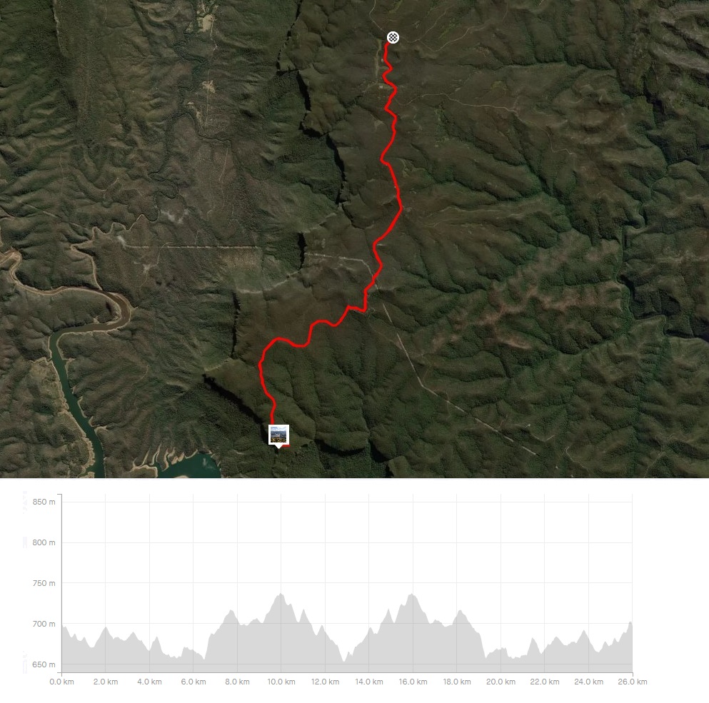
Kings Tableland Road Out and Back
26km all on Kings Tableland Road - longer or shorter with different parking spots. No steep ascents, just lots of undulating firetrail. Bush views for much of it. The highlight is the lookout at the end over Lake Burragorang - you’ll be sharing it all with MTBers and 4WDs.
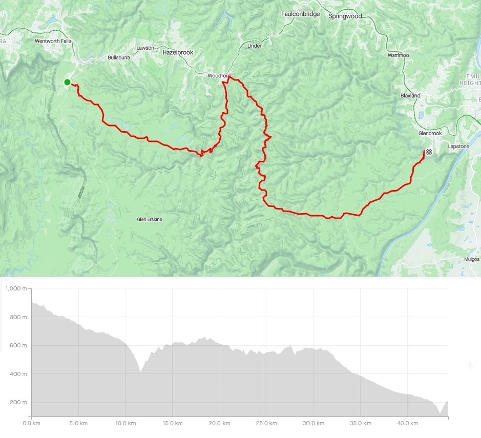
Wentworth Falls To Glenbrook - one way
45km mostly on fire trail - longer or shorter with different start/end points. A few steep ascents with lots of undulating firetrail. Bush views for much of it. This route is the end of the Unreasonable East Miler. You’ll be sharing the start and end with vehicles, and an occasional MTBer along the way. And check that Glenbrook Causeway isn’t flooded before you start - it’s a long way back!
For a bit extra (up to 65km total) start at Katoomba and follow the cliff top tracks to Wentworth Falls.
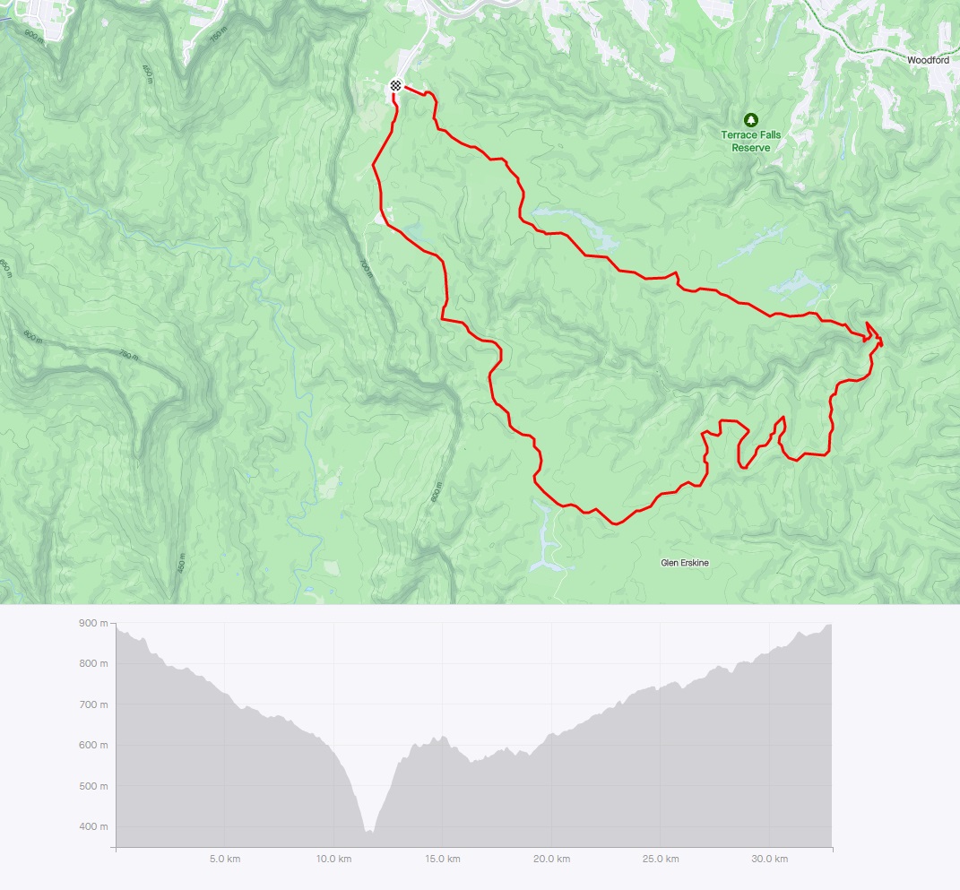
Ingar & Andersons Fire Trail - loop
35km all on fire trail with one big down & up at the creek junction. Uninspiring bush views for much of it. This route is part of the Unreasonable East Miler. You’ll be sharing about 10km on Kings Tableland Rd with vehicles and an occasional MTBer for the rest of it.
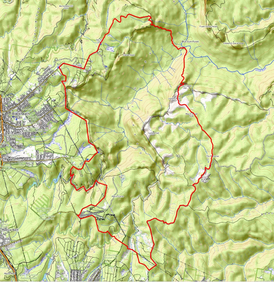
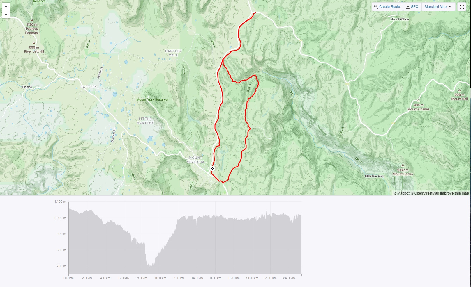
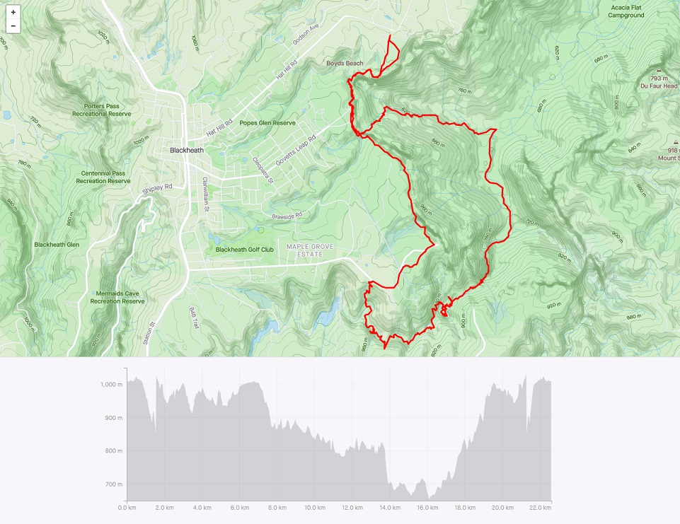
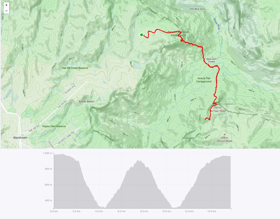
Grose Valley 35-40km Loop
35-40km with lots of vert. 80% single track, 15% fire trail, less than 5% road. Lots of technical (aka walking), lots of steps, spectacular views for much of it. An epic run that include descent into Grose Valley, cross the river on a log, ascent back to plateau, after 10km of single track and fire trail, follow Bruces Walk steeply across two creeks before doing a circuit of Grand Canyon, to return to views over the Grose you just crossed. Then after numerous lookouts and both varieties of steps, pass Govetts Leap, and Popes Glen to Boyds Beach where a steep rough track returns you to the road to Perrys Lookdown.
There are 5 or 6 different options to park (Evans, Perrys, Govetts, Mt Hay Rd), and lots of side trips to make it longer (Popes Glen, Pt Pilcher, Mt Hay, Anvil Rock, Pierces Pass). This is an epic and technical day with a only little route finding - much of the flat & down is runnable.