
Upper Wentworth Creek
The source of Wentworth Creek is west of Wentworth Falls. It has a dam built in the 1940's to supply water to the Wentworth Falls reservoir. This short trip visited the dam and pumphouse, and also the falls above and below.
Overview
The source of Wentworth Creek is west of Wentworth Falls between Mt Hay Road and Blaxland Road. It has a dam built in the 1940’s to supply water to the Wentworth Falls lake. This short trip visited the dam and pumphouse. There are also two relatively unknown waterfalls above and below the dam - Carters Falls and Sapphos Leap, and also a pleasant cascade a little further upstream.
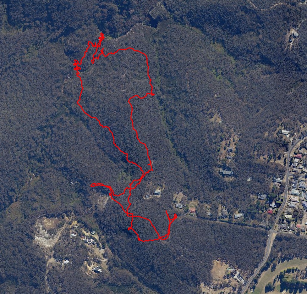
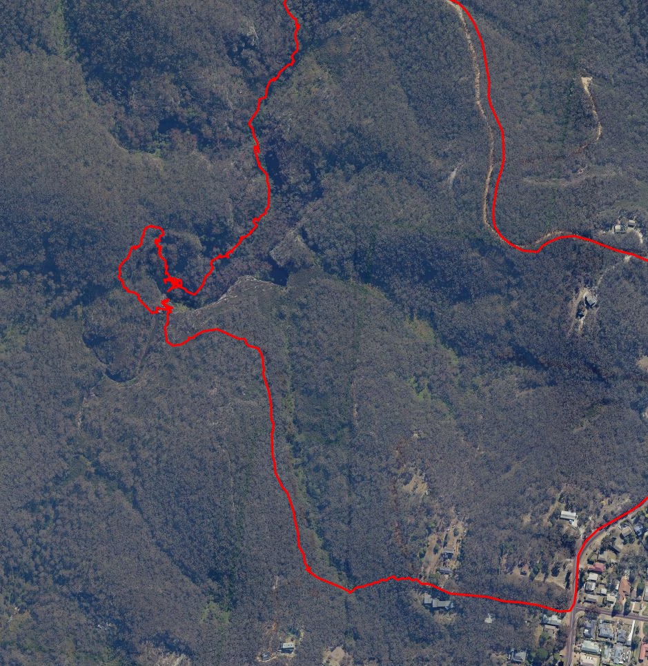
Aerial View
The route starts at Darwin Ave, and visited the disused quarry first, before contouring past the sidecreek and descending alongside that creek to Carters Falls. This route entails follwing many false wallaby tracks and is not especially recommended - didn’t really work for me.
Route
One route starts at the turning circle at the end of Darwin Avenue. Avoid the private property by heading South for 100m before finding a myriad of tracks to the West. Pick one and when past the property boundary bash along swamp wallaby tracks trying to follow the contour to avoid the upper reaches of the side creek.
The property may become visible on the right, but continuing on will soon lead to a firetrail close to the Waratah Road continuation.
A possible alternative route to this point is to park at the end of Waratah Rd and follow the easement to the firetrail.
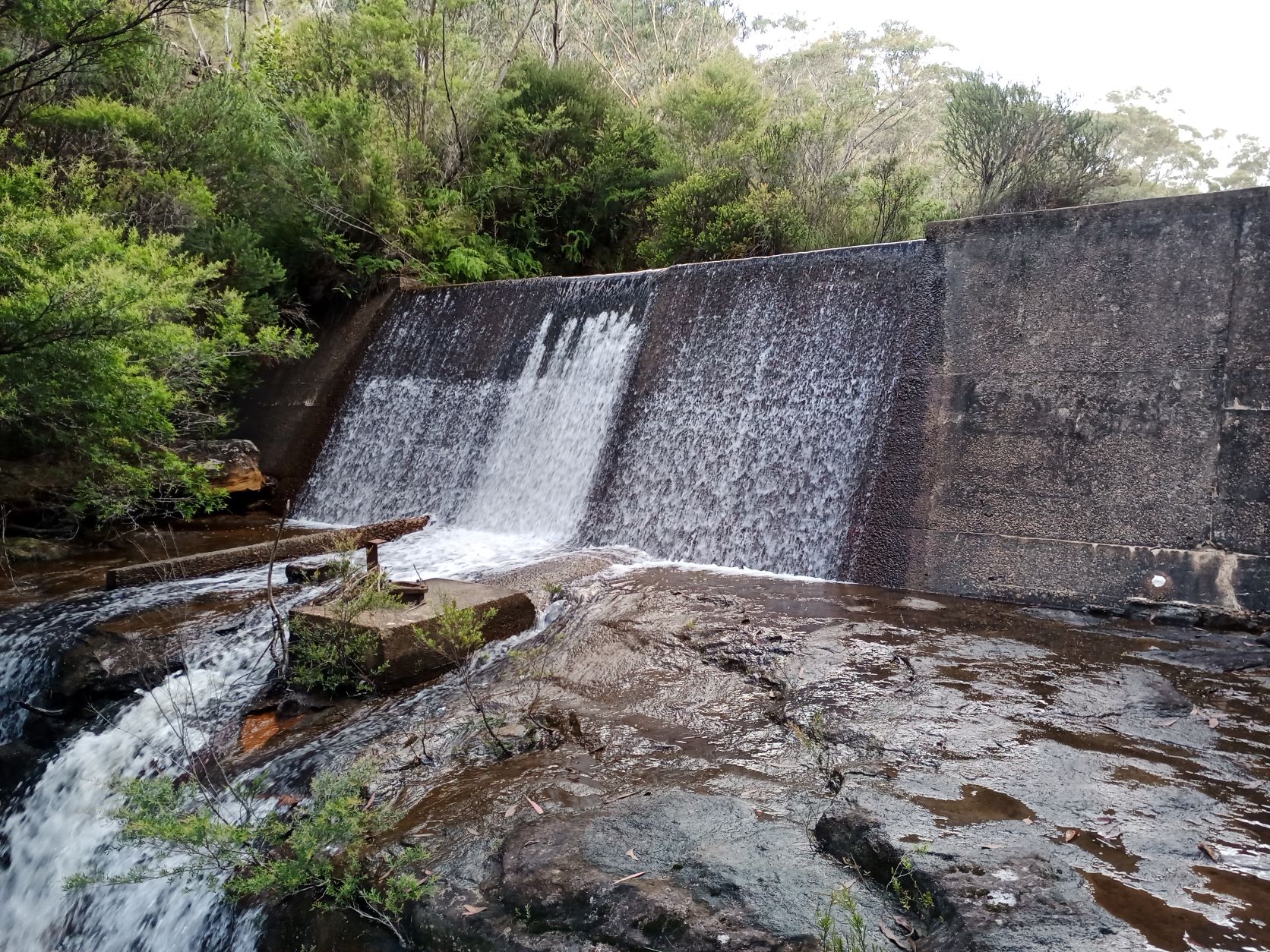
However, this firetrail ends, so contouring East will find the original(?) rough track above another sidecreek that leads down to a low drop. The lower electricty pole will be visible for the last part of this track. Negotiate the drop to find Sapphos Leap and the dam wall, with the pumphouse 50m upstream.
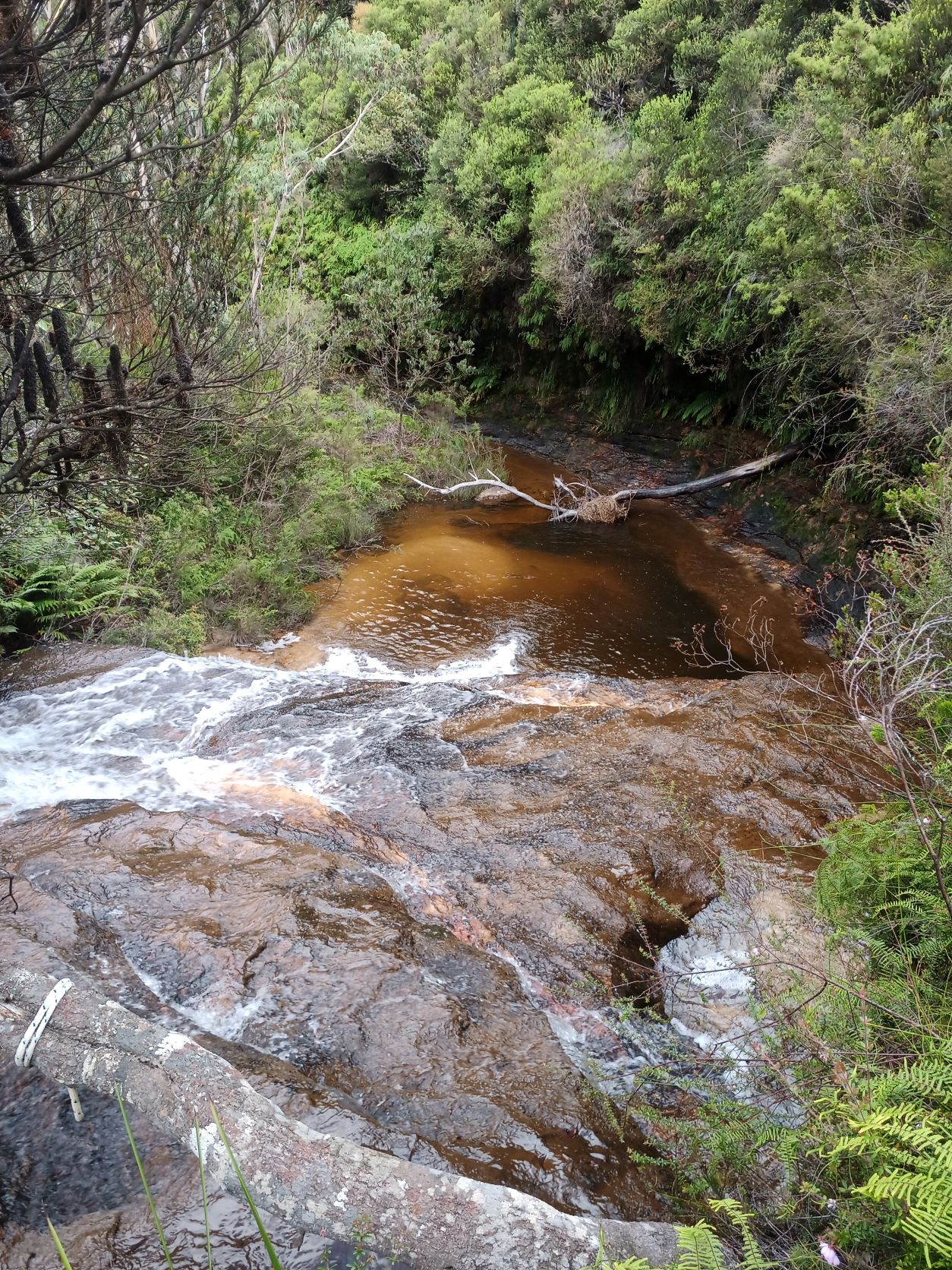
Further upstream is Carters Falls, and another 100m upstream of that are the pleasant cascades.
The Creek
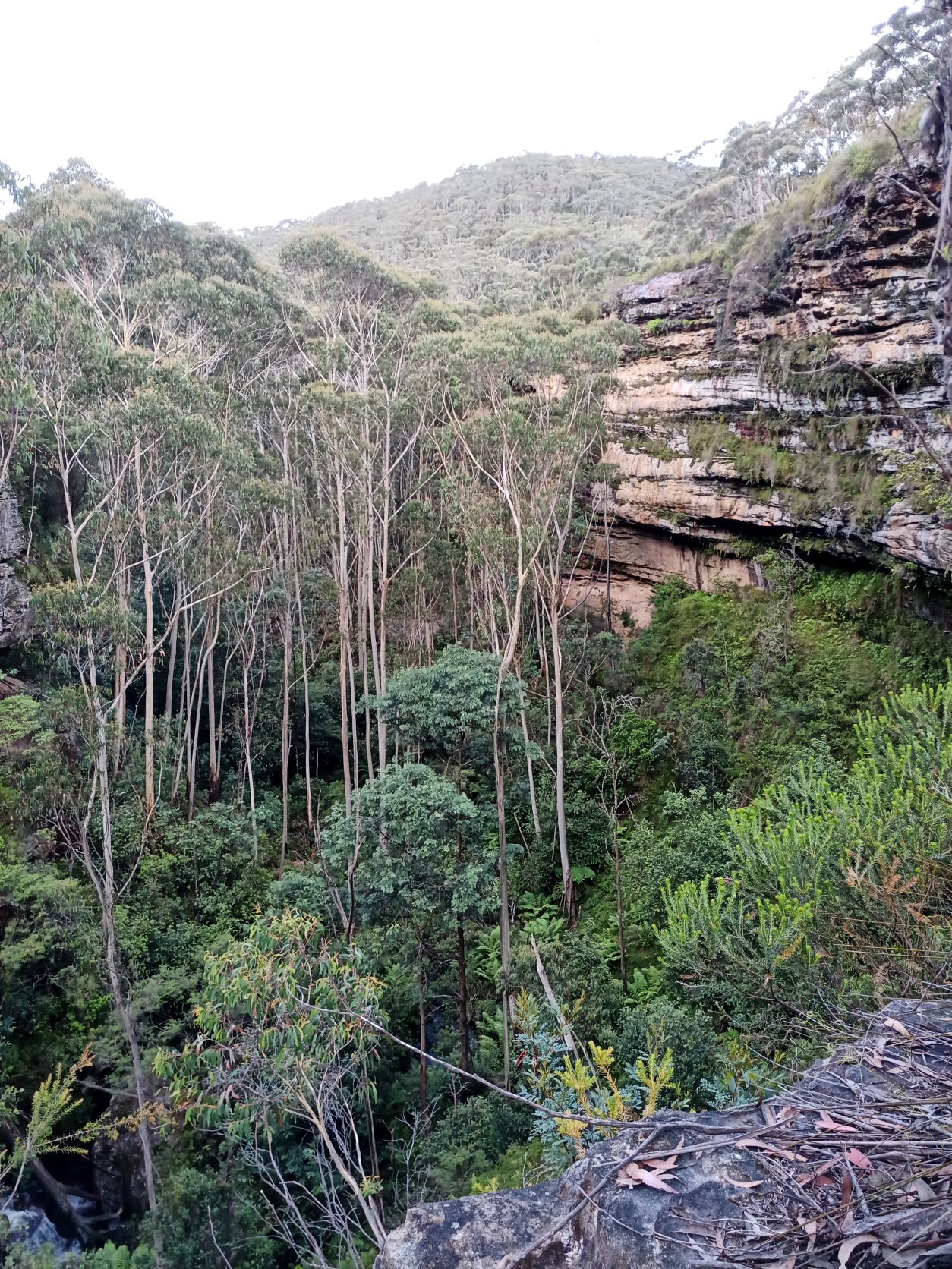
The bush bash down wallaby tracks leads to the top of Carters Falls. The picturesque cascades upstream above can be visited from this point. It was impossible to descend safely, so crossing with care and ascending the side creek opposite found a route to the dam below.
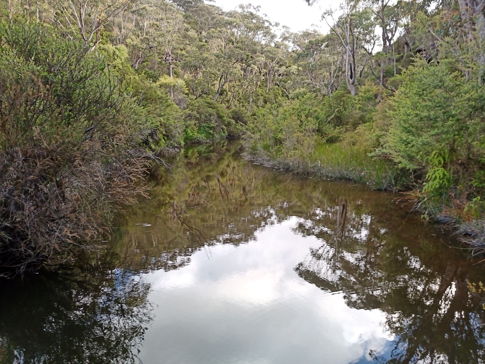
The dam encloses a fairly small area and is not especially deep.
The dam wall remains structurally sound.
Immediately below the dam is Sapphos Leap, a 20m waterfall into a silted up pool. It looked tricky to descend on either side.
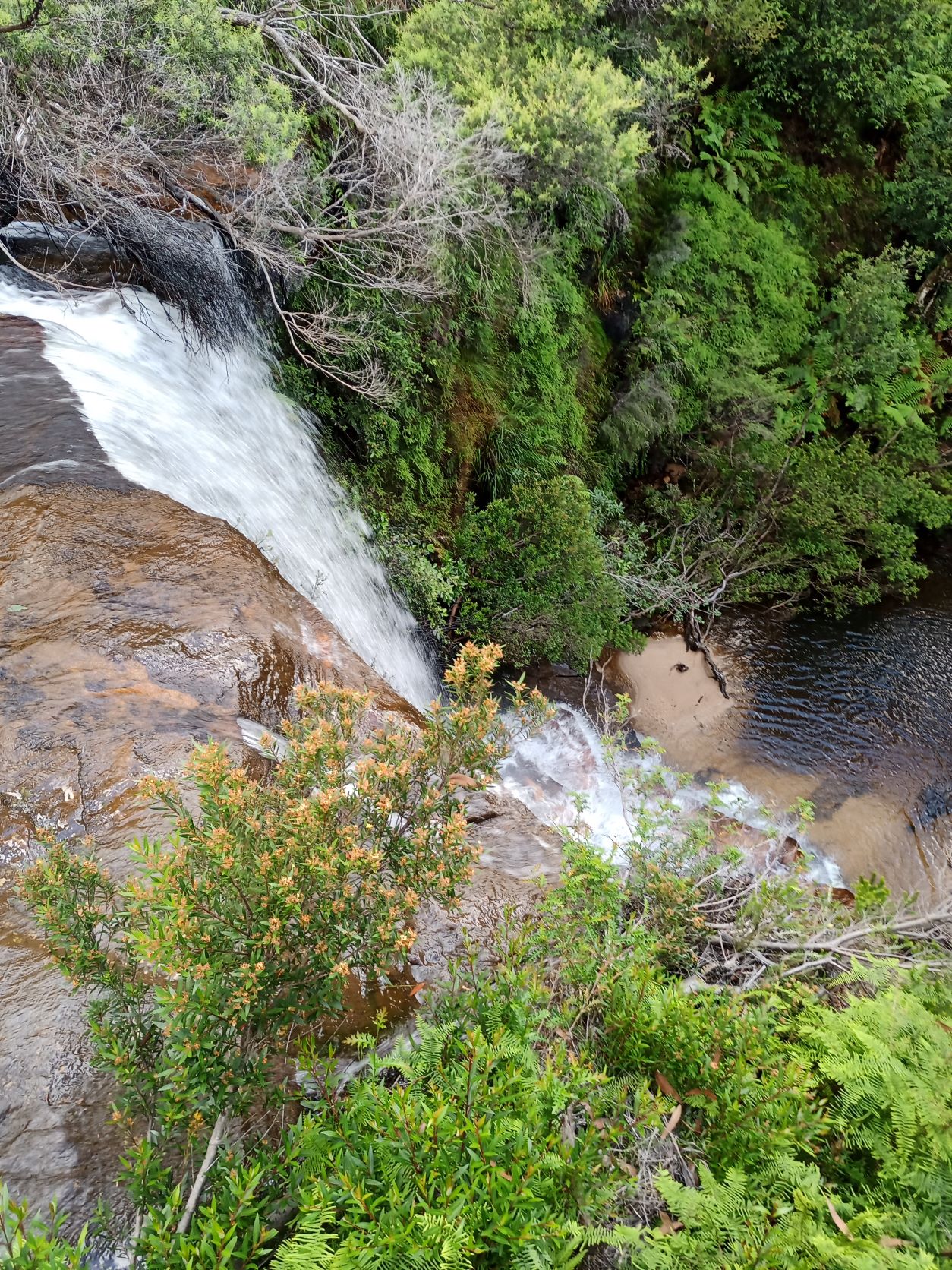
And below the leap it starts to become more like a canyon.
After crossing below the dam back to the Eastern side, the swordgrass hides a track that leads 25m upstream to the pumphouse.
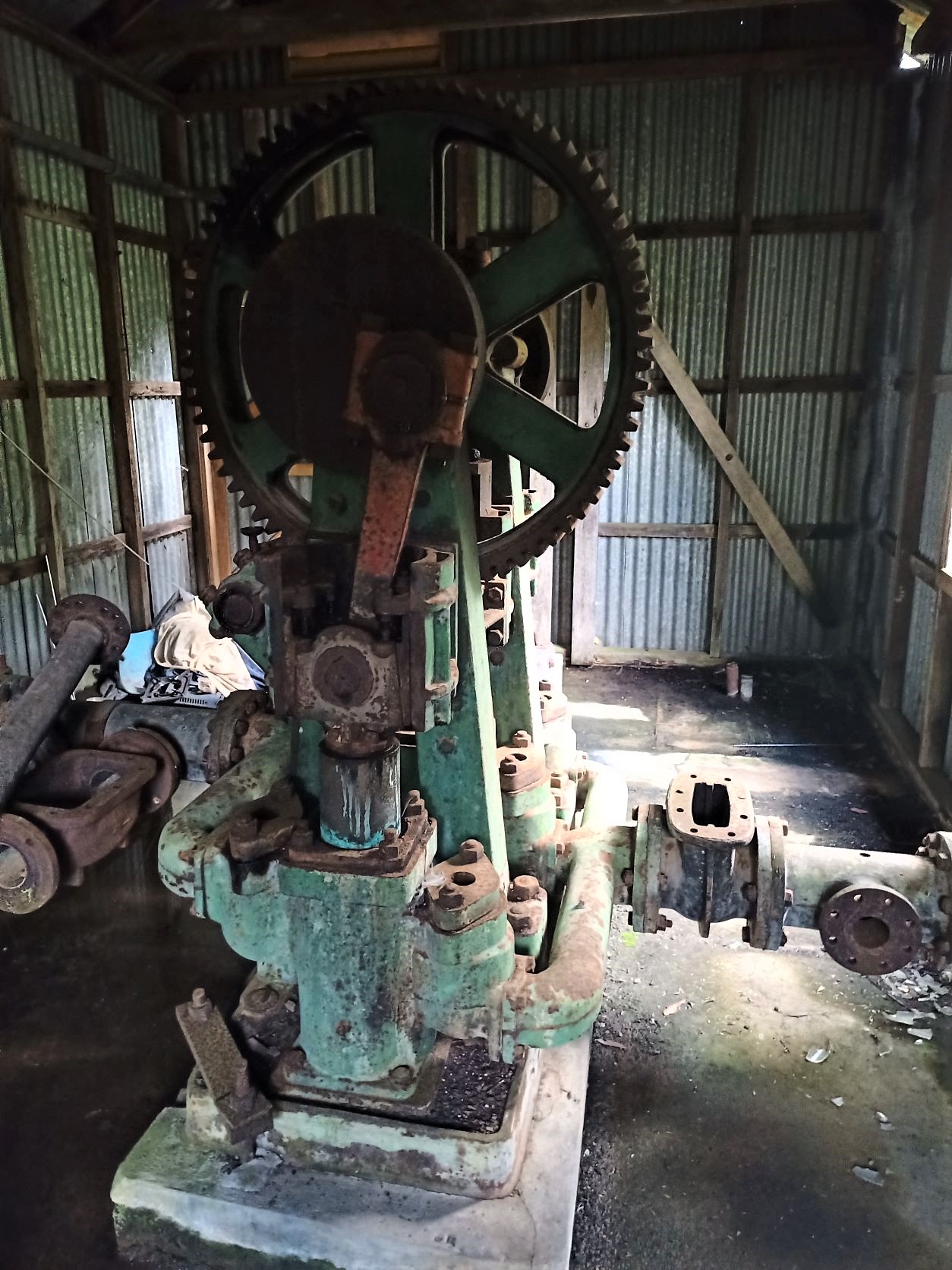
The pumphouse is still sound, the corrugated iron is stamped with a 39 in a star, probably the year of manufacture.
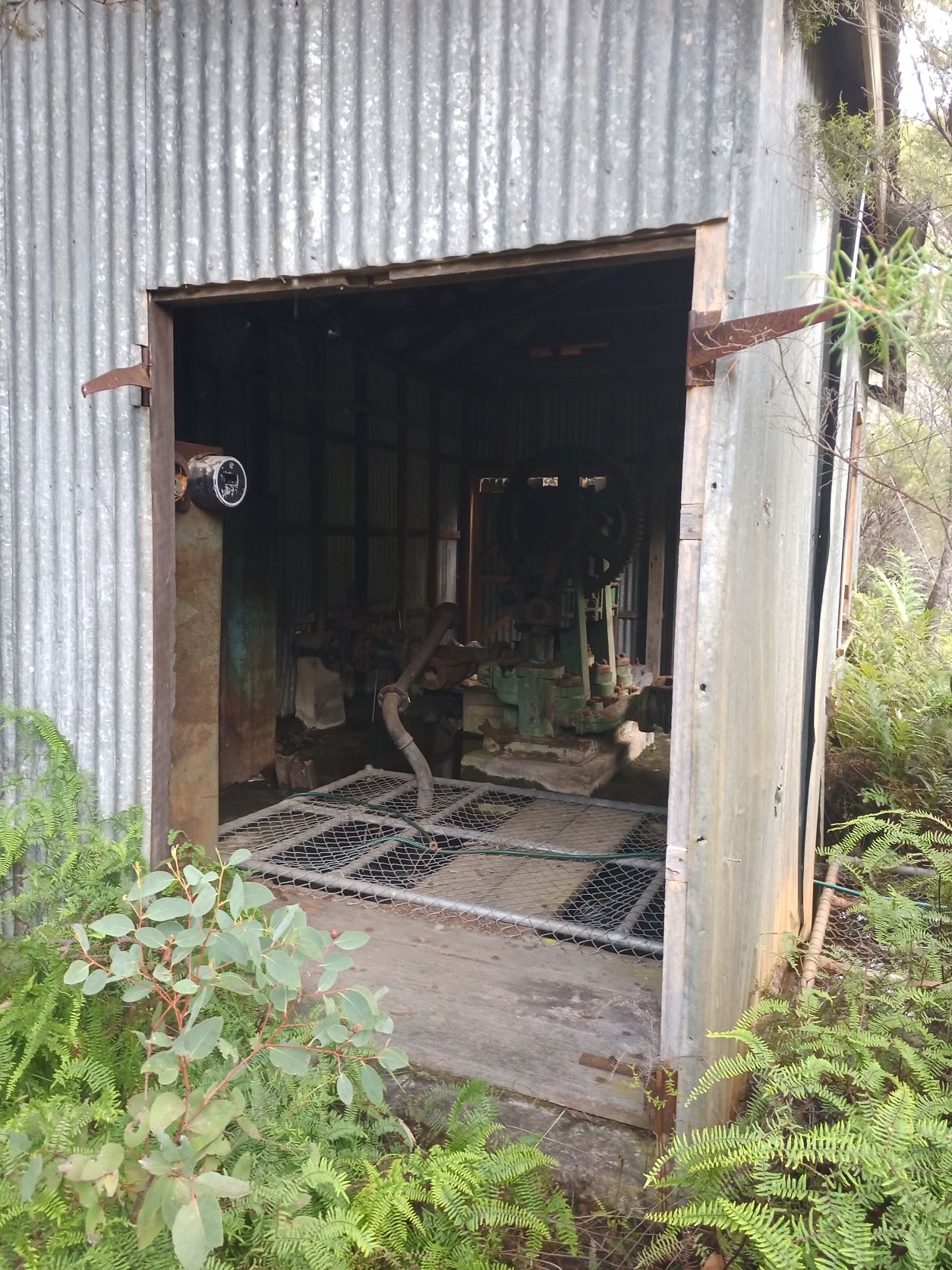
The pump is in good condition, although the electric motor has been removed.
Following the rough track back up the hill it passes a ridge which may well cover the pipe up the the lake.
History
The SMH published an article which is thought to relate to financing the dams construction at the SMH archive.
Edit 9/7/2022
A later trip in July 2022 approached Sapphos Falls from the North. After parking at Evans St and descending Bruces Walk to the creek, we endured a strenuous creek bash (managing to keep feet dry) to the base of the falls. After photos we ascended the obvious steep ferny route NW towards Mt Hay Road and then an equally ferny bush bash over the top eventually descending to the weir.
The exit was up to the end of Waratah St (via reasonable wallaby tracks), which is preferable to the route described above.
Stats
A couple of hours
Distance 3km
Ascent 50m
Time: 1:10