
Blue Drum Creek & Ledge to Holbeachs Indent
Kings Tableland has a few passes the give access to Kedumba Valley from the plateau. Blue Drum Creek is an abseil route with an exit to the North. The route taken was to descend into South branch of Blue Gum Creek, avoid first abseil by sidling steeply to the North branch, crossing it and then ascend slightly to the West to reach the opposite ledge facing the abseil. Then follow the ledge for 500m until there is a steep route both down to the talus and up to the plateau.
Kings Tableland has a few passes the give access to Kedumba Valley from the plateau. Blue Drum Creek is an abseil route with an exit to the North. The route taken was to descend into South branch of Blue Gum Creek, avoid first abseil by sidling steeply to the North branch, crossing it and then ascend slightly to the West to reach the opposite ledge facing the abseil. Then follow the ledge for 500m until there is a steep route both down to the talus and up to the plateau.
The ledge requires surefootedness on steep loose talus and good scrambling ability with a tolerance for exposure.
Route
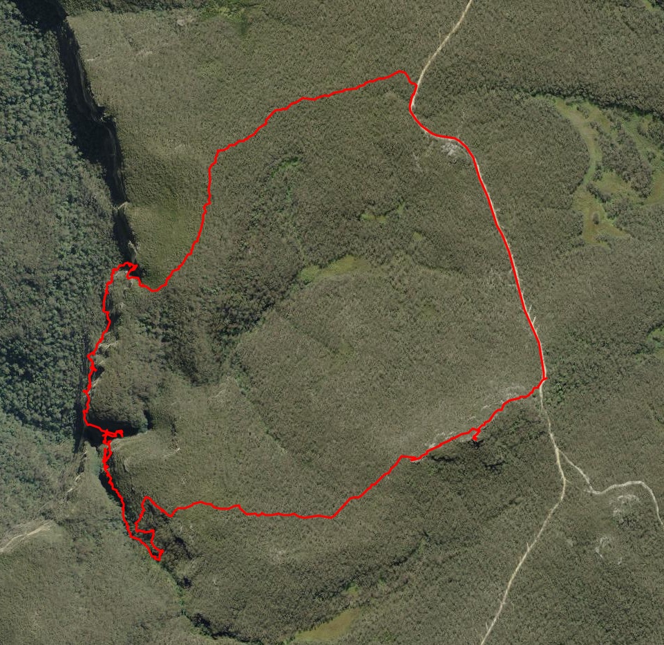
Aerial view of the whole route. Note that the GPS tends to bounce around when close to cliffs, so some of this route needs to be treated with caution. It’s usually impossible to tell which ledge the route is actually on.
This trace shows the route from Kings Tableland Road. The route is clockwise from anywhere on the road.
Route Description
After parking somewhere suitable on Kings Tableland Road follow the ridge SW over the pagodas of Harris Hill and past the trig point.
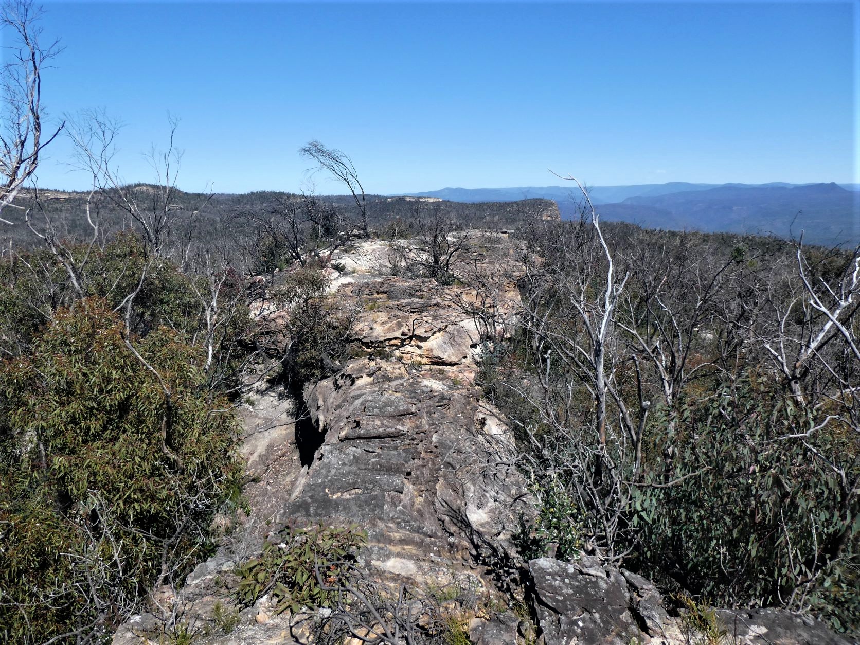
Then head West towards where the South branch of Blue Drum Creek meets the edge of the cliff.
The first cliffline to the North of the Creek can be descended (somewhat counter-intuitively) close to the nose, then backtrack upstream for 200m to find a slope into the creek.
And follow the creek easily over boulders and soft sand and then boulders to reach the lip of the falls.
Backtrack a few meters from this lip and head for the steep grassy slopes to the right. This leads towards the North branch of the Creek.
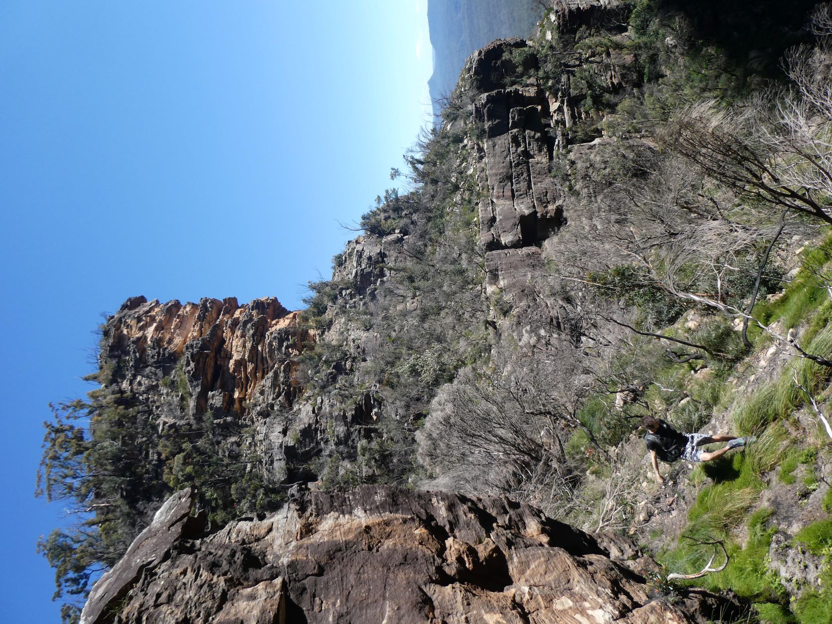
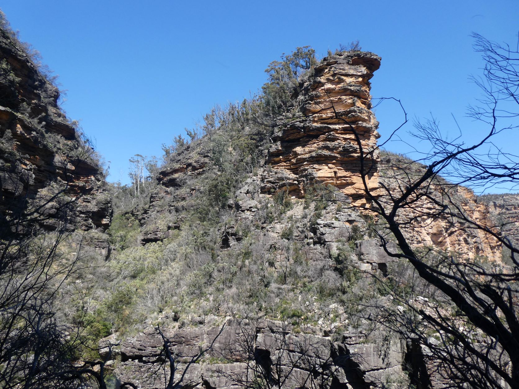
Cross the creek and head up the other side and bear left towards the cliff face, where there is a good view of the head next to the South branch of Blue Gum Creek just negotiated.
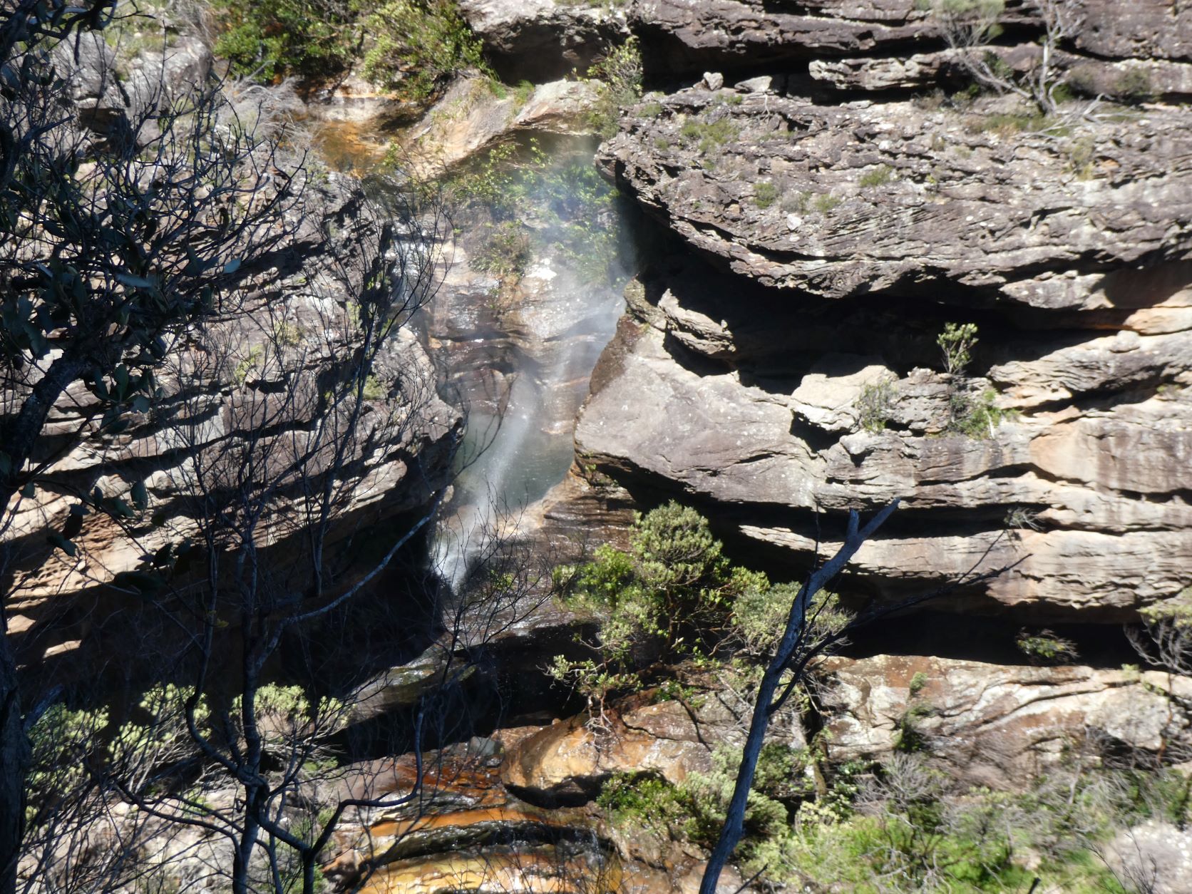
And also the falls below the first abseil. The wind was particularly strong and blew the waterfall vertically upwards for 15m!
Rounding the corner of the North Branch saw the force of the wind reduce sufficiently to consider completing the ledge.
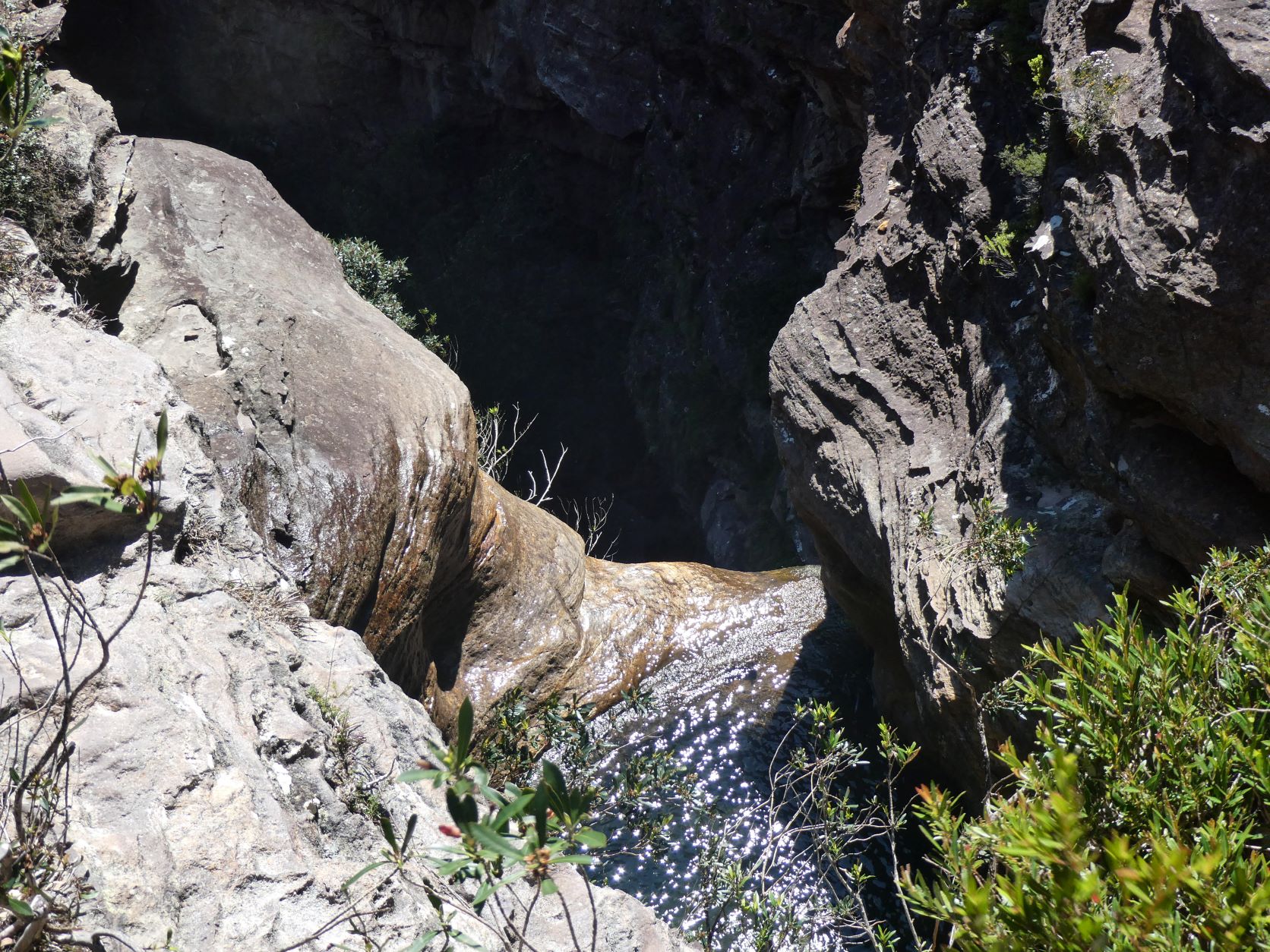
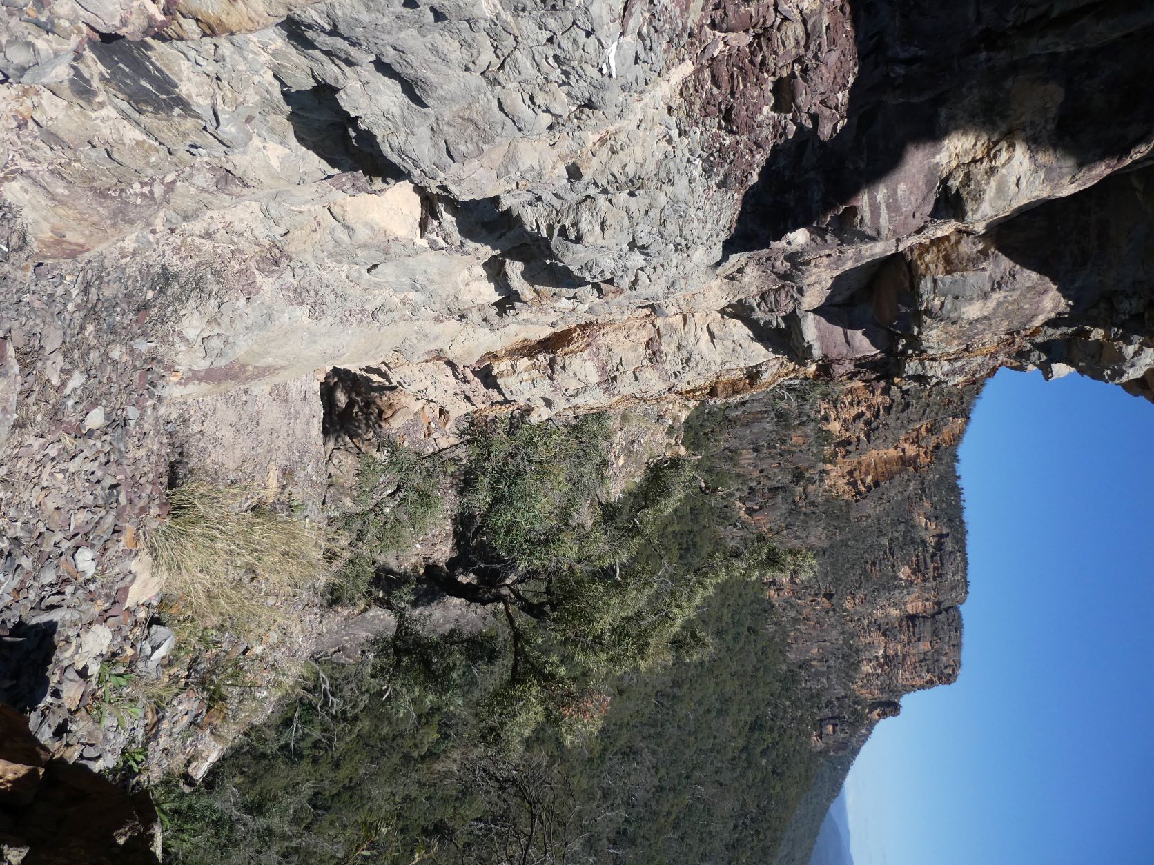
The ledge soon narrowed.
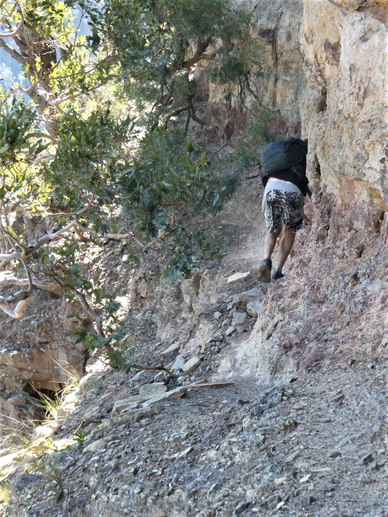
And after more narrowness, a two meter slot above a dropoff appeared, and was followed by a straightforward scramble up three meters to a steep and loose ledge.
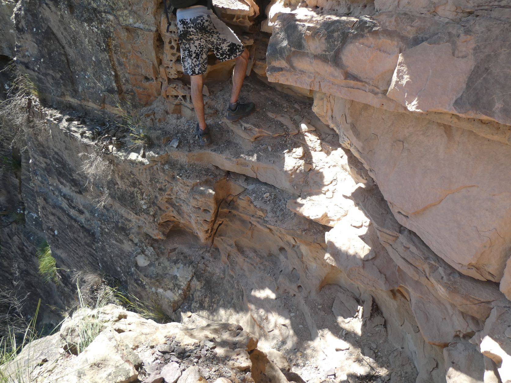
Looking back at it is a bit more daunting.
Continue along the ledge until there is a steep route both down to the talus and up to the plateau - this is the exit from the Blue Drum Creek canyon. Following the faint loose pad steeply up finds several scrambling options - pick one.
Shortly afterwards the plateau is reached. Walk NE through dense charred & unpleasant scrub for a few hundred meters before it improves a little, and then veer more NE and arrive at the fire trail after 30 minutes.
Stats
A short day -
6.5km
400m of ascent
Elapsed 3:15
Care
This is a route that has only a few route-finding and navigational challenges
All of your party should be comfortable with exposure and be especially sure footed, particularly when traversing the sections of steep, narrow and loose ledges.
Proficiency with scrambling is also required at one point - there is potential for a safety tape to be dropped for seconders.
And finally, this is not a Pass to be attempted in wet or windy weather.