
Erskine Creek
The source of Erskine is close to Kings Tableland Road at Wentworth Falls. It winds for 30km Eastwards right down to the Nepean River at Glenbrook National Park. This trip explored a small section of the upper reaches.
Overview
The source of Erskine is close to Kings Tableland Road at Wentworth Falls. It winds for over 25km right down to the Nepean River at Glenbrook National Park. This trip explored a small section of the upper reaches. The creek is wide enough and has enough flow to be considered a river.
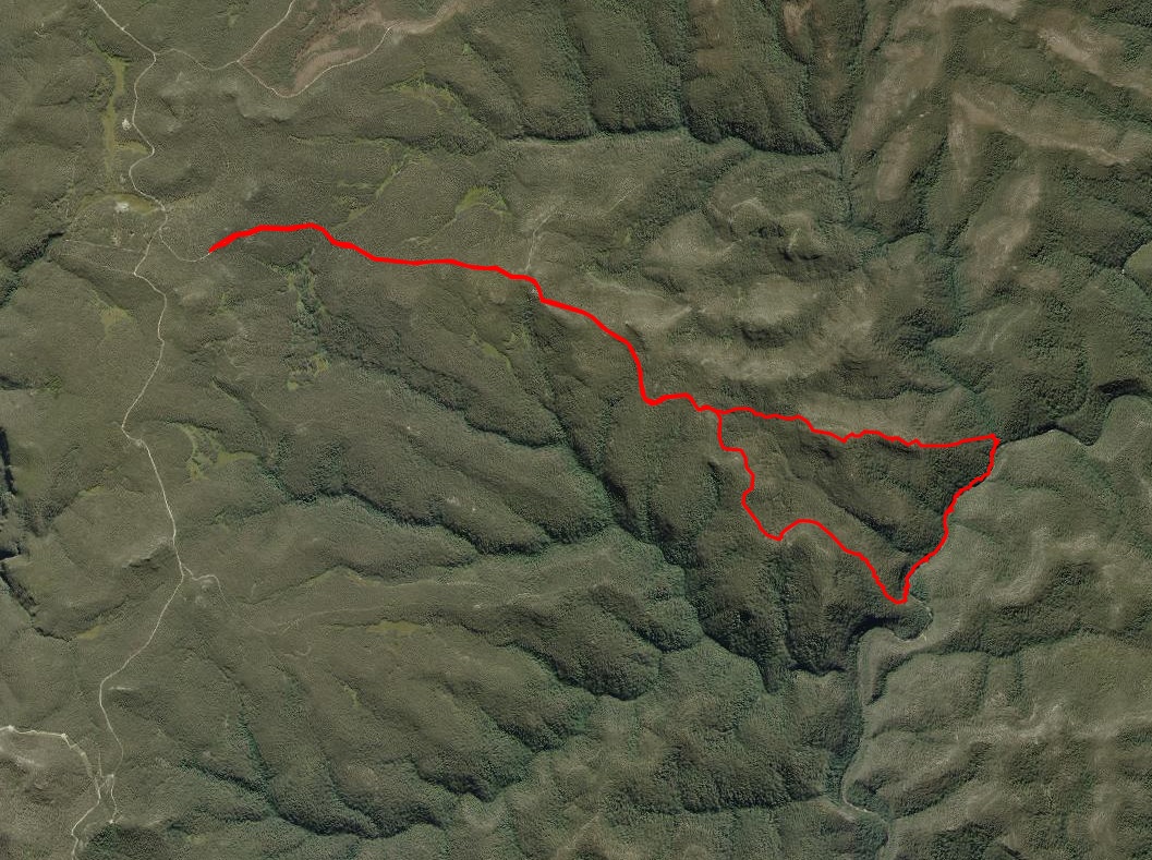
Aerial View
The route starts at the locked gate 500m down the Red Ridge Fire Trail. We followed the trail to Hayrick Hill where we left it to ascend to the 609 spotheight near Mt Gibson. After a short morning tea stop at the South facing lookout we began to descend its’ Eastern spur to where Bedford Creek joins the Creek before continuing downstream and then exiting steeply via the Red Ridge and back to the fire trail.
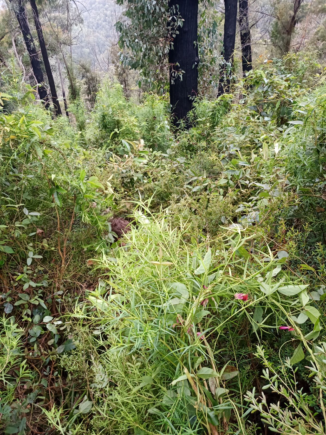
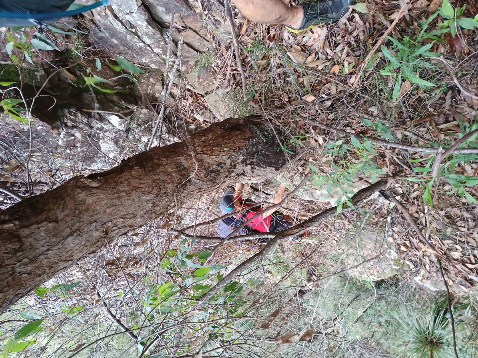
Descending to the creek was torturous. The head high vegetation made progress slow especially as it was laced with fallen logs and lawyer vine and a 45 degree angle. Yes that is the fallen leaders head just visible.
We easily avoided the last low cliff lines to hit Erskine Creek 100m above its’ confluence with Bedford Creek. Large boulders forced us into the close vegetation on the right bank.
Soon the junction with Bedford creek was reached and a small sandbank offered us unobstructed views upstream and downstream over a pleasant large pool.
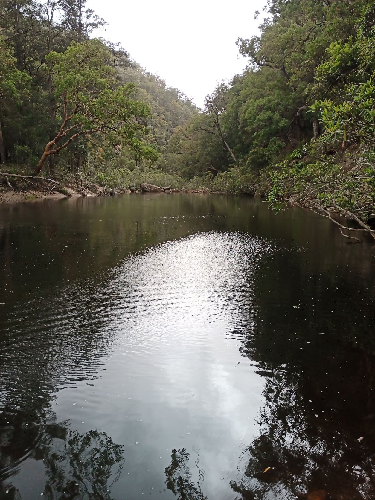
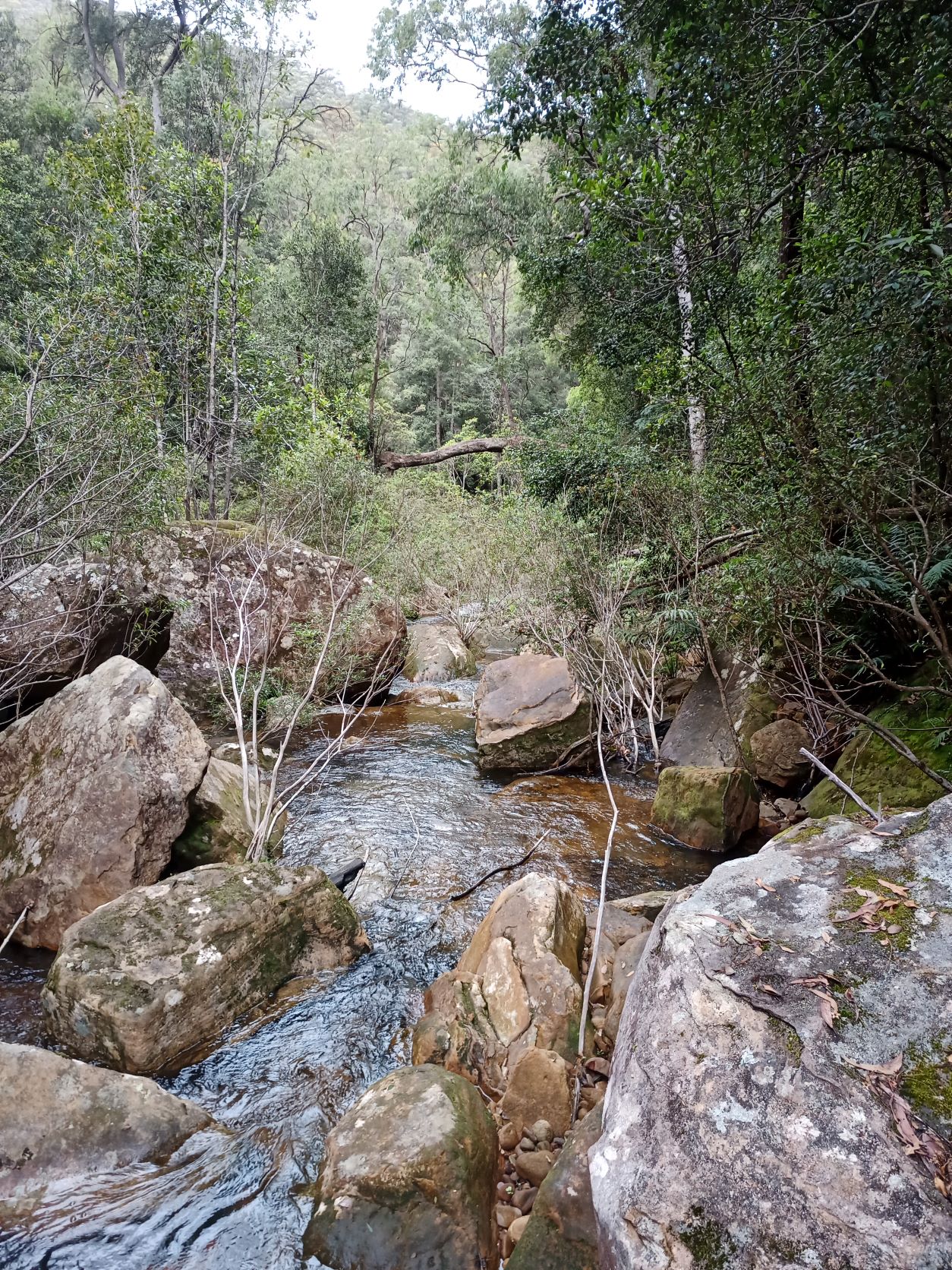
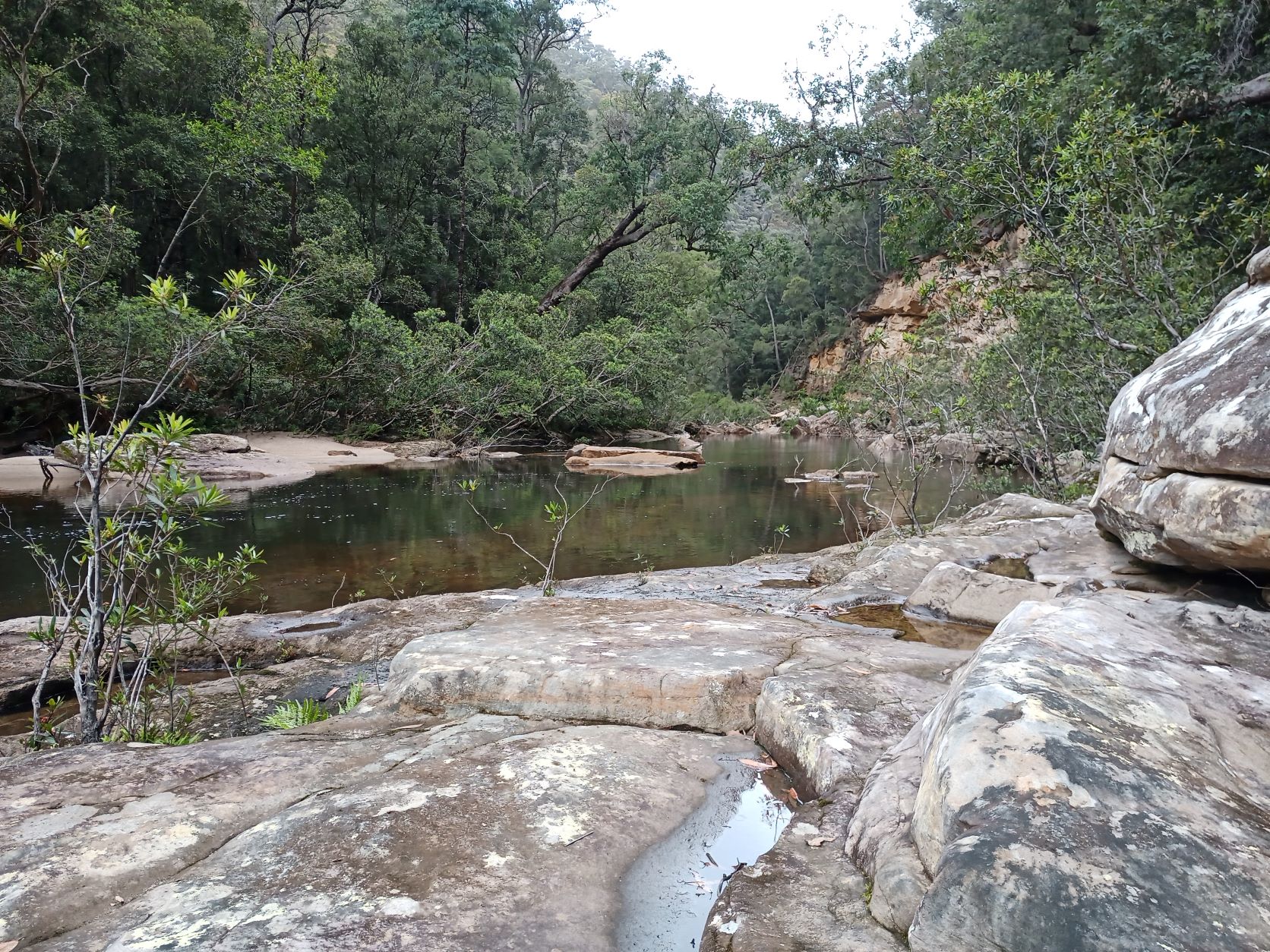
We stayed exclusively on the right bank past long stretches of smooth rock benches and slow flowing pools. There were no easy crossing points, although this was a particularly wet summer.
Ahead on the bend came 50m of recently eroded sandstone. It seemed to be still unstable, so we moved quickly past it.
The rule of thumb for travel along canyons and wild trackless gorges is to plan for 1km/h progress. The smooth rock sections made up for some of the difficulties presented by the tangled vegetation on the banks, and the inevitable backtracking. That 2km section took us around 90 minutes.
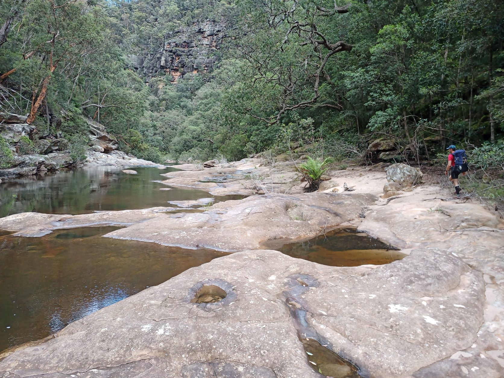
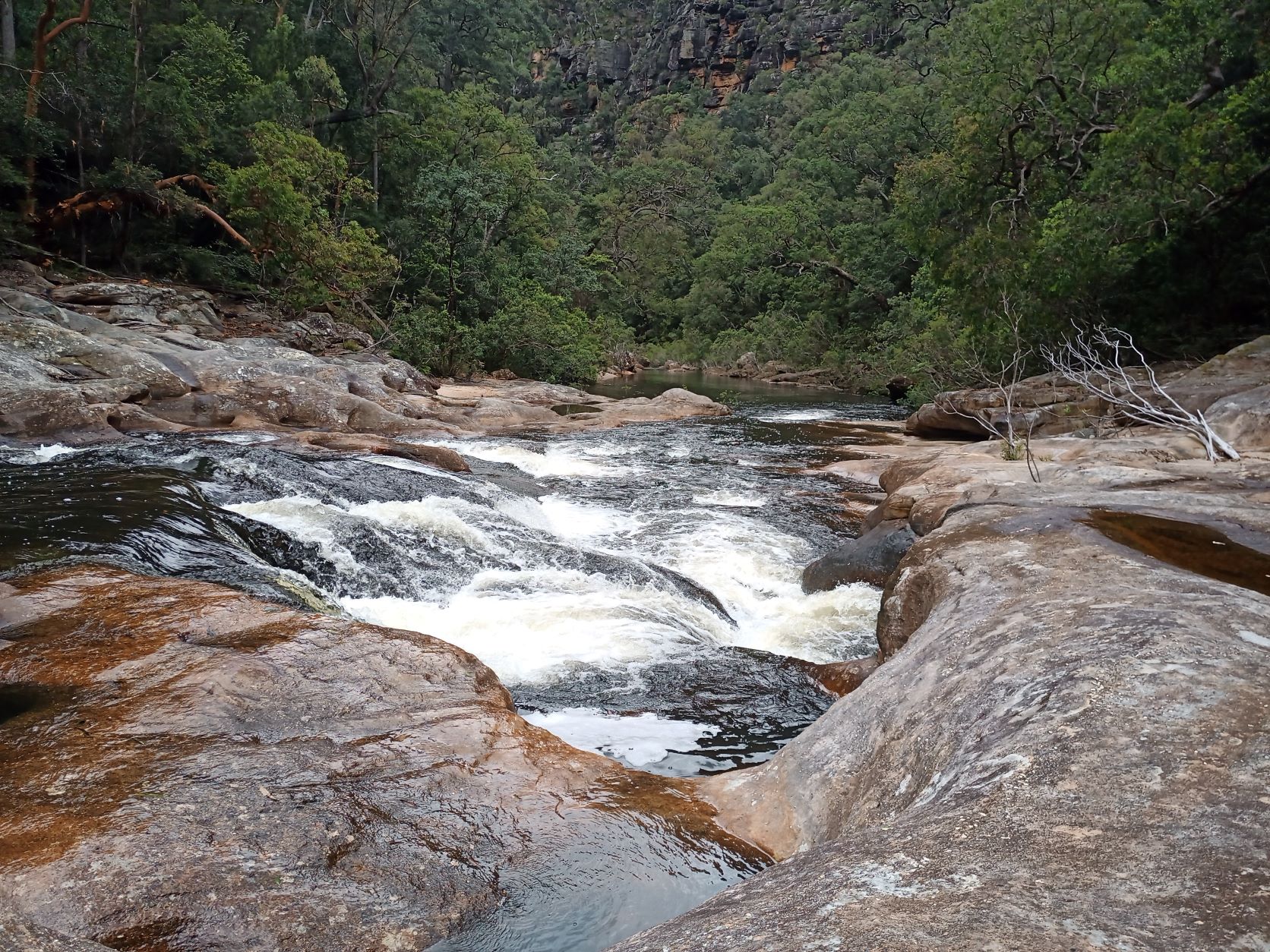
We encountered very pleasant rapids over the smooth rocks, making for more easy going.
Then as the sides of the gorge became steep we came to a mandatory swim. It was either a 4m fast swim across the rapids above a few rocks, or a longer one across the still pool below them. We chose neither. Instead the ridge on the right bank had a few scattered clifflines that looked doable.
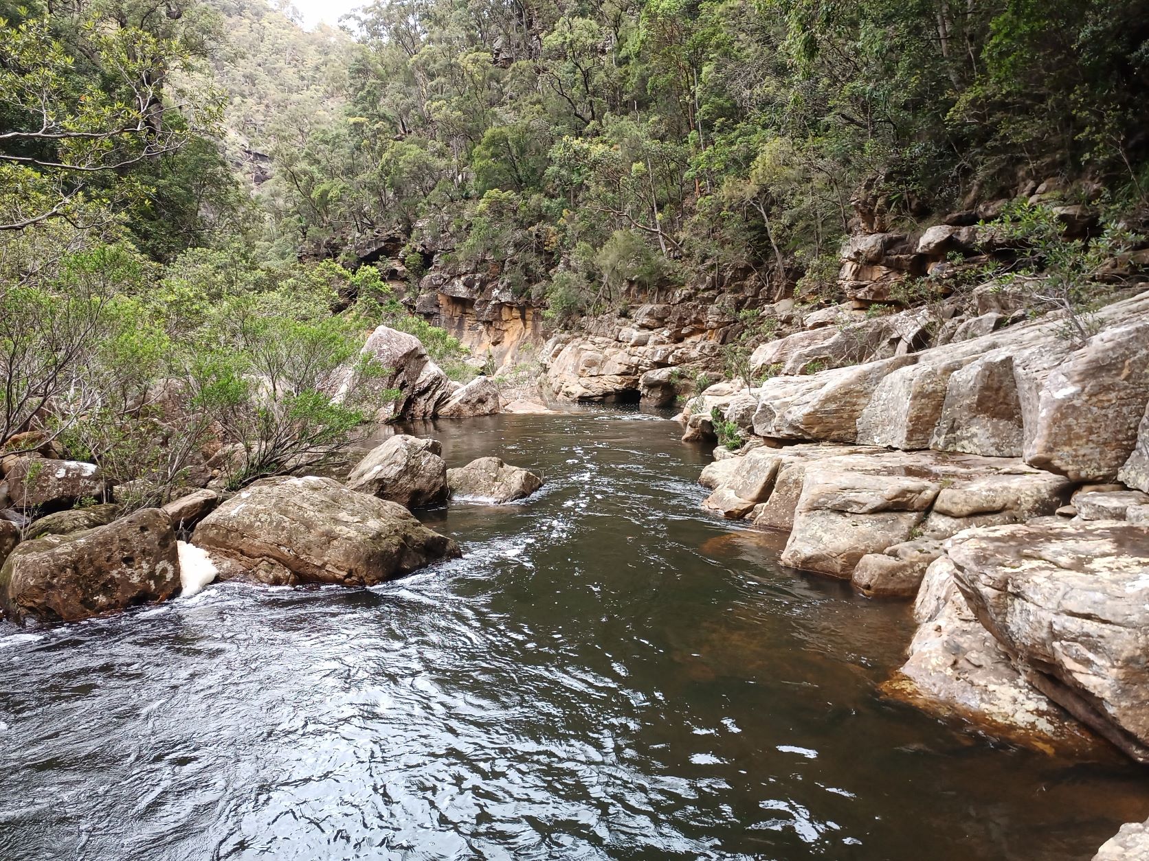
So after backtracking 50m to escape the low cliffs in the gorge, we traversed various good ledges to ascend.
The climb to the ridge got steeper and with more loose material underfoot. However, there was rarely any serious exposure and mostly good trees to hold onto.
And once the spine was reached, it was relatively easy bushbashing to reach the end of the Red Ridge firetrail.
Stats
Half Day
Distance 13km
Ascent 220m
Time: 4:30
Drybag and gaiters are recommended.