
Holbeachs Descent and Spring Creek Ridge Pass
Holbeachs Descent and Spring Creek Ridge Pass are both little travelled passes into the Kedumba Valley.
Holbeachs Descent is little known pass into Kedumba Valley from Kings Tableland. It is very steep and moderately exposed but easy to locate. The exit route is either back up the way you came down - probably not the first option of choice given the freshness of the descent in the participants minds; countouring around to the right and up the easy Lions Pass; or the option described below to cross the talus and ascend (the also little travelled) Spring Creek Pass.
Route
Start at the Lions Head track on Kings Tableland Road near Double Hill. Find the unmarked start that climbs steeply for 200m up through the scrub to Double Hill. In late 2020 it was still burnt out after the first 200m, but the track as easy to find. Follow it West, then South along to cliff edge for 3km as it undulates all the way to Lions Pass and then Lions Head.
To continue down the Pass, backtrack 50m and descend steeply at first down a short obvious ridge to the East and then very steeply into the first gully. Then descend even more steeply over loose rocks for 100m and 10m before an obvious drop off, contour left into the 2nd gully. Descend this gully (just as steeply) to a drop off and contour right back into the first gully. After a reasonable amount of exposure (tape optional, but recommended) the talus is reached.
Follow a narrow (but not especially exposed) ledge to the left and descend steeply to Spring Creek. Battle across the creek, and head straight towards the base of point. After 300m the going gets significantly easier along a broad level terrace.
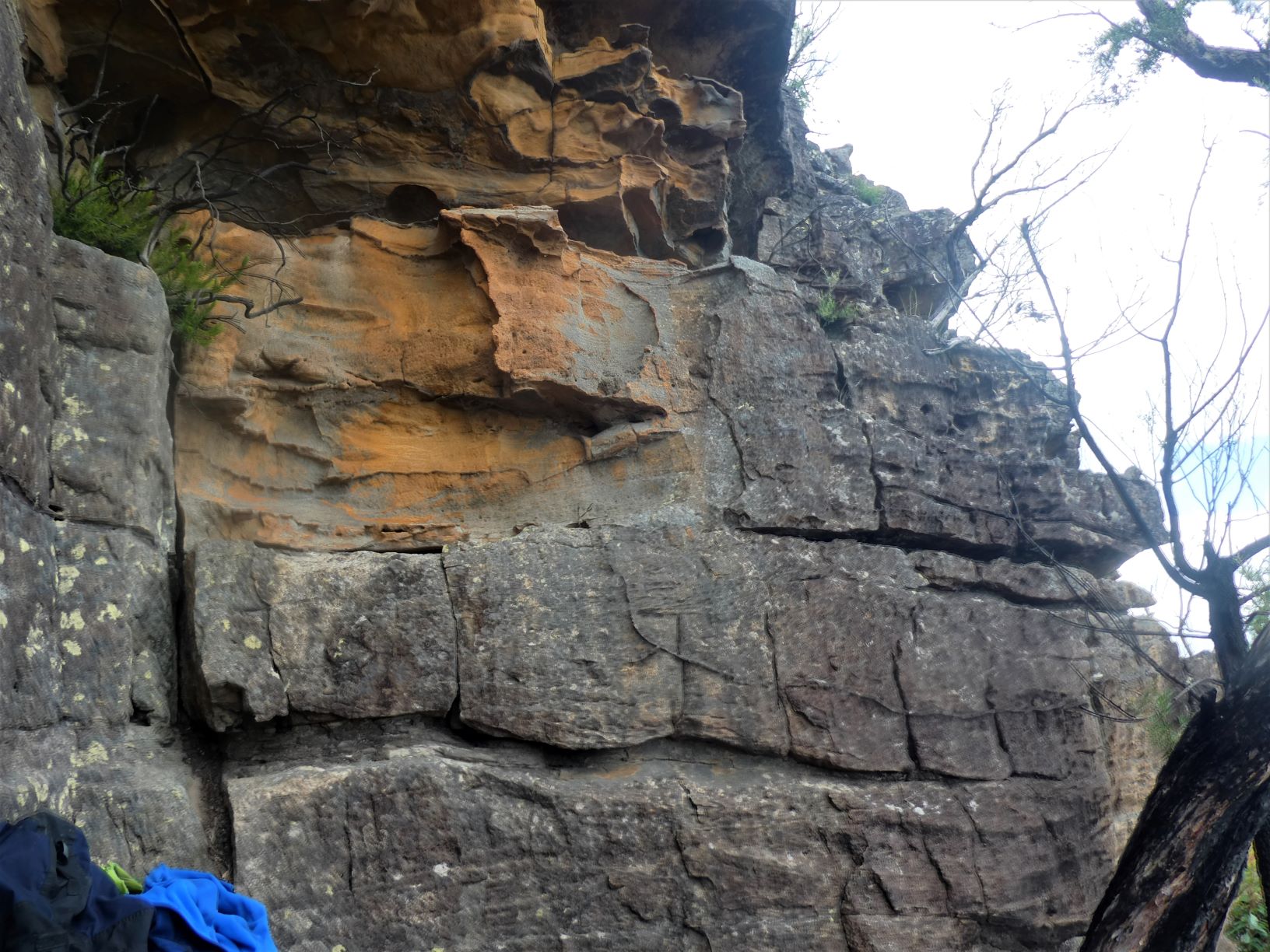
Continue right around the point until the Point faces South West along a spine. Ascend to the spine where you’ll find a nearly ascendable wall. Don’t ascend there, but descend 10m to the East and only there scramble up the steep ramp, and follow the line of least resistance. This line includes a small forked Cassuarina that assists up a 1.5m rock step. From there follow to the East through a small orange overhang, and find yourself at an easy 3m rock face (pictured below). The ascent is v. straightforward and that’s the top.
From the lookout a further 100m North there are good views of the route from Lions Head into the valley. And follow your nose North and East across the tops to the join the fire trail.
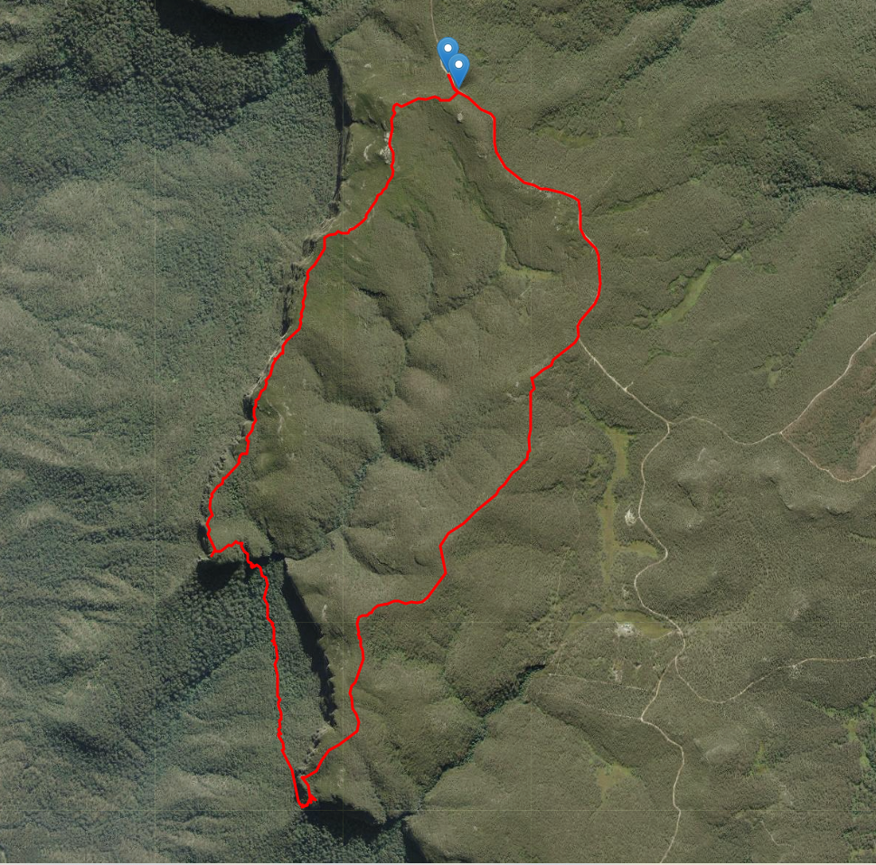
Satellite view of route to Holbeachs Descent
Actual Timing
- Left Car at 7:45AM
- At Lions Head Pass by 8:27
- At Lions Head by 8:37
- Down the first part of Holbeachs Descent by 9:05
- Bush bash down to Spring Creek, cross it, and bash 1.5km and ascend to the Spring Creek Point spine by 10:02
- Ascend to plateau by 10:15
- 4km bush bash over tops to fire trail by 11:40
- 2km dirt road to car by 11:55
Stats
Approx 9.5km
Approx 950m of ascent
2km on fire trail, 3km on foot pad, remainder offtrack
Track Notes
Start at the Lions Head track on Kings Tableland Road near Double Hill. Find the unmarked start that climbs steeply for 200m up through the scrub to Double Hill. In late 2020 it was still burnt out after the first 200m, but the track as easy to find. Follow it West, then South along to cliff edge as it undulates.
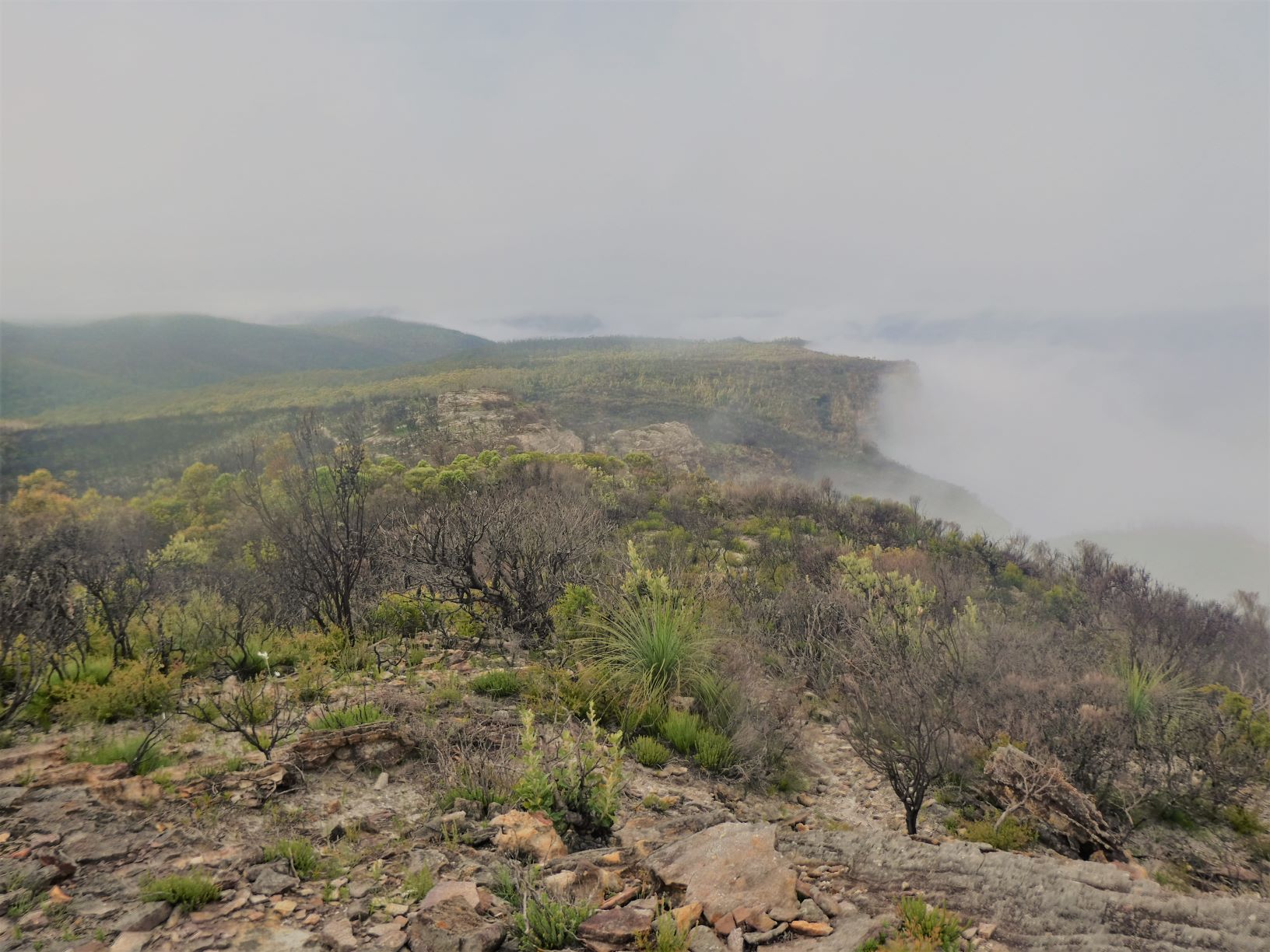
The valley was still cloudy, but the tops were just clearing as I jogged through.
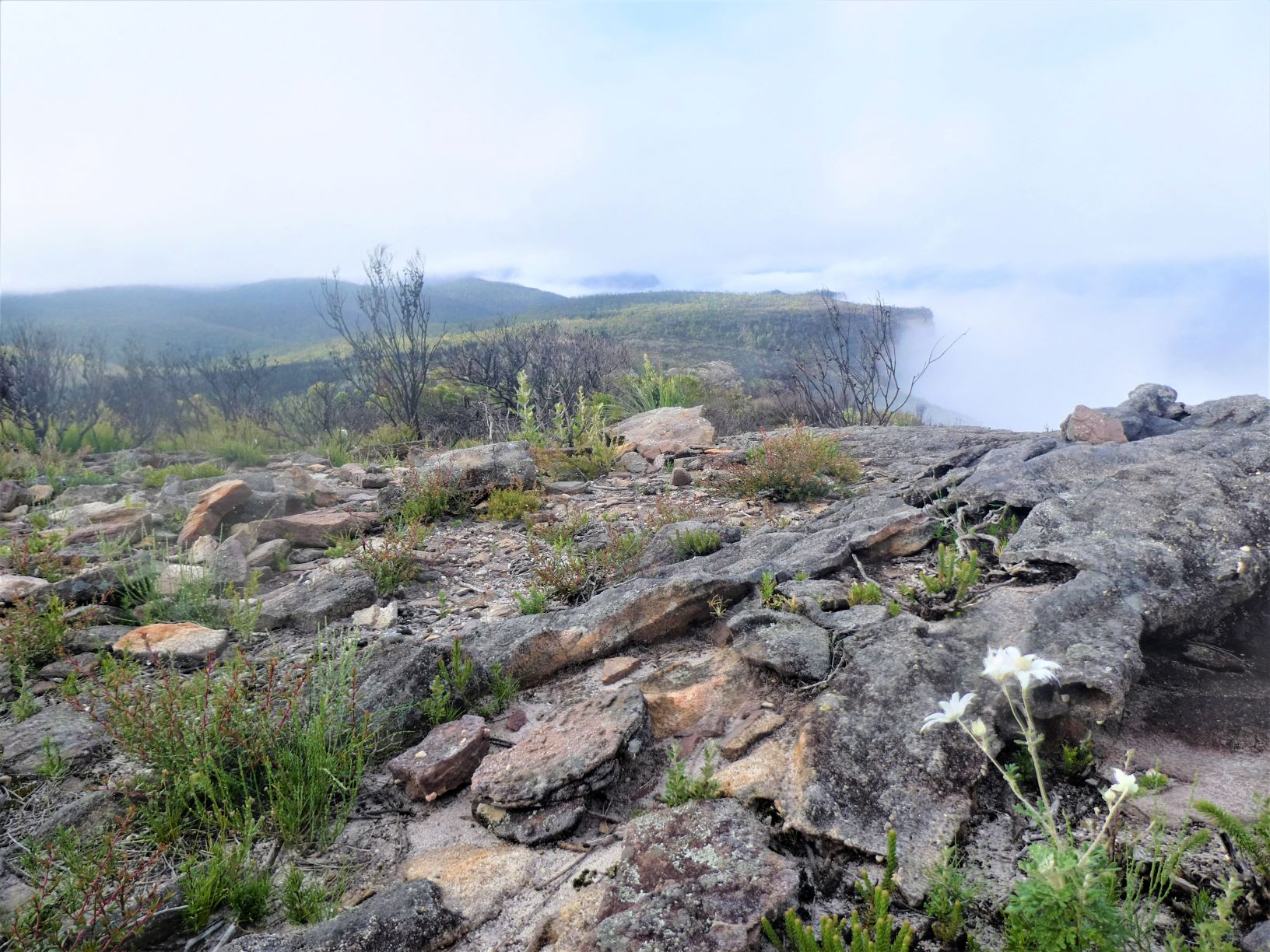
And the flannel flowers offered a foreground.
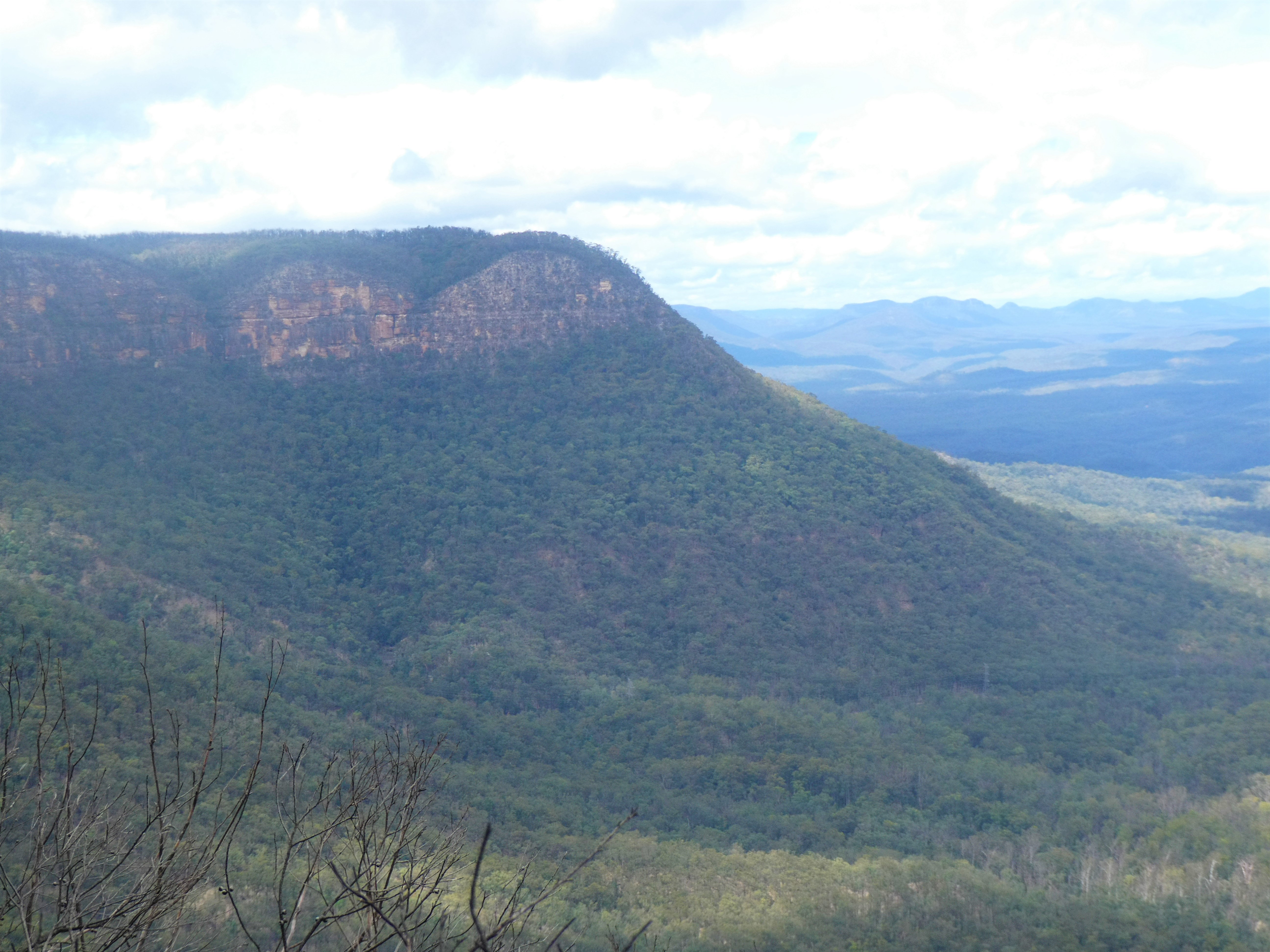
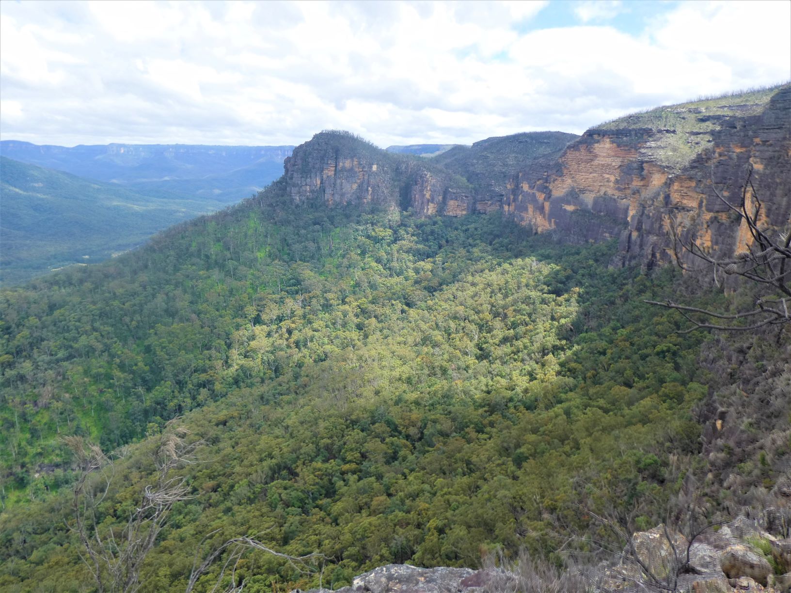
The track South gets close to the cliff edge. Looking West the Korrowall Ridge and Point Repulse is on the skyline. And the slab hut in Kedumba Valley is just visible above the clouds.
Continuing to the cairn at the top of Lions Head Pass and then quickly onwards and upwards to Lions Head. The 180 degree plus view from Kills Head in the South to Wentworth Falls in the North, via the Kanangra ranges, Blackhorse Mountain, the South end of Narrowneck, the Korrowall Ridge and East Col of Mount Solitary and the escarpments of Katoomba and Leura.
The cairn at Lions Head is a good morning tea spot, the log book remains unburnt (unlike of the one at the Pass).
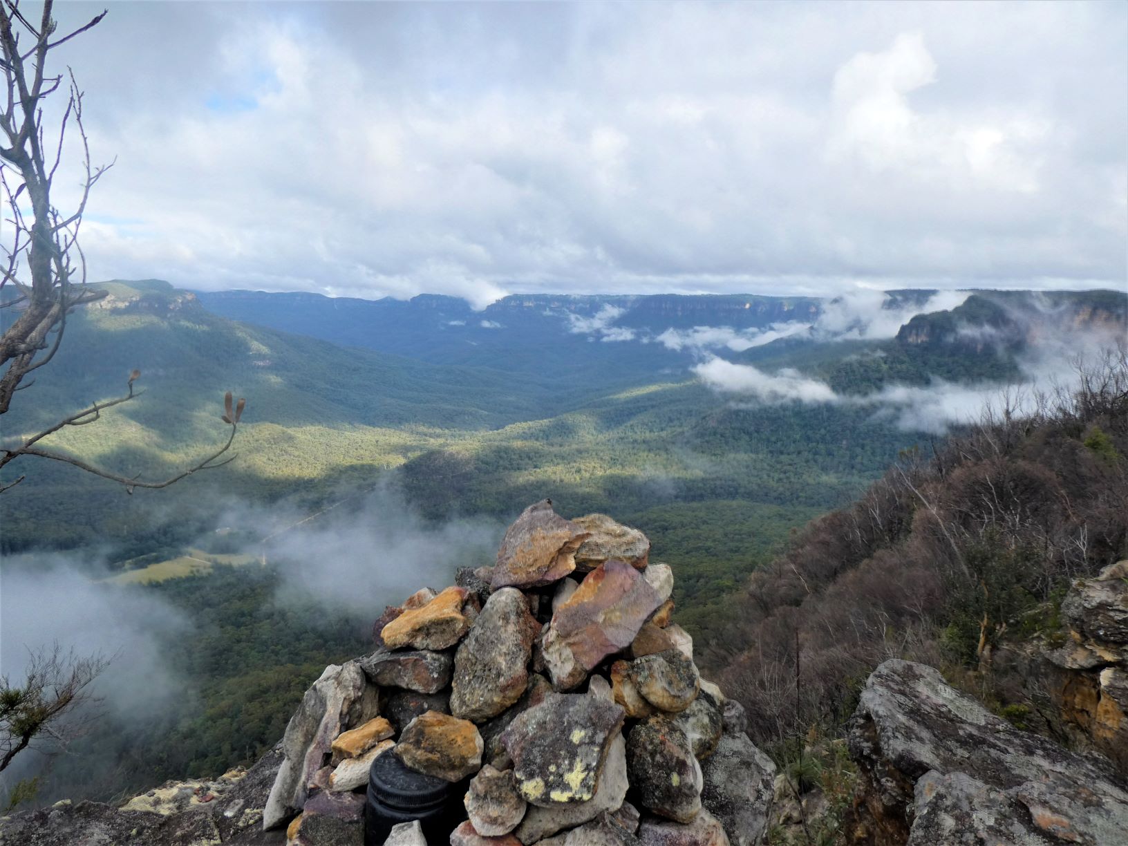
And South to Kills Head - another Pass into the valley.
Descending Holbeachs Pass
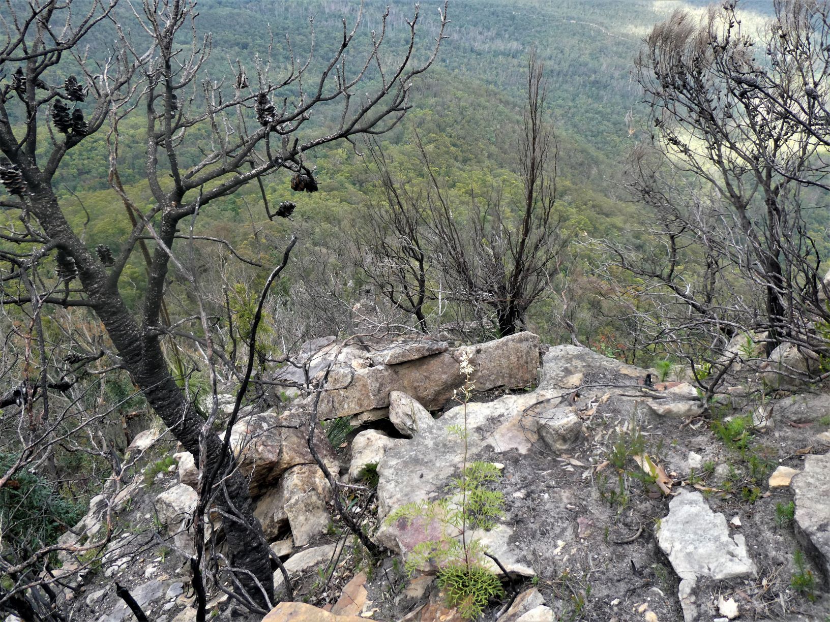
The gully from the Holbeach Descent is about 100m East of Lions Head, so a short 50m backtrack followed by a descent at first only steeply and then v. steeply to the East down a short obvious ridge into the first gully. There will be loose rocks on the descent to the gully - choose your footing carefully.
Once in the gully, there’s maybe 100m of descent over loose rocks (this is a rarely travelled pass) brings you to within 10m of a drop off.
The first gully doesn’t look especially steep once you’re down, but every one of those rocks is loose and every fern hides another loose rock. However, there are a few signs of a rough track down.
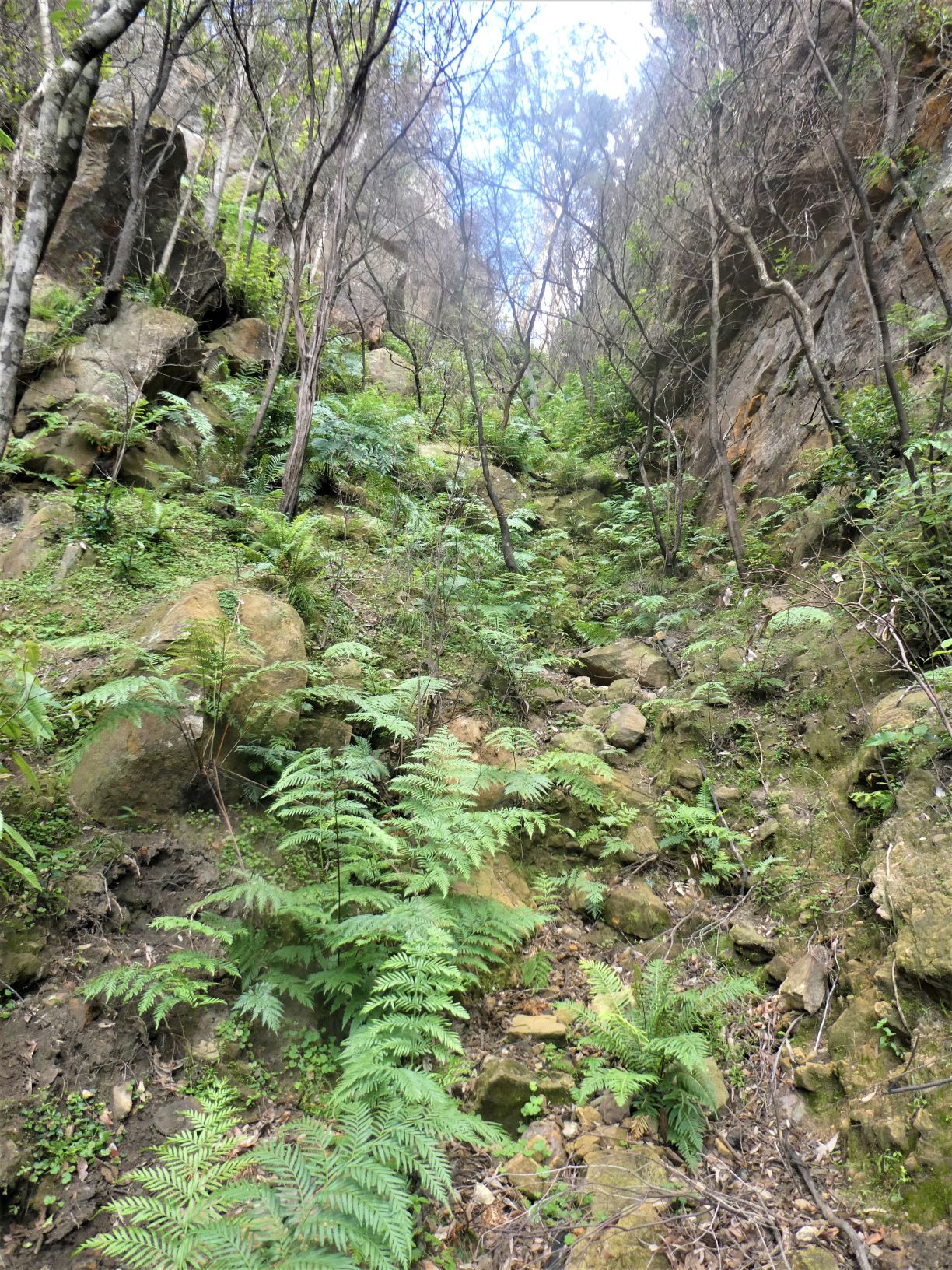
Contouring left into a 2nd and more Easterly gully allows the descent to continue… just as steeply. It comes to steep 3m slabs that could probably be negotiated with tape and a steady pair of hands. It is slightly easier to contour right and back into the first gully. And after a small amount of exposure (tape optional, but recommended) the talus is reached.
Follow a narrow (but not especially exposed) ledge to the left and descend steeply to Spring Creek. Battle across the Creek over large boulders and fallen branches, and head straight towards the base of point. After 300m the going gets significantly easier along a broad level terrace.
Ascending Spring Creek Ridge Pass
Continue right around the Point until the Point faces South West along a spine. The spine is visible from the aerial shot shown below. Ascend to the spine where you’ll find a nearly ascendable wall. Don’t ascend there, but descend 10m to the East and only there scramble up the steep ramp, following the line of least resistance. This line includes a small forked Cassuarina that assists up a 1.5m rock step. From there follow to the West through a small orange overhang, and find yourself at an easy 3m rock face.
The ascent is v. straightforward with wide footholds recessed into the face… and within minutes you’ll be on an easy gradient to the plateau.
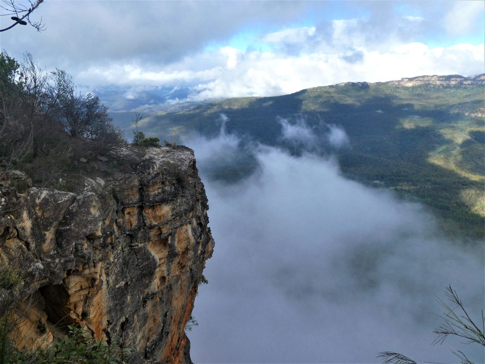
From the lookout an easy further 100m North there are good views of the route from Lions Head into the valley. The dark area of the cliff near Lions Head is the Holbeach Descent, with the ensuing steep descent to Spring Creek apparent.
And follow your nose North and East across the tops for 4 km to the join the fire trail. The first 500m is mostly uphill and through springy charcoaled Banksia. After that, it gets slightly better and a little faster going for much of the remainder of the high trek.
Descending Spring Creek Ridge Pass
If you feel that reversing the route is preferable, consider that Spring Creek Ridge Pass is especially difficult to find from the plateau. This is mostly becasue the short easy climb is indistinguishable from the impossible precipitous drops that characterise the remainder of the Point. The climb is directly in line with the spine that just protrudes from the greenery on the talus. To find it I’d suggest carefully investigating every edge above the spine looking for a wide ledge 3m below, starting from the East side. You may even spot a couple of well-placed rocks to guide you. However, I expect the good (recessed) footholds clearly visible from the bottom of the climb to be completely invisible from above, making any descent look impossible without a rope. There are a couple of those well-placed rocks shown below directly in line with the spine far below.
And finally the route as recorded by Garmin.