
Gladstone Pass and Lawbeck Pass
Descend Gladstone Pass, ascend Lawtons Gully, head West and ascend the climbers route to Isobel Bowden Ridge and return to Fairmont.
My intention was to descend Gladstone Pass, follow Lindemans Pass to the East to reach Lawtons Gully, descend to visit the mine adits, then ascend Lawtons Gully and eventually Lawbecks Pass.
A few of those got missed, either for good reason, or finding a better alternative.
Route
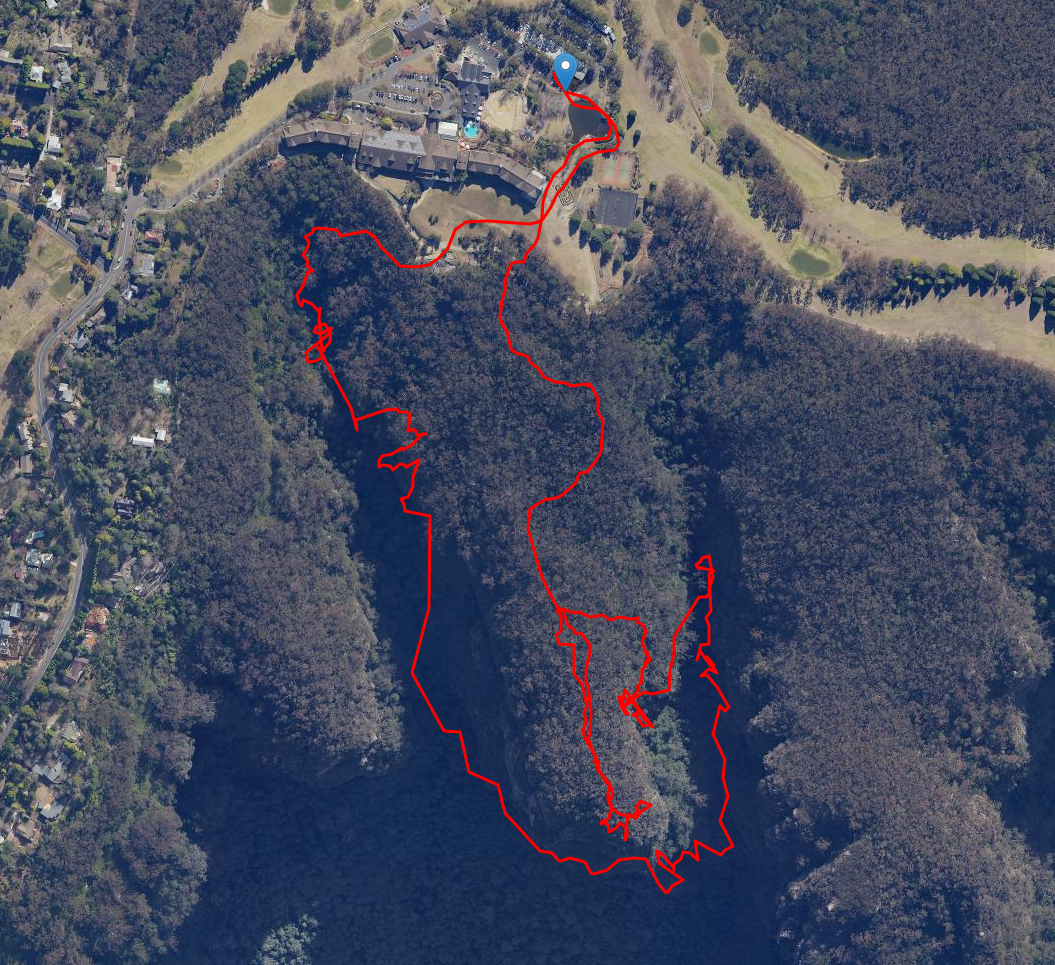
Aerial view of descent of Gladstone, ascent of Lawtons Gully to the 15m waterfall, backtrack to the ascent of climbers route, bush bash to end of Bowden Ridge followed by brief descent to top of climb, and return to car park..
Gladstone Pass
Parking at Fairmont Resort (far end of Level 3 is optimum), follow around the duck pond, past the resort, west across & down the grassy slope, and immediately across the dirt track to find the signposted top of Gladstone Pass.
Muddy, wet, slippery, steep, log jams are all suitable adjectives to describe the first third of the Pass.
The middle third is best described as wet, slippery, precipitous, steep, exposed.
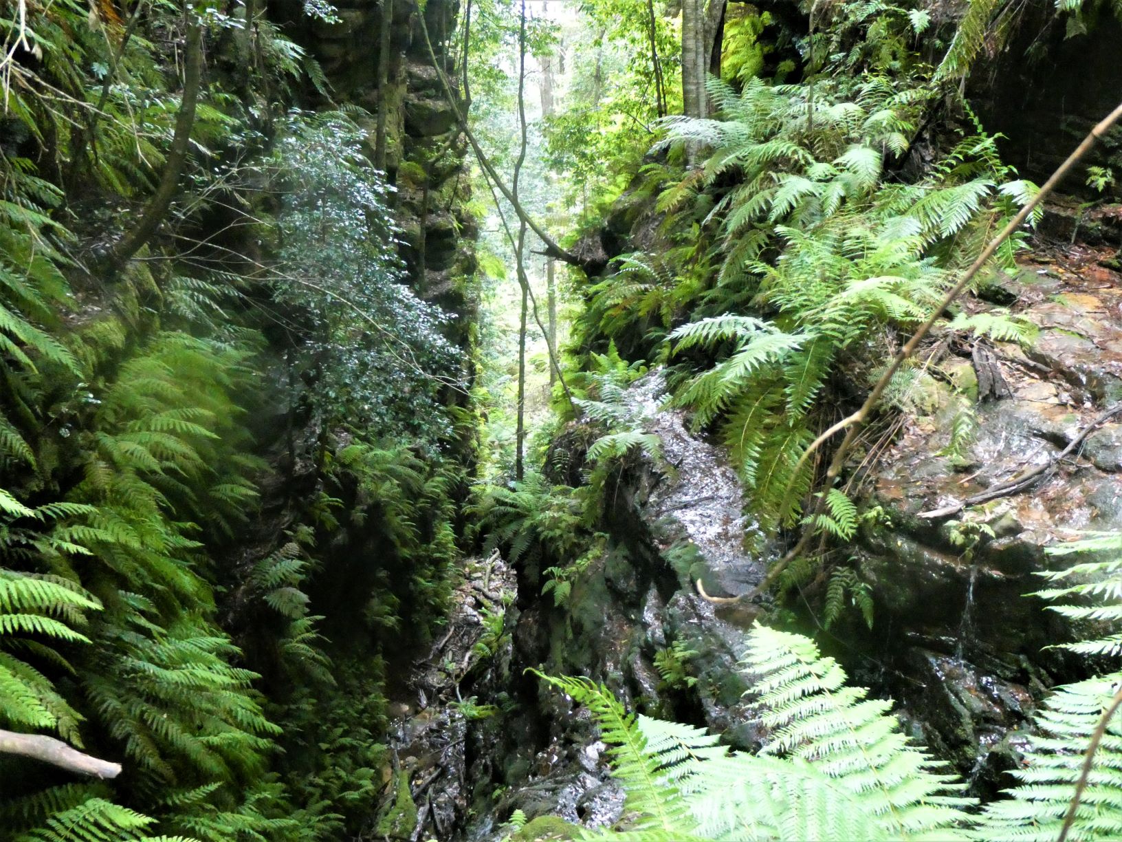
The final section is only fairly steep, rocky, relatively drier, slightly harder to route find, with multiple creek crossings.
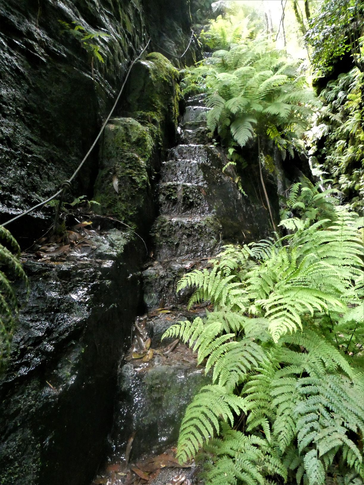
The exposed sections are roped, below is the 5-8m drop to the creek.
Lindemans Pass and Mine Adits
Eventually, the gully widens, with the track appearing to head high and West, before dropping a little to an obvious cairned juntion. Crossing the creek and following Lindemans Pass around to the East on good track gets to Lawtons Gully within 10 minutes.
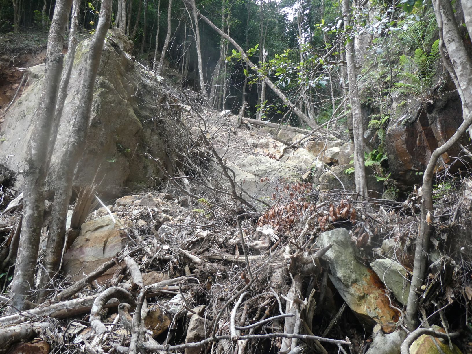
However, a significant landslip, presumable caused by the recent heavy rain, has destroyed the original track and also the lowest 20m of the creek above the track. The slip appears to now be stable although I only put weight on the larger rocks.
There is an alternative route up the creek 50m back towards Gladstone Pass.
Sidetrip - Visit to mine adit
A quick, steep and rough descent on the true right of the creek sees a smaller landslide on the right. This appears to have destroyed the entrance to the deeper adit. The small adit is a further 40m pf bushbash along the contour. This sidetrip took 15 minutes max.
Lawtons Gully
Ascending the gully has a few obstacles - the first being the landslide.
The second is an awkward short climb up a rock on the left of the creek, with only a weak fern to assist, and slippery footholds. A judiciously placed log or rock to provide a higher starting point assists greatly.
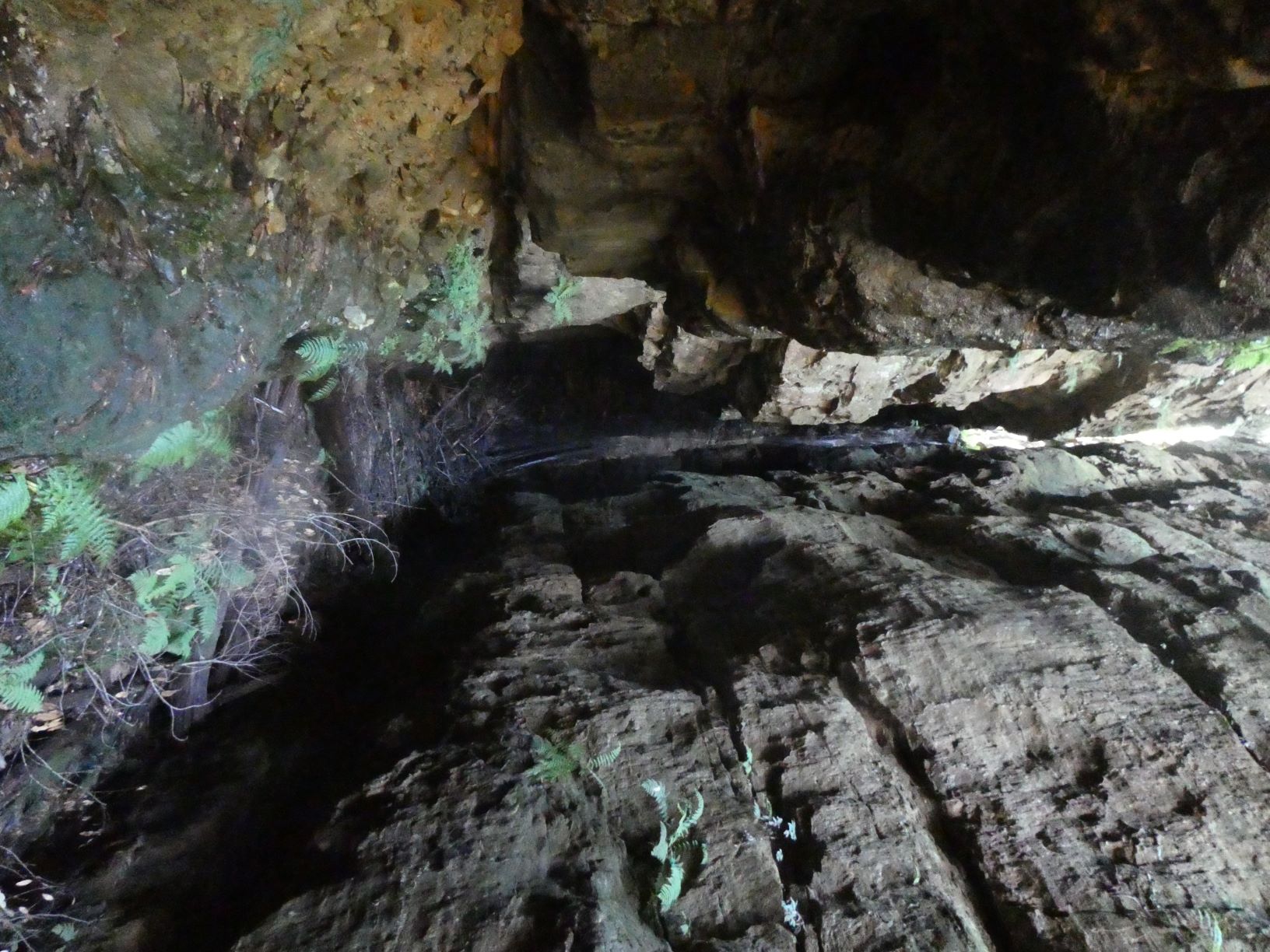
After climbing often very steeply up loose dirt exclusively on the left side of the creek, the route flattens out and shortly afterwards the 15m waterfall is reached. I recall abseiling this in February 2003 in search of a new canyon. In the absence of anchor points we used more than a dozen rotten logs and branches jammed in the gully. It worked that time.
Backtracking I intended to do a quick recce to the west to see if there was a possible route up through the ledges to the ridge, before returning to the opposite side of the gully to ascend Lawbecks Pass.
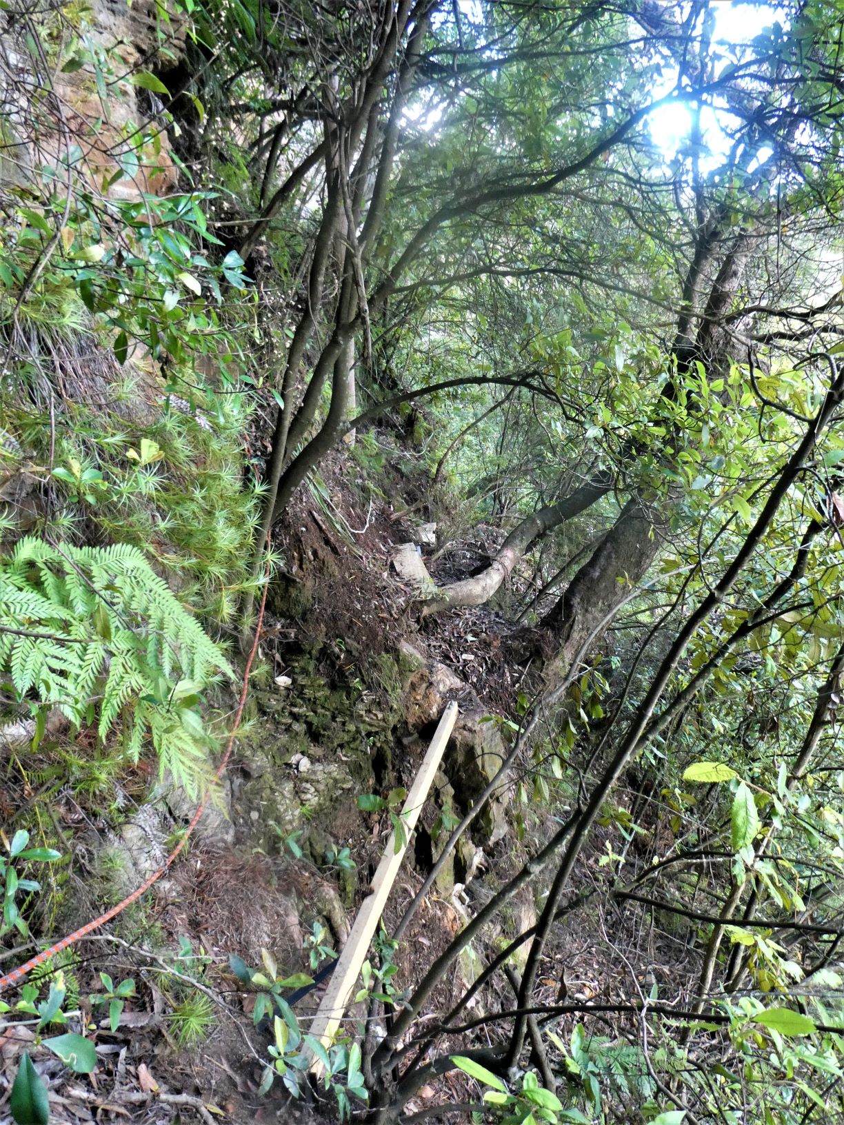
It was not to be. I returned back downstream through the gully, ascending the slopes keeping high to the south, and west whenever possible, steeply but mostly very steeply through loose dirt and dense scrub. There was no sign of any track, the slope soon became 60+ degrees, with small trees providing a degree of safety. And eventually the orange cliff base was reached about 80m from the nose. I was surprised that immediately before me there were rebar steps recently glued into the rock ascending a faultline… and below me following the cliff line to the South was a 25m ascent rope up the steep slope. Presumably a climbers track.
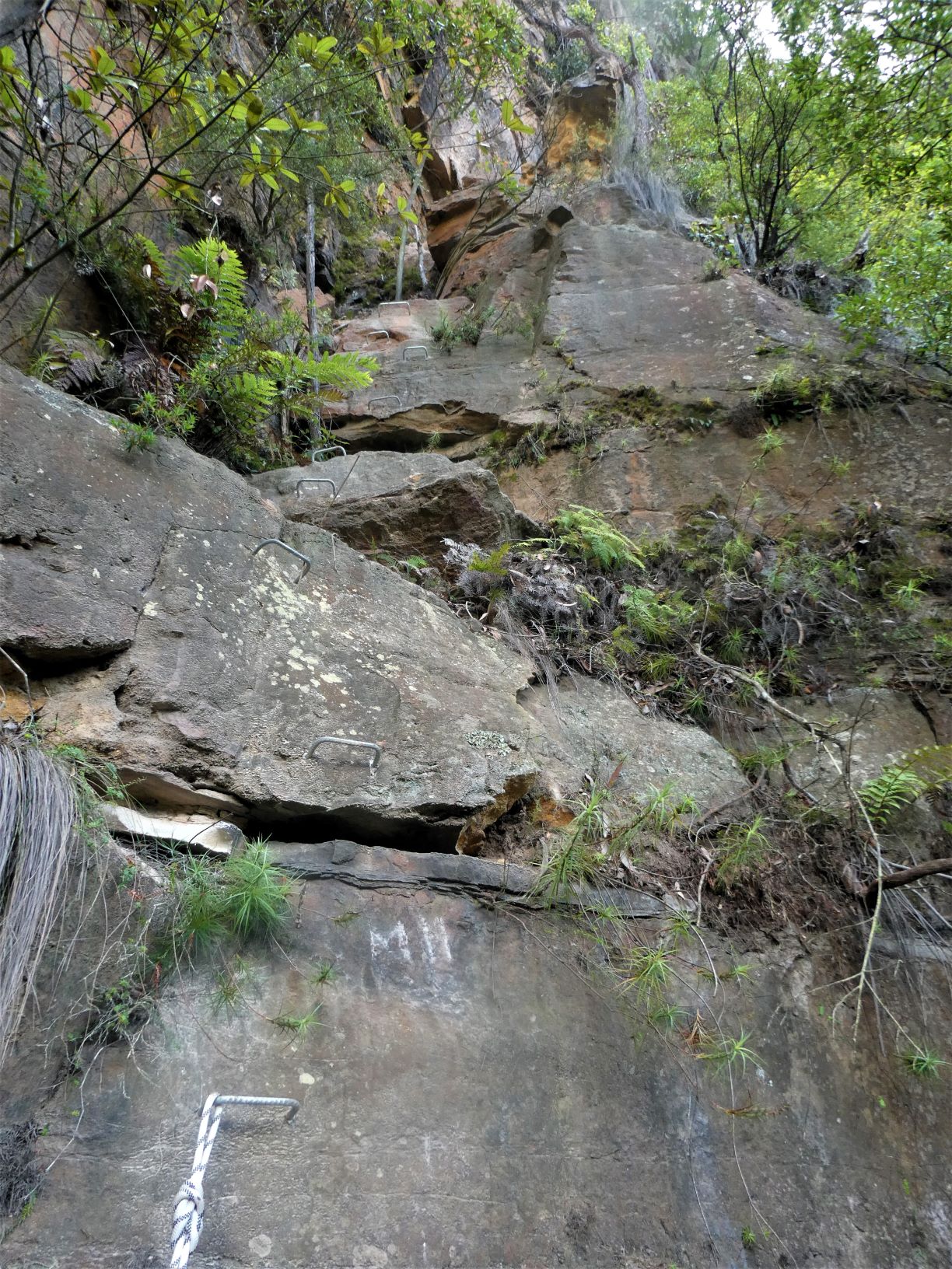
Ascending the steps was exposed but straightforward, with only one short section that required extra care, having only poor or wobbly natural handholds. Most parties would need to be roped up to ensure safety & handle the exposure.
It was maybe 20m of ascent, then the pad continued Northwards and contoured through some more roped sections with additional planks over the steep parts.
And Yes, the ascent to get to the base of the climbers route really is that steep.
The faint pad continues along the contours North and then turns left and up onto the ridge to meet the pad that heads out to Isobel Bowden Point.
Following the occasional pink flagging tape, in less than 10 minutes I was at the small, cosy & level Point (which is to the Eastern side) with excellent views of Lawtons Gully and Gladstone Lookout to the East…
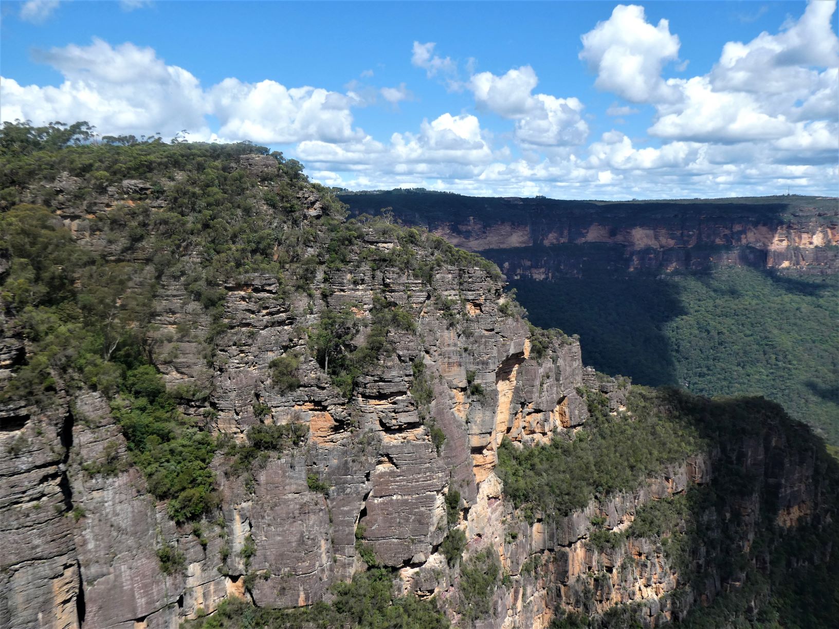
… and views of Kedumba, Mt Solitary to the South, and round to Narrowneck and Sublime Point.
From there return along the faint & rough pad along the ridge to get to one of the tourist pads around the Fairmost. Taking the left at this track returns to the Fairmont High Ropes within 5 minutes, taking the right turn would take only a little longer.
Actual Timing
- Left car park at Fairmont 1:49PM
- At top of Gladstone Pass 2 minutes later
- Base of Gladstone Pass at 2:06PM
- Base of Lawtons Gully by 2:25PM
- Mine adit by 2:29
- Visited mine adit and returned to Lawtons Gully by 2:38
- At base of climbers route by 3:26
- At waterfall 3:01
- At top of Isobel Bowden Ridge by 3:35
- At lookout at end of Bowden Ridge by 3:47
- Brief descent to top of climb by 3:50
- Back at car park by 4:07
Next Time
I intend to try part of the route in reverse, descending the climbing steps, up the gully and find the ‘real’ Lawbeck Pass. The top of the climb should be reasonably easy to locate the 2nd time.
So the title of this post is only accurate as regards the intention, not the outcome.
Stats
8.05km
890m of ascent.
Elapsed 2:20 hours
Care
This is a route that has significant route finding challenges. It has steep sections, significant exposure, serious bush bashing, loose footings and potential for sub-optimal outcomes.
Plan for your timing to be significantly longer than those shown - traveling alone, familiarity with the route, steep slopes & passes and little time to rest & enjoy the surroundings affects the timing significantly.