
Seven Passes between Leura and Wentworth Falls
Descend Copeland Pass, along Lindemans Pass, ascend Gladstone Pass, descend Bowden Pass, ascend Lawbecks Pass, descend Roberts Pass, ascend Wentworth Pass and return to Fairmont.
After ascending Bowdens Pass earlier this week (possibly a first ascent from the valley), and unfortunately missing out on Lawbecks Pass, I committed to rectifying that ommission.
The quickest way to ascend Lawbecks Pass is to walk 10 minutes from Fairmont, descend Bowdens Pass into Lawtons Gully ascend the Pass and a further 15 minutes to return to car park… less than 90 minutes - too short even for a half day trip.
But tacking on a couple of extra passes on the end - Roberts and Wentworth are very convenient would make it a more worthwhile trip. And even adding a couple more to the start would be interesting, while giving the option of an early exit after Lawbecks Pass. It was forecast to be 31C by early afternoon, however most of the route has good tree cover and on the South side anyway.
So the plan was to descend Copeland Pass, traverse along Lindemans Pass, ascend Gladstone Pass, descend Bowden Pass, ascend Lawbecks Pass, then decide whether to continue to descend Roberts Pass and ascend Wentworth Pass or just return to the Fairmont.
Route
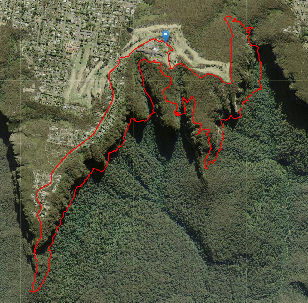
Aerial view of the full route.
Planned timing
- 20 minutes to Sublime Point
- 30 minutes to descend Copeland Pass to Lindemans
- 40 minutes along Lindemans to Gladstone (depending on landslips, fallen trees)
- 40 minutes up Gladstone back to Fairmont
- 15 minutes to top of Bowden
- 30 minutes to descend to Lawtons Gully
- 10 minute snack & water stop
- 30 minute ascent to Moya Point ridge
- 10 minutes to Roberts Pass
- 25 minutes to descend to base
- 40 minutes to Wentworth Pass
- 20 minutes up Wentworth Pass to Empress Canyon
- 20 minutes to return to Fairmont Total 6-6.5 hours
Copeland and Lindemans Passes
Parking at Fairmont Resort (far end of Level 3 is optimum), head back up the road and to the end of Sublime Point Road, and down to the (excellent) Lookout. Return to the bridge and follow the pad down next to it, and keep descending over the slippery needles, tending to keep to the Western side of the spine. After the keyhole, it stays steep and after 10 minutes a minor track appears to go up 5m back the the spine - take it. Continuing down will lead to the climbers ledge on the Western side of Sublime Point, and subsequently the westernmost Copeland Pass variant. Following the spine, through a couple more keyholes with (rope assisted) climbdowns winds through scattered boulders but will eventually to the nose were it joins Lindemans Pass.
Lindemans Pass contours East and pass over a couple of significant landslips.
Recent rains waterlogged the rock and doubled it’s weight, causing it to plummet and destroy the track.
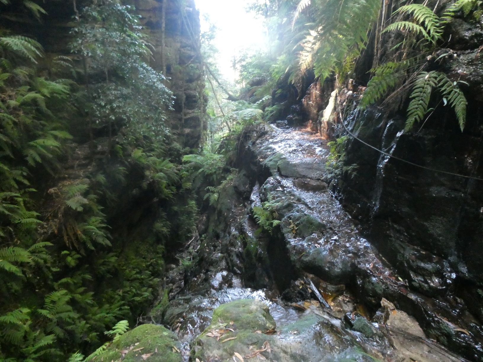
And eventually the track arrives at the cairned foot of Gladstone Pass.
Ascending initially on the left bank, then crossing the creek several times leads to the base of the exposed slippery roped section.
It’s a historic pass with steps carved from the sandstone.
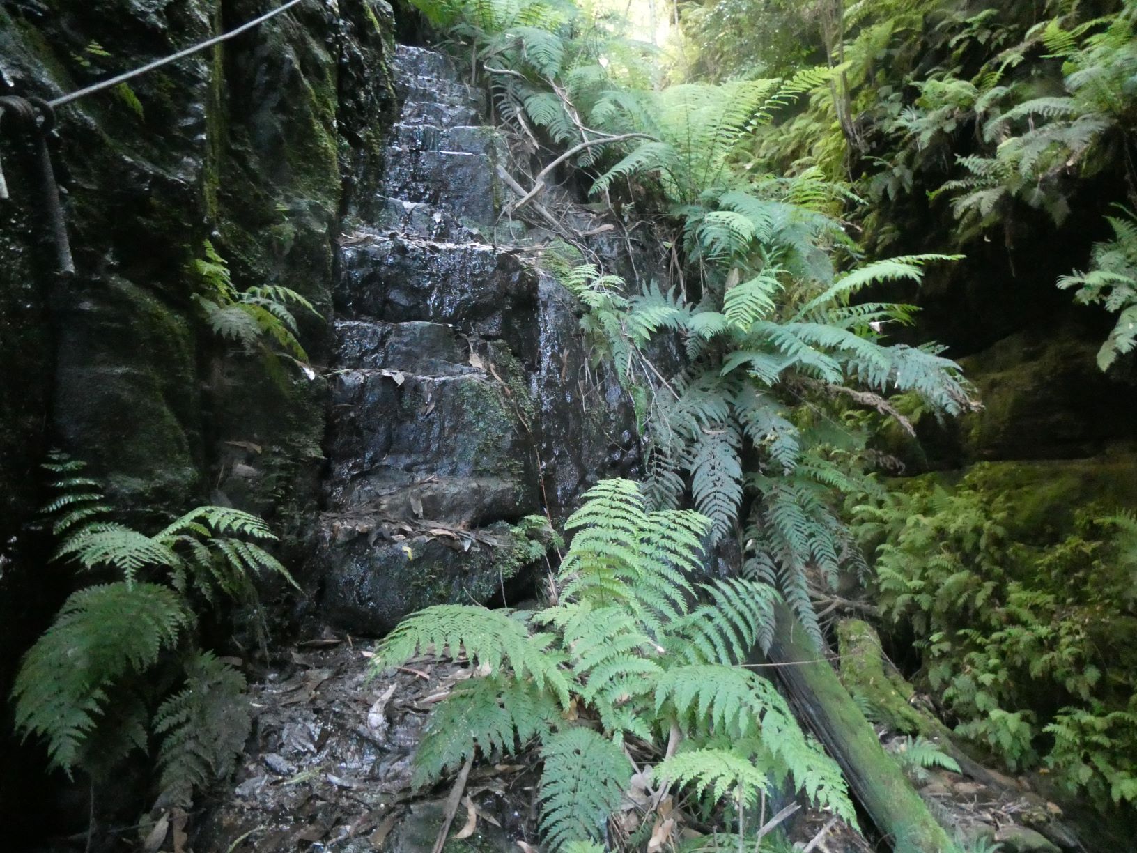
The top of the steps overlooks 10m of precipitous slippery rock to the creek bed.
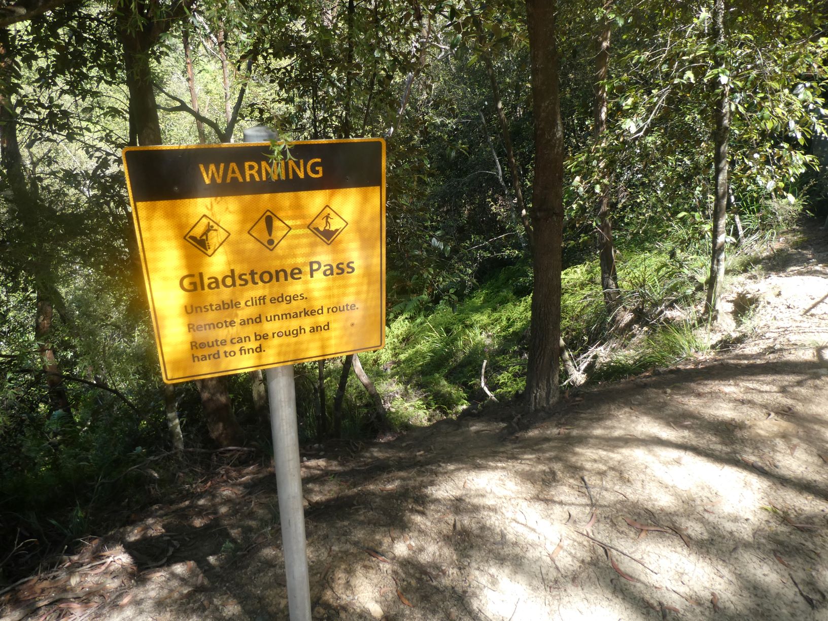
After a steep muddy section the dirt track is reached, with a polite informative sign.
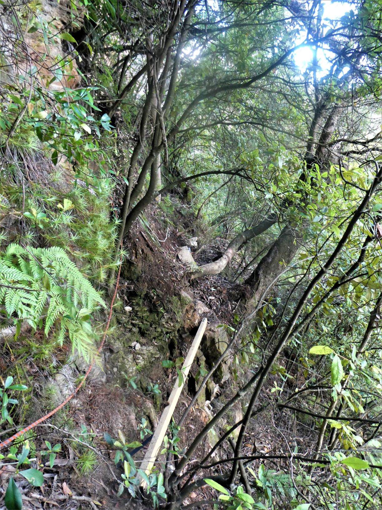
Turning right towards the high ropes courses, there is a minor track in the bush that starts within 5m of the landing zone of the long flying fox. Follow it for 10 minutes, taking the next right fork down Isobel Bowden Ridge. Shortly after it starts ascending slightly there’s a v. minor track on the left (close to 2 pink tapes) - it will lead East, then South to a short hand over hand up a rock, then to a couple of planks, followed by this 3rd one.
And immediately afterwards is the climbers descent. It is about 12-15m with mostly good foot/handholds glued to the rockface.
It looks a lot easier from the base.
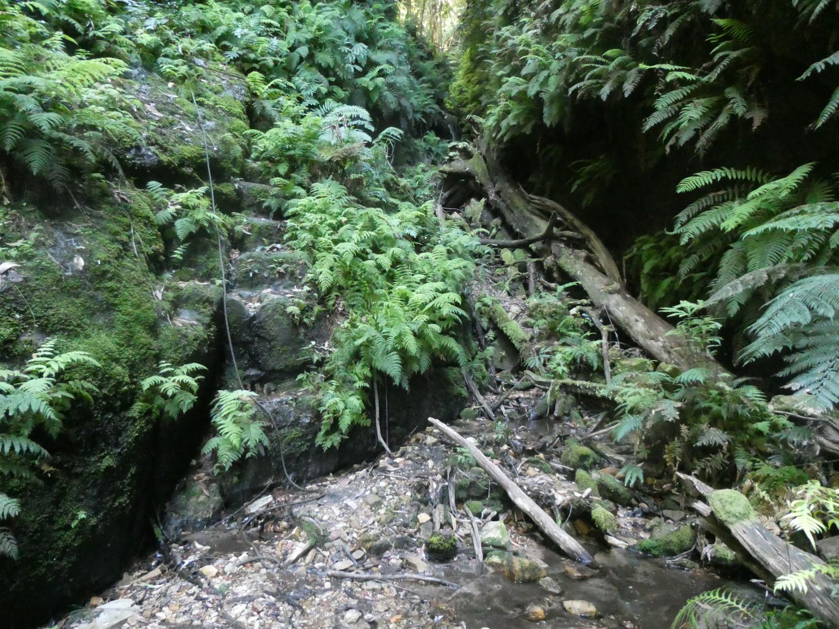
From this spot, there are several ropes that lead down to the start of a climb close to the nose of the Point. Descend only the first 2 ropes. Then bushbash due North, descending where appropriate using the plentiful small trees as the only reliable contact with the slope. After about 15-20m of descent the slope becomes only very steep. You may be lucky enough to come across a small cairn on a slightly flatter area - from there contour much more easily North to a lowish gray cave and subsequently to the creek in Lawtons Gully.
Ascend a little keeping an eye out for the unlikely Lawbecks Pass on the opposite side.
It looks like it has excessive exposure. The rope just visible drops into the narrow chimney on the cliff face to assist with the chimney ascent & nose traverse.
I took a short snack/water break for ten minutes to assess the situation.
The chimney is only 40cm wide, and has a large branch propped on a chockstone leaving less than 30cm to squeeze past it - not an exit for larger adventurers! By walking up the branch onto the chockstone using the rope, it’s fairly straightforward (although exposed) to achieve the sloping ledge on the nose at the front of the boulder & then traverse to the right hand face to ascend again to get behind the tree and to the base of the (hidden) ramp.
From there the exposure reduces significantly. It’s a steep ramp with a few handholds, long legs help with the mandatory chimneying past a boulder or two. It’s followed by a slightly tricky exit from the ramp, which leads to three options - the thin ledge North, the thicker ledge South back over the gully, or the immediate tricky free climb.
I investigated the climb, then both ledges briefly, and returned to the climb. A fall from there would probably see you a fair way down the gully very quickly, so don’t fall. It is followed by another slightly overhung climb. Both have adequte hand and footholds on adequate rock, but both require a degree of confidence in free climbing. There are suitable anchors to drop a tape to assist seconders.
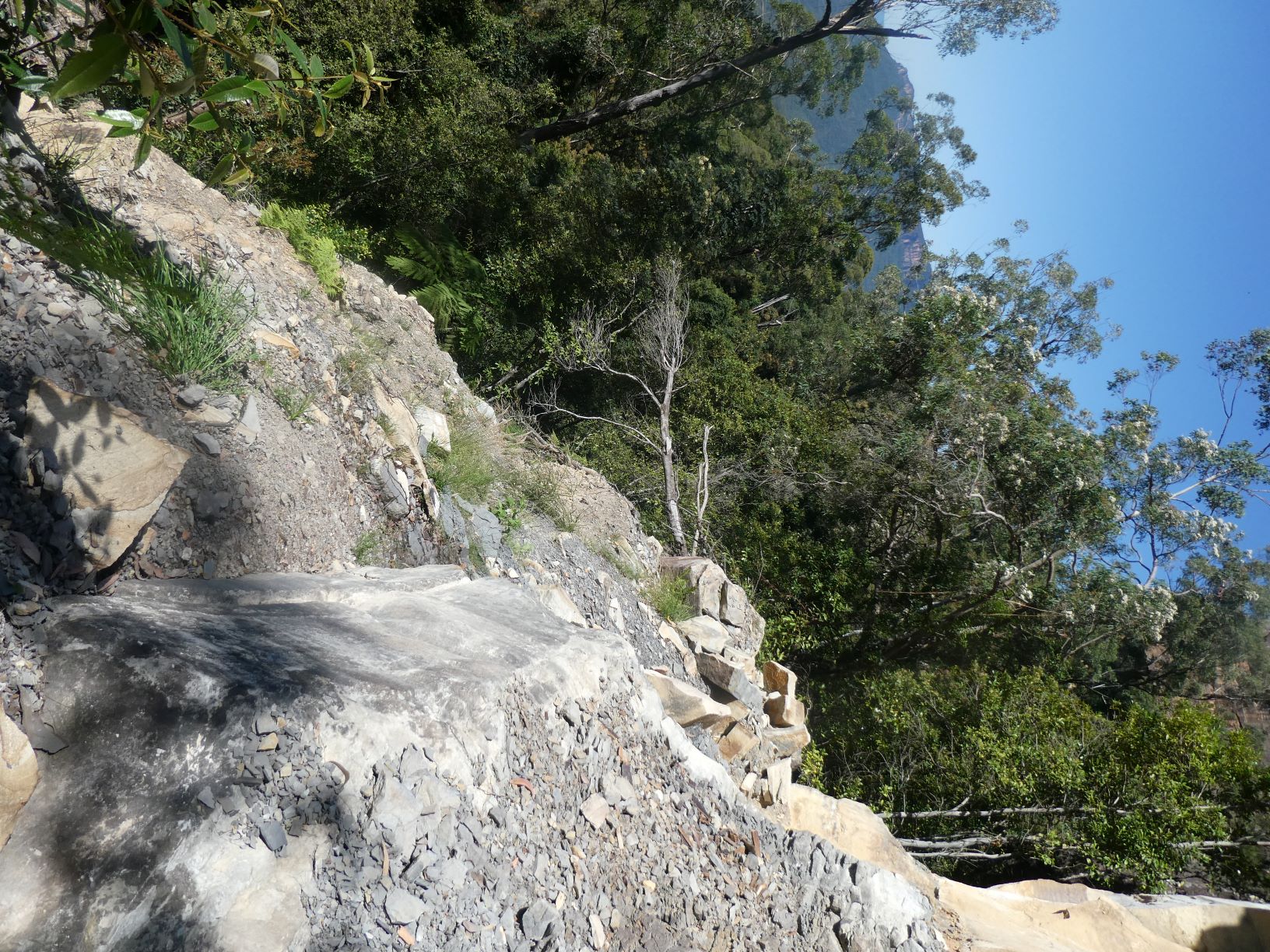
A rough pad from the top of the climb indicated that it was the route that others have chosen. Following it led to the old Gladstone Lookout track; taking the right option leads to Gladstone Point after 10 level minutes.
From Gladstone Point looking across to Isobel Bowden Ridge and Lawtons Gully, Bowdens Pass follows greenery diagonally up and right. The angle of the slope is apparent.
I would guess that continuing down the series of climbers ropes would lead to the ledge where any climbs would start. A previous trip found a rope and descent pad 10m North of Isobel Bowden Point directly above that ledge.
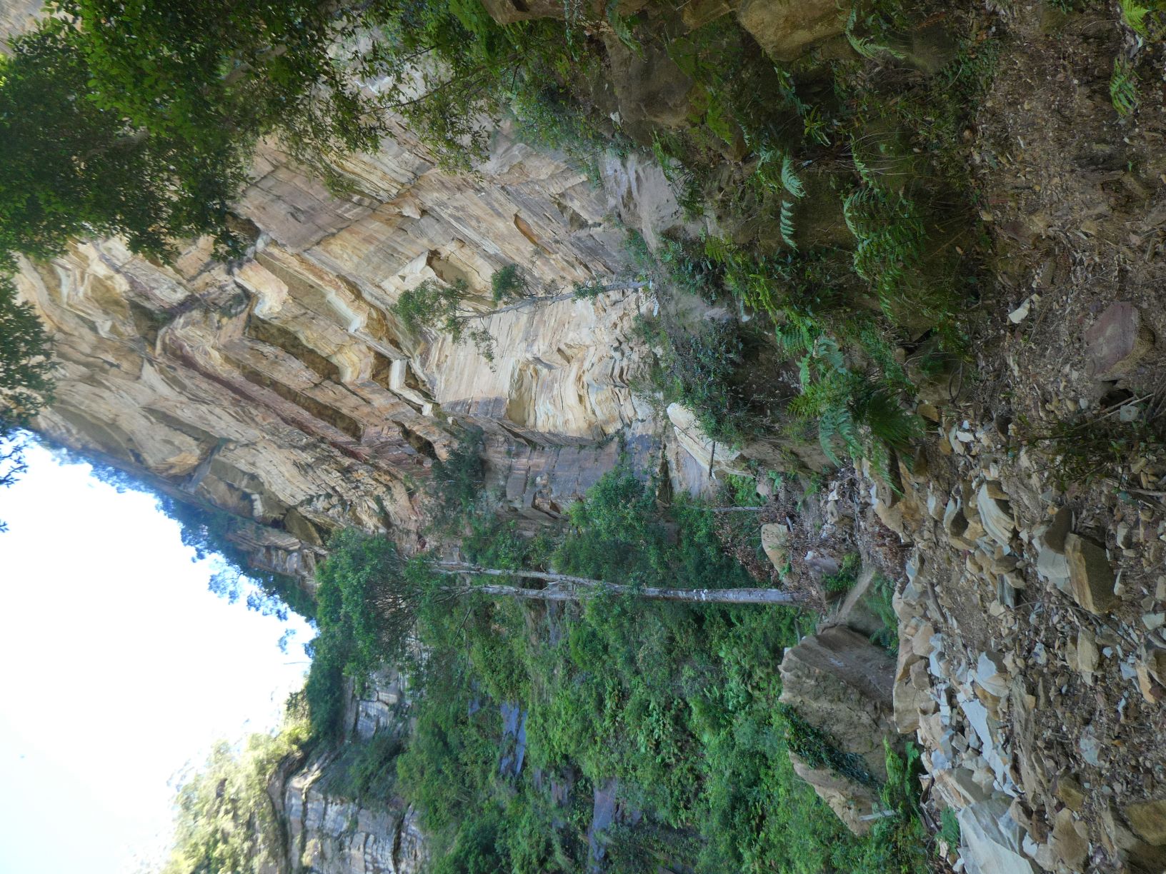
After another 3 minutes to the ‘new’ Gladstone Lookout Track and 1 minute to the top of Roberts Pass, the descent of Roberts Pass is pleasant.
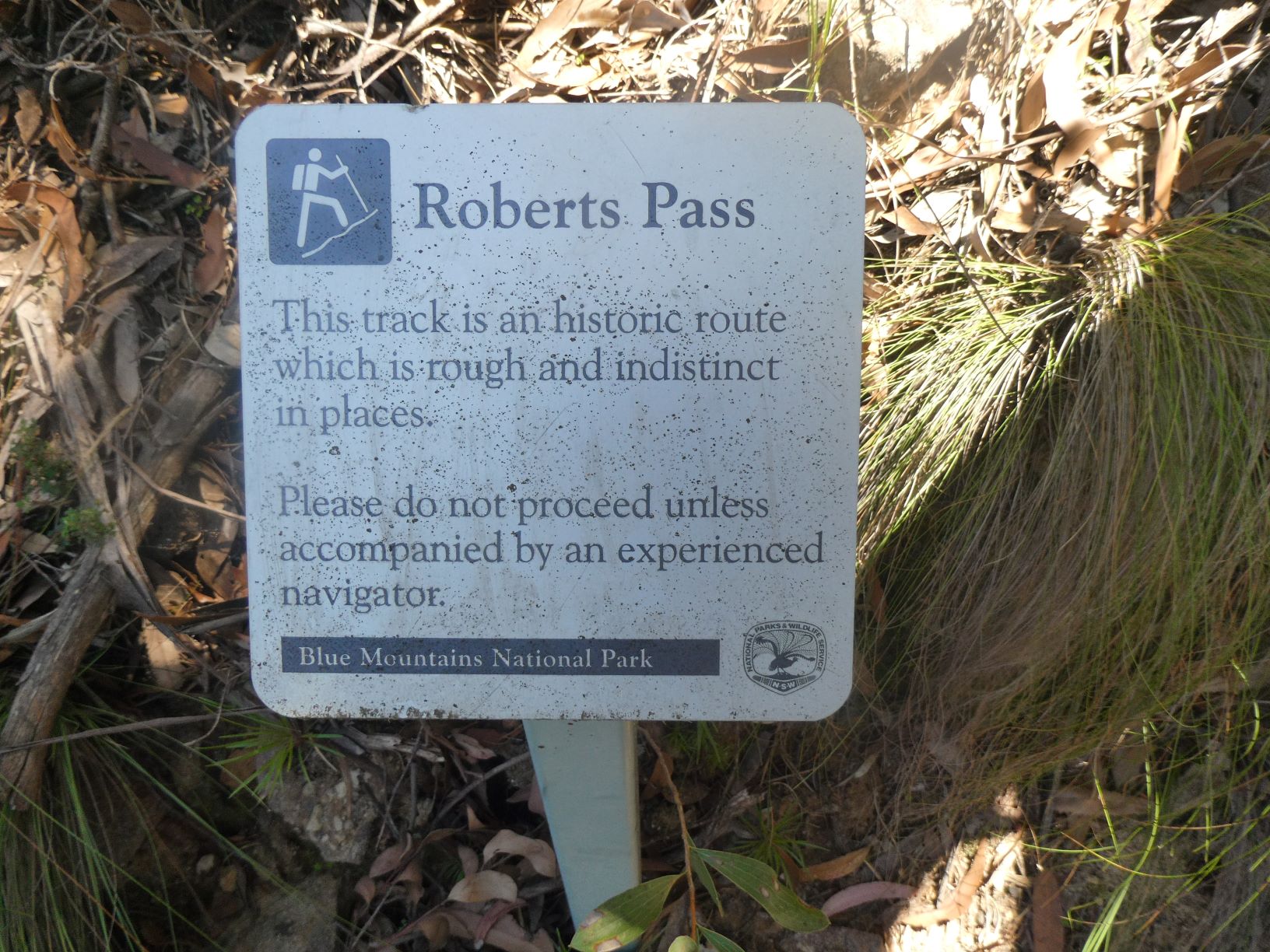
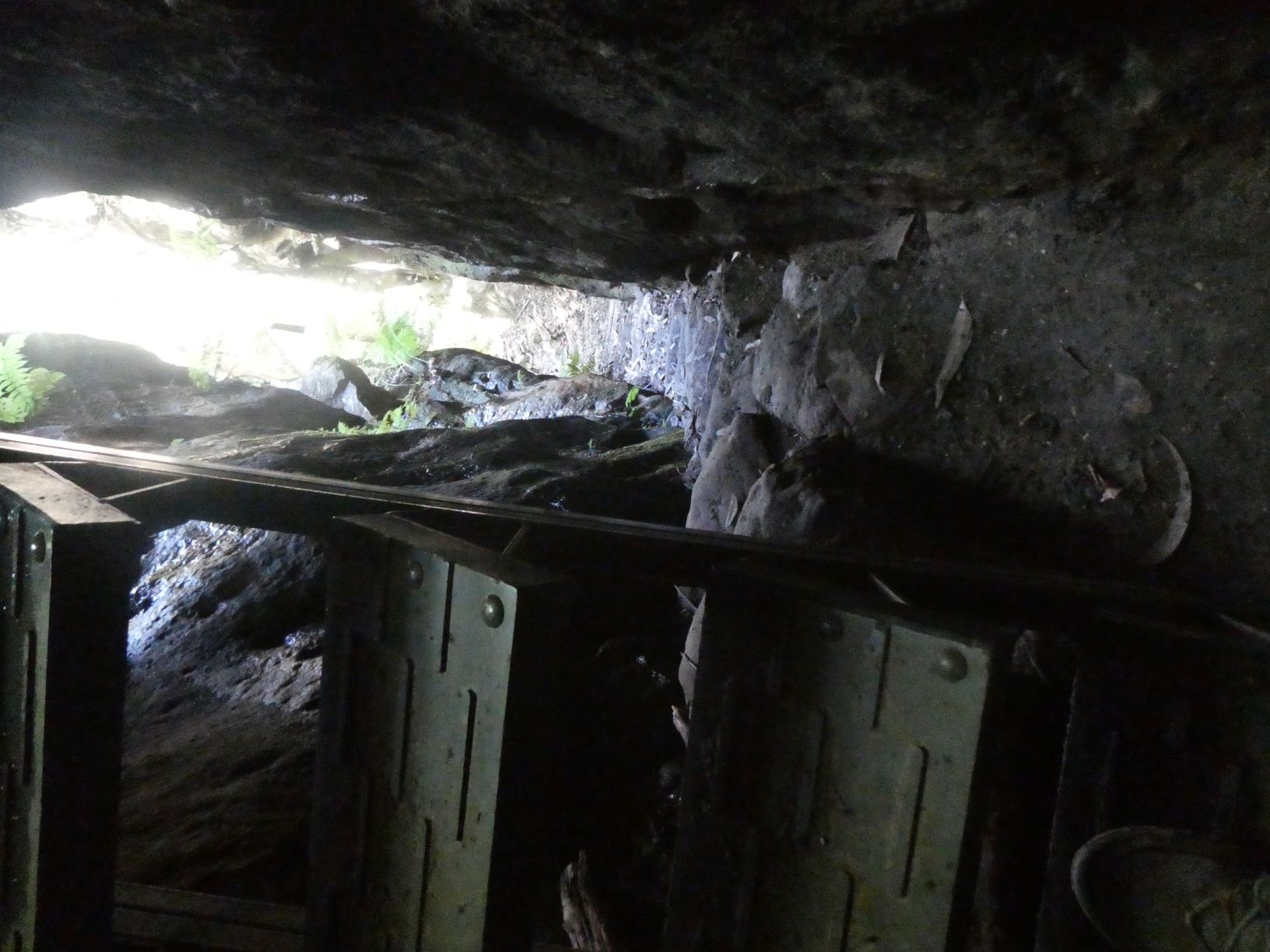
Descending to the iconic steps in the slot that defines the Pass.
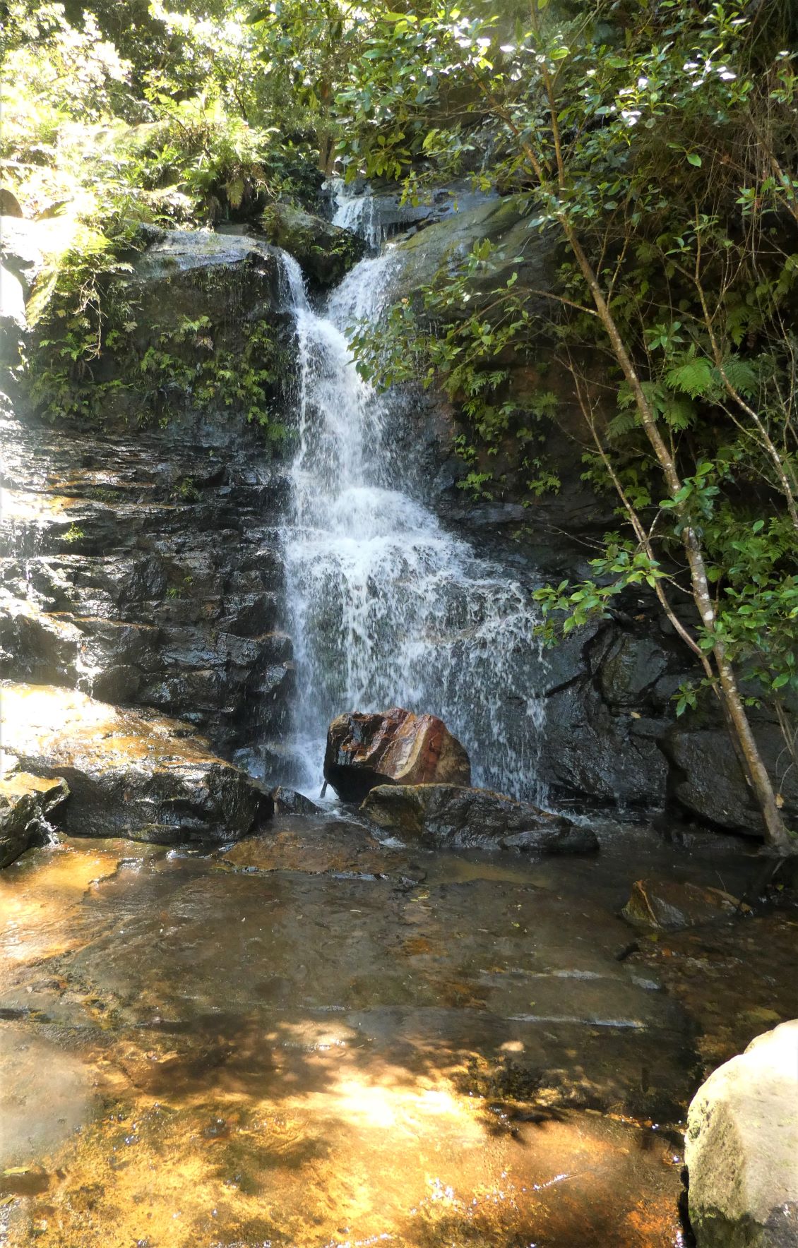
And a pleasant wander along the flat part of Roberts Pass to Wentworth Pass and the waterfalls
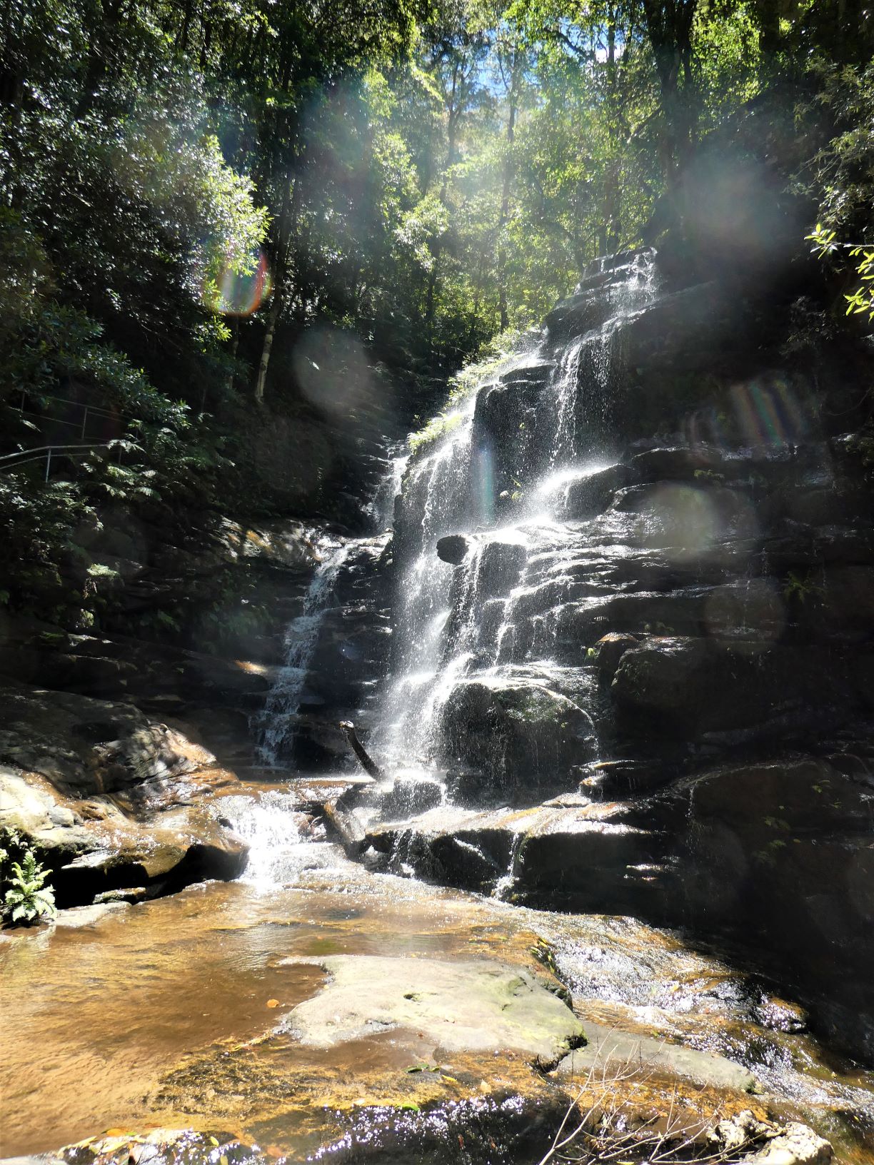
From there head up past Empress Falls, take the Nature Track, then over Lillians Bridge and return past the golf course to the Fairmont.
Actual Timing
- Left car park at Fairmont 8:44AM
- At Sublime Point 9:02
- Descended Copeland Pass to Lindemans by 9:53
- Along Lindemans to foot of Gladstone Pass by 10:15
- Top of Gladstone Pass 10:39
- Top of Bowden by 10:55
- In Lawtons Gully by 11:23
- 10 minute snack & water stop
- 30 minute ascent to old Gladstone Lookout track on Moya Point ridge by 12:05
- Gladstone lookout by 12:11
- Short photo break then to Roberts Pass by 12:19
- At base of Roberts Pass by 12:28
- At Roberts/Wentworth Pass junction by 12:59
- Nature track/Empress Canyon junction by 1:18
- Back at Fairmont by 1:42 Elapsed 4:58
Stats
GPS says 18.50km, probably nearer 14km
1681m of ascent.
Elapsed 4:58 hours
Care
This is a route that has significant route finding challenges. It has steep sections, significant exposure, serious bush bashing, loose footings and a requirement for free-climbing ability with potential for sub-optimal outcomes.
Plan for your timing to be significantly longer than those shown - traveling alone, familiarity with the route, steep slopes & passes and little time to rest & enjoy the surroundings affects the timing significantly.
There are early exits and the possibility of reversing sections if anything becomes overly problematic.