
Seven Mount Solitary Passes
Mount Solitary has two well known passes - the Korrowall Knife Edge at the North West and the Eastern Col. There are also two less well travelled ones - Miners Pass and Point Repulse - both fairly long days. However, there are several other bushwalking passes that get from the talus to the plateau. This trip completed three of the well known ones and four of the undocumented ones.
Mount Solitary has two well known passes - the Korrowall Knife Edge at the North West and the Eastern Col. There are also two less well travelled ones - Miners Pass and Point Repulse - both fairly long days. However, there are several other bushwalking passes that get from the talus to the plateau. This trip completed four of the litle known ones. In order they were Korrowall Knife Edge, Winding Pass, Bitter Cave Pass, Toorak Gully and Overhang/Blarney Pass, Point Repulse and finally Miners Pass.
Some of these passes require confidence on narrow exposed ledges and some scrambing ability over exposed drops.
Much of the route entails bush bashing up and down steep loose talus.
Three of the passes (Miners, Korrowall Knife Edge and Point Repulse) were done twice - once in each direction.
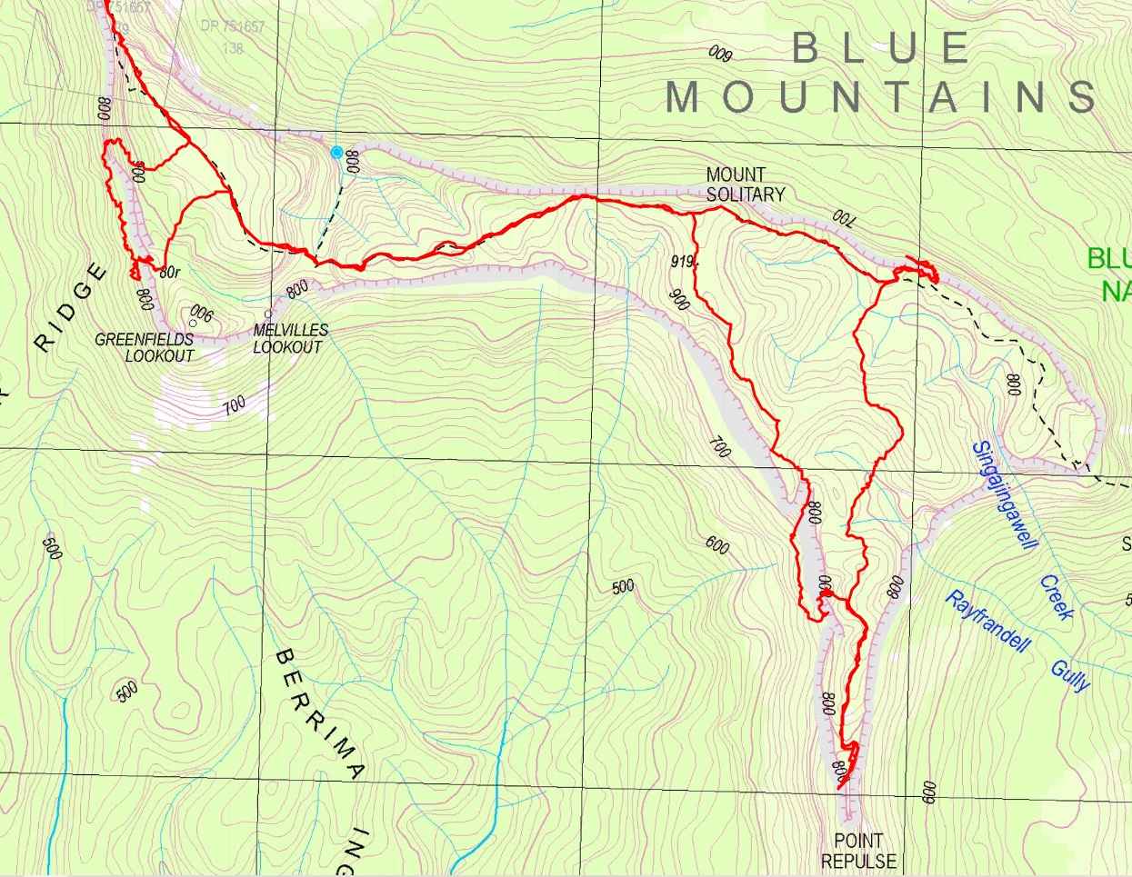
Route
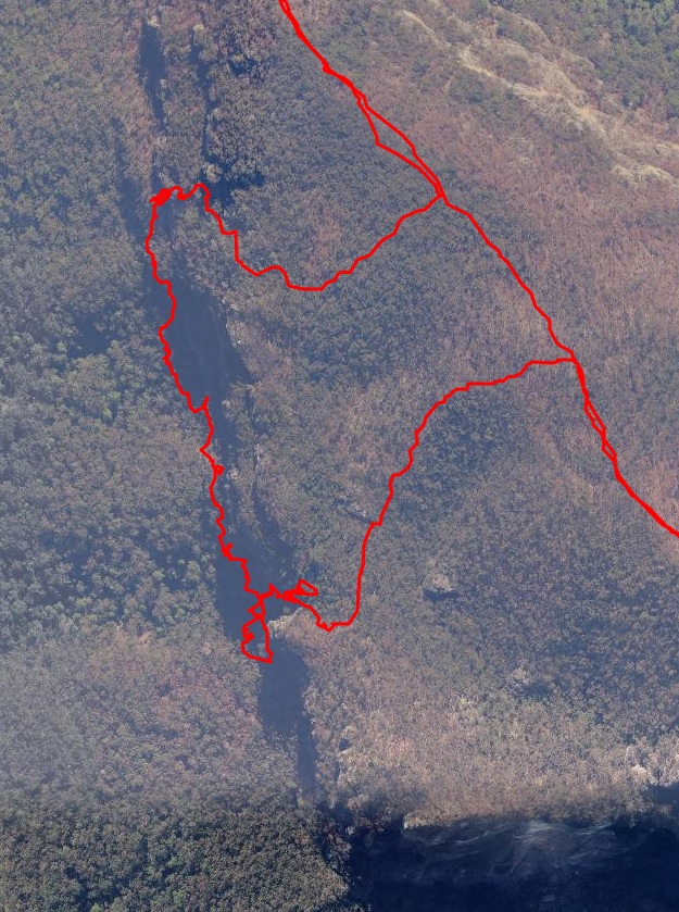
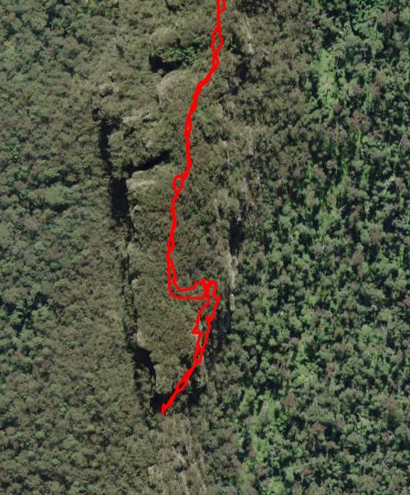
Aerial view of the relevant parts of Mount Solitary. Note that the GPS tends to bounce around when close to cliffs, so some of this route needs to be treated with caution. It’s usually impossible to tell which ledge the route is actually on.
The route from Golden Stairs to Mount Solitary is not shown.
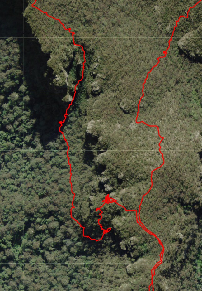
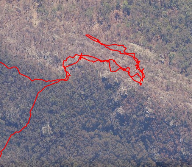
And more detail of the four areas containing passes.
Winding Pass with Bitter Cave Pass further South
Toorak Gully with Overhang/Blarney Pass further South
Point Repulse out and back
Miners Pass out and back
Track Notes
Park at Golden Stairs and head to Mount Solitary via Korrowall Knife Edge.
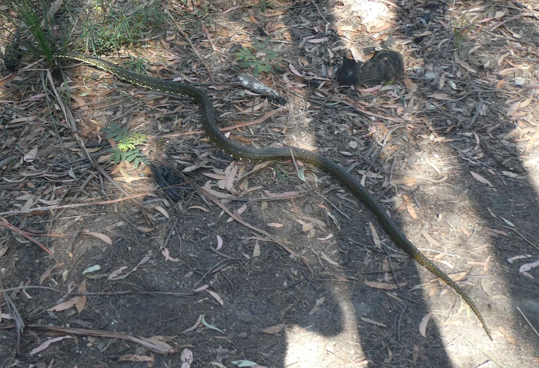
Avoid the 2.5m Diamond Python hunting on the top of Mount Solitary.
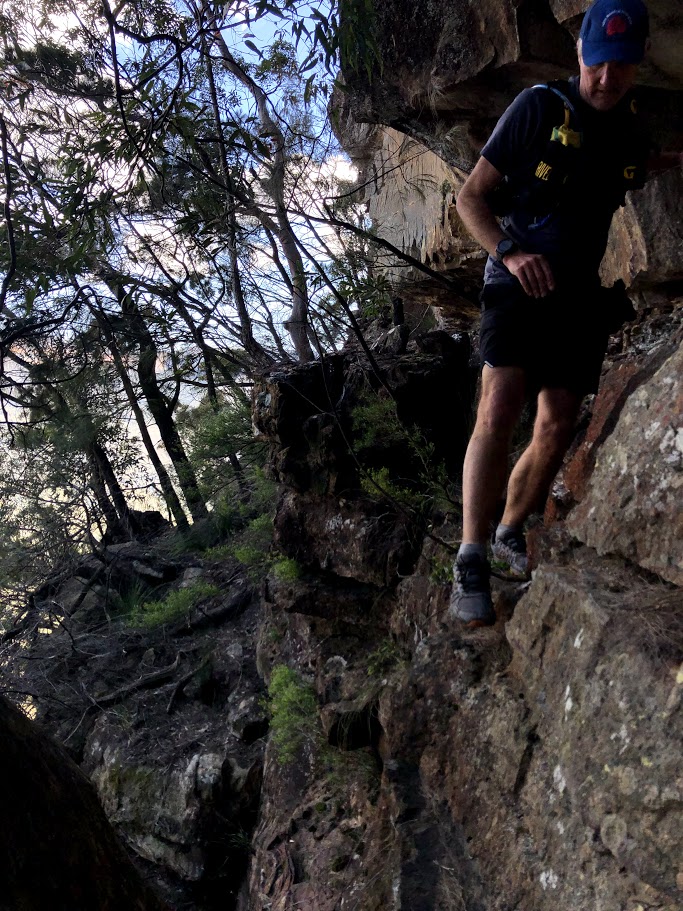
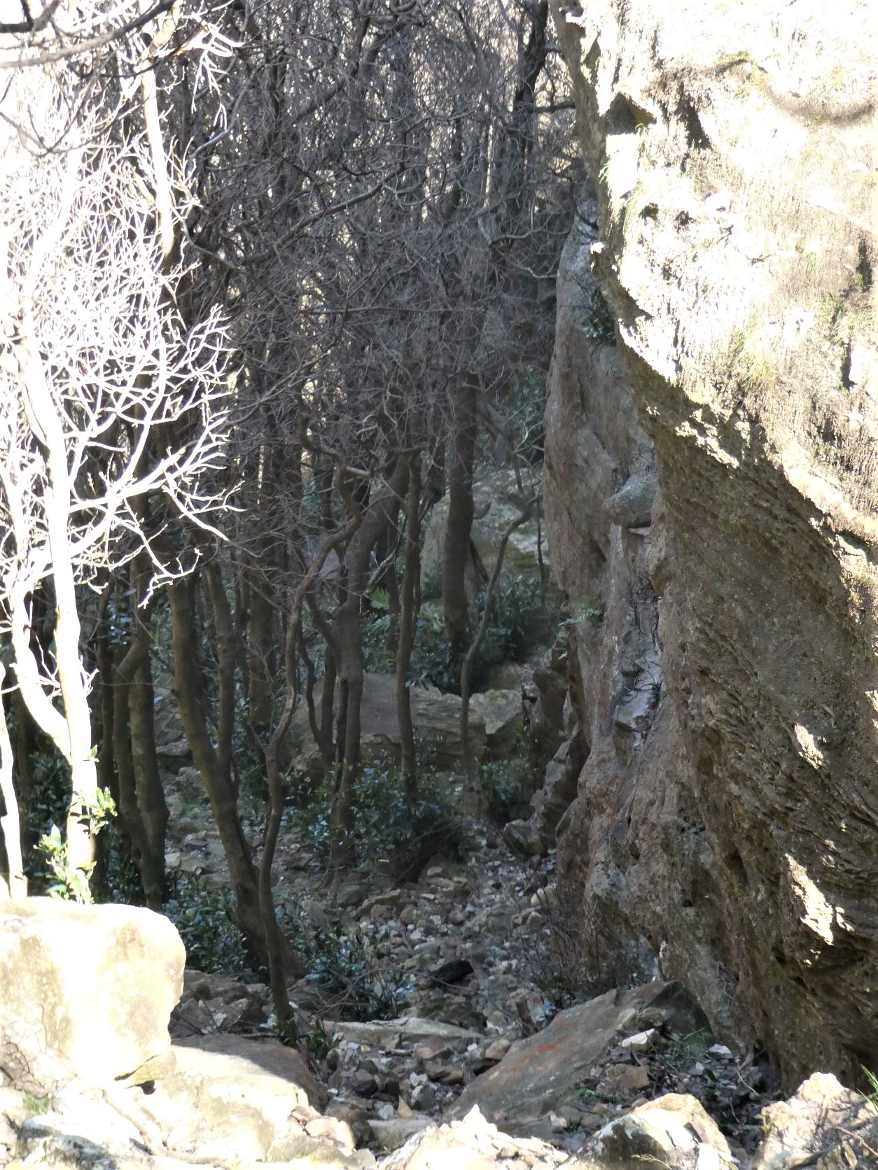
Once on top follow the main trail for a few hundred meters before veering West and descending steeply over loose dirt and Allocasuarina needles past the upper clifflines. The pass is down a wide steep gully that gets to within 8m of the talus.
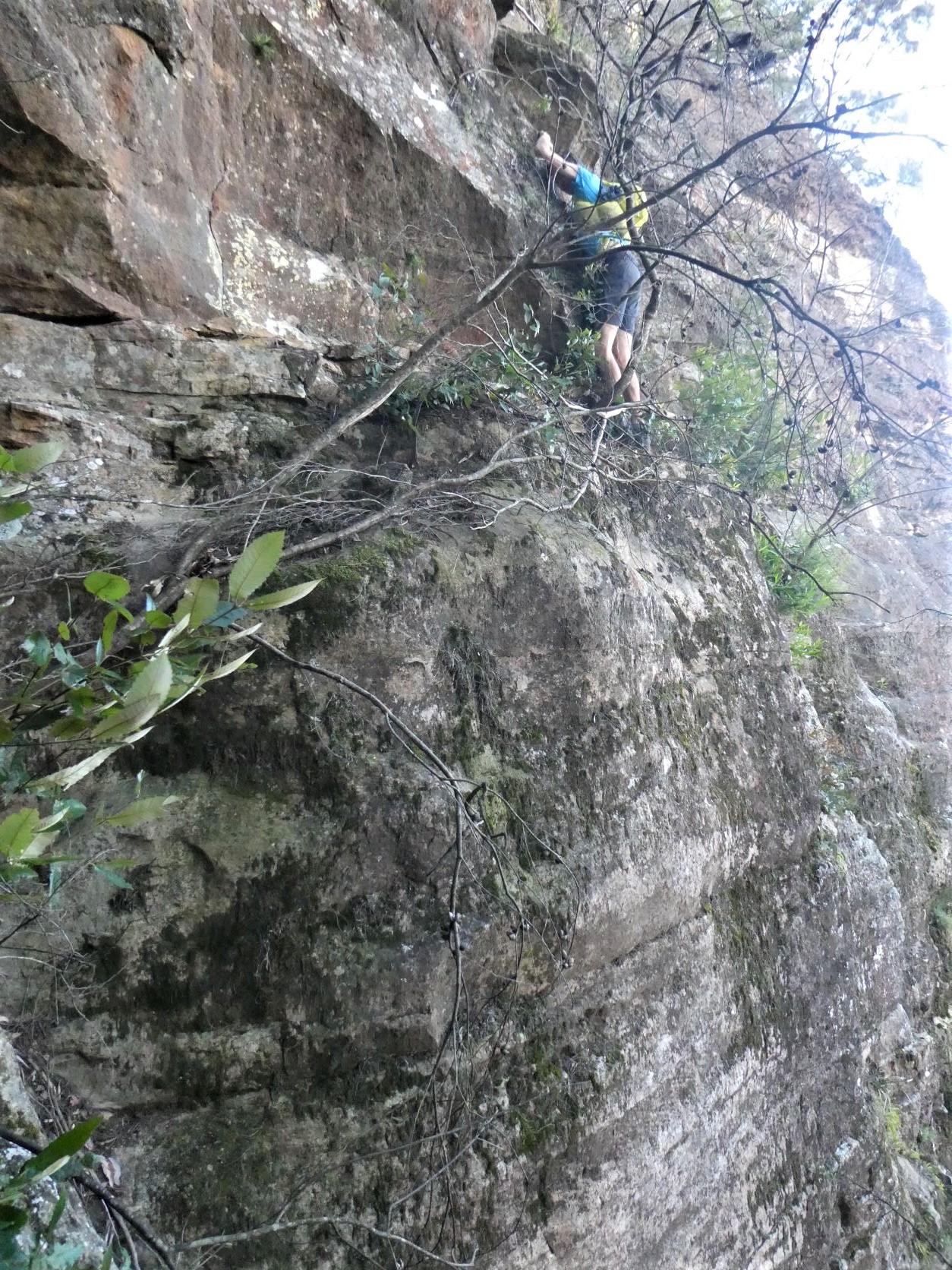
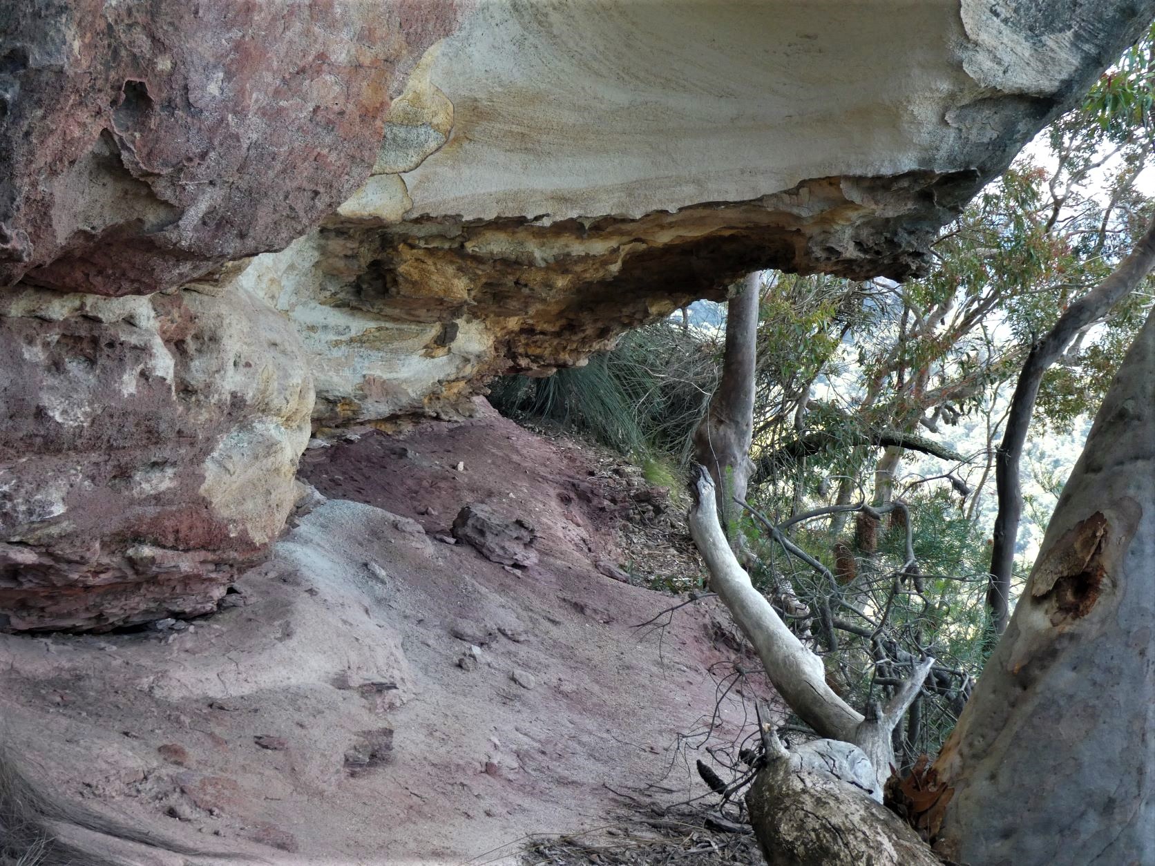
There’s a ledge at about 4m that can be descended to using the fixed rope that we left down a very narrow and shallow slot. The fixed rope is almost invisible from the top and completely hidden from the base unless you’re exactly in-line with the slot. This was named Winding Pass by Rodney Nelson in 2012 and rediscovered by the author from the base on a previous trip.
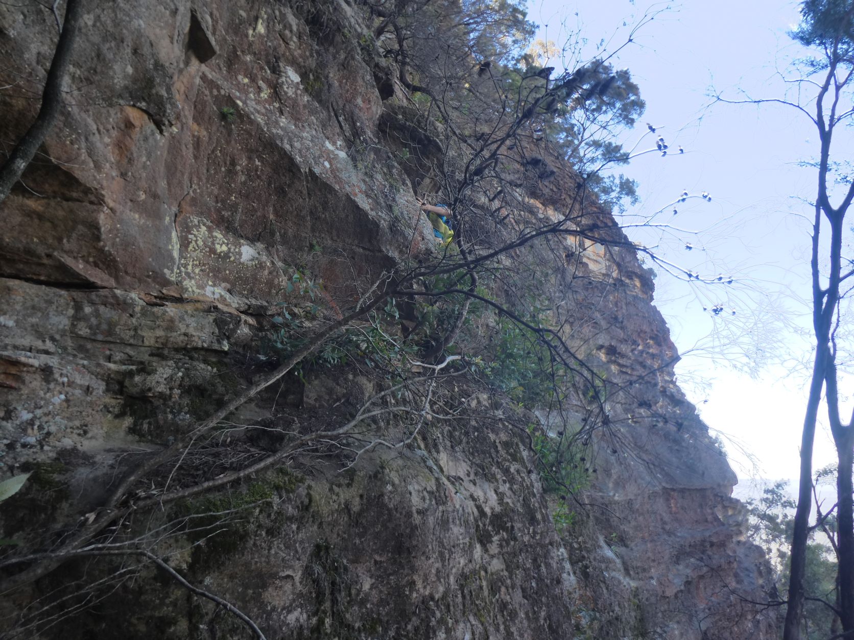
And from the reasonable ledge it’s an easy but careful cliff hugging 5m north towards a deep slot where the talus rises to within a meter of the ledges end requiring only a small but slightly awkward jump or slither.
Following the talus South for a further 400m with mostly minor difficulties interspersed with a couple exposed, loose and narrow ledges found the base of Bitter Cave Pass.
A small scramble to the North immediately followed to the South by a low and slightly tricky ledge under an overhang and above a 5m drop.
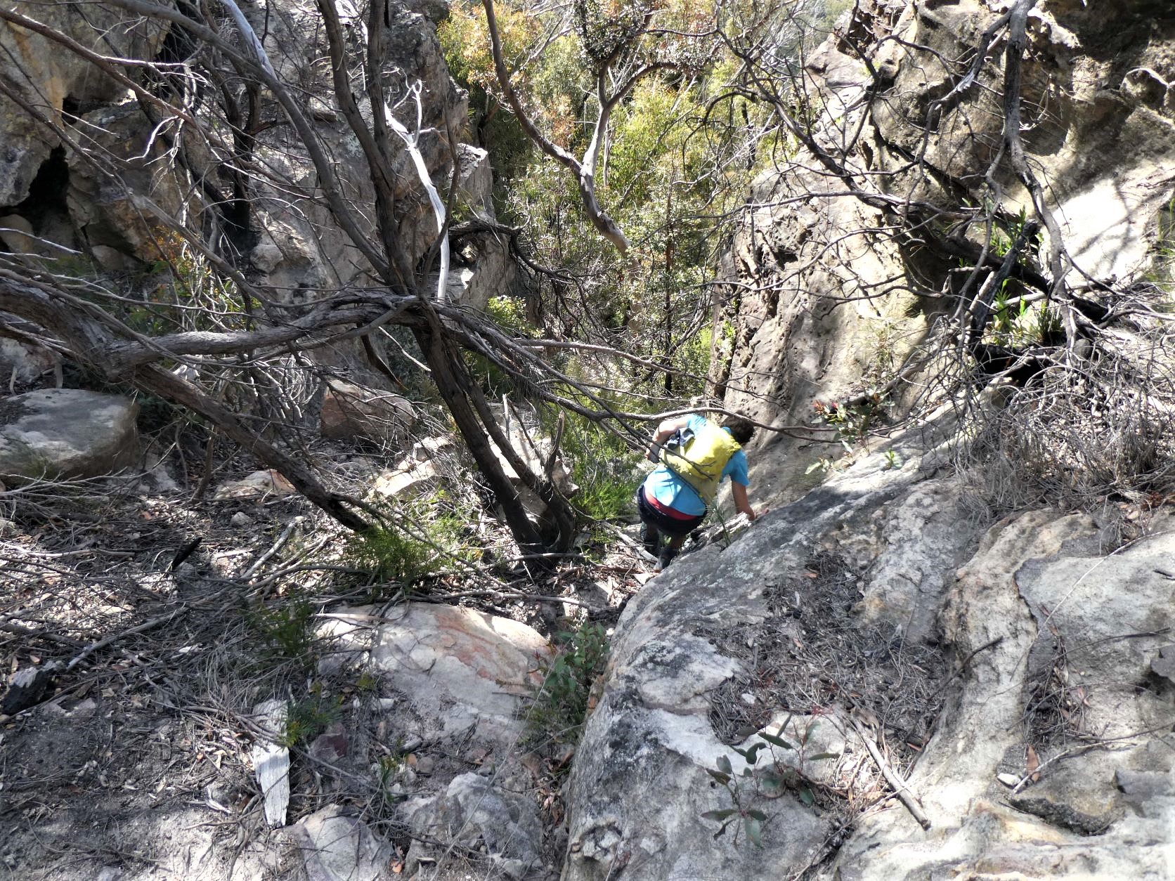
Then head up a particularly steep gully to the overhang (mind your head) that has a narrow slot at the North. The easy tree provides a solid handhold for those taller than 205cm. The rest of us are left to contend with paltry downward facing footholds and a precarious chimney maneuver. However, there is little exposure and the tree is quickly within reach.
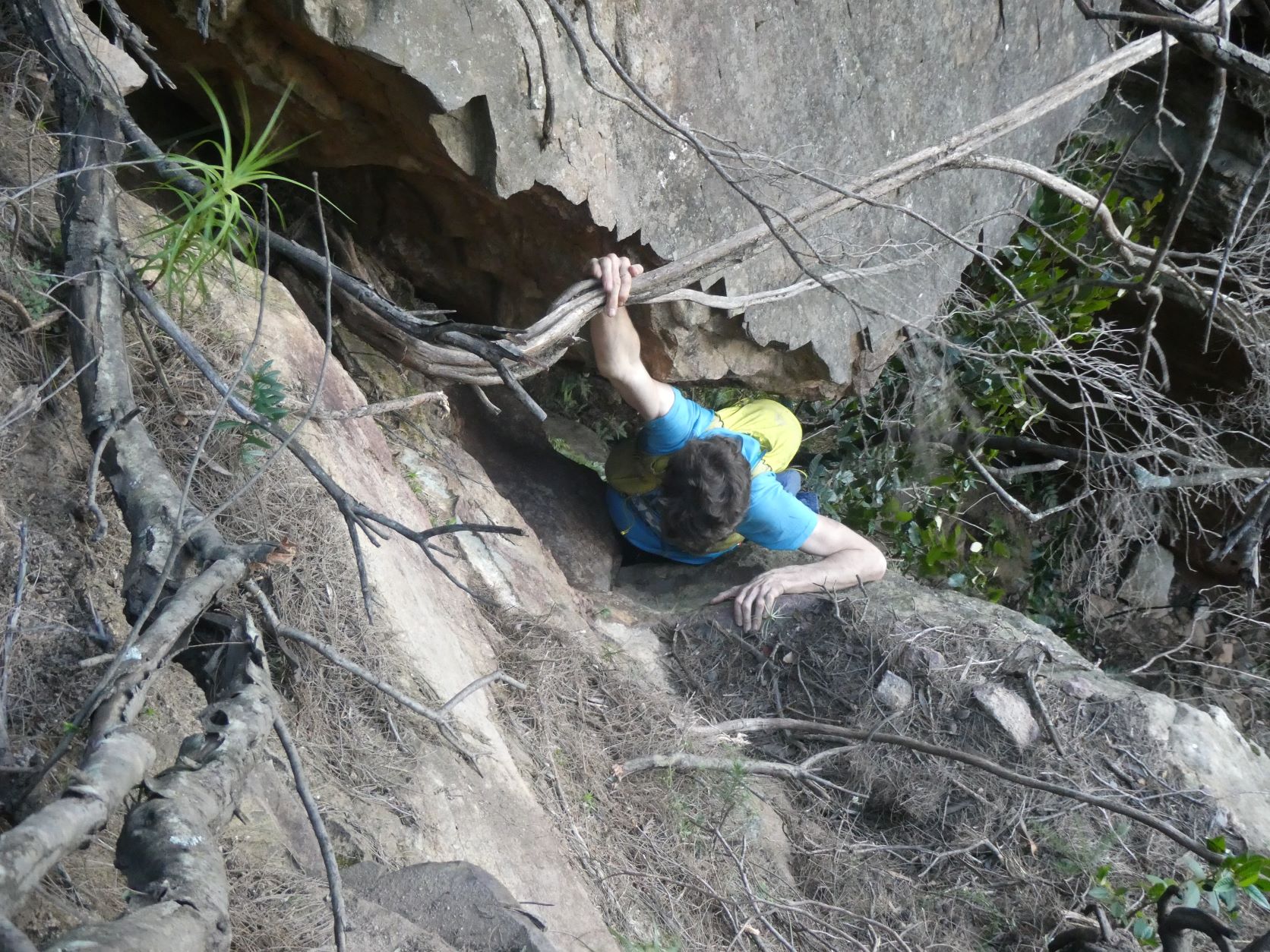
Steep loose dirt and fallen trees is all that remains to achieve the top.
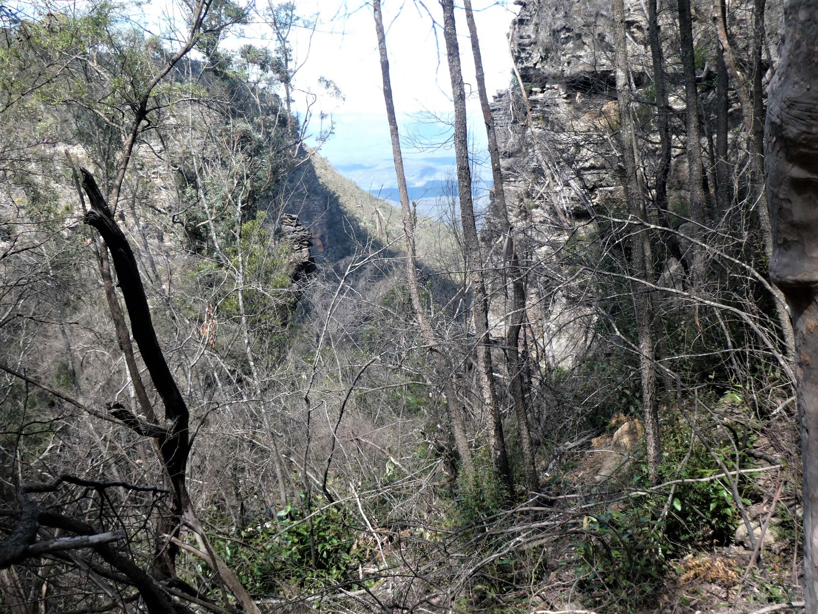
Onwards to the ridge, down into Chinamans Gully, then to the 919 spot height, where the faint to non-existent track leads South to the much photographed Eggcup Rock.
Toorak Gully
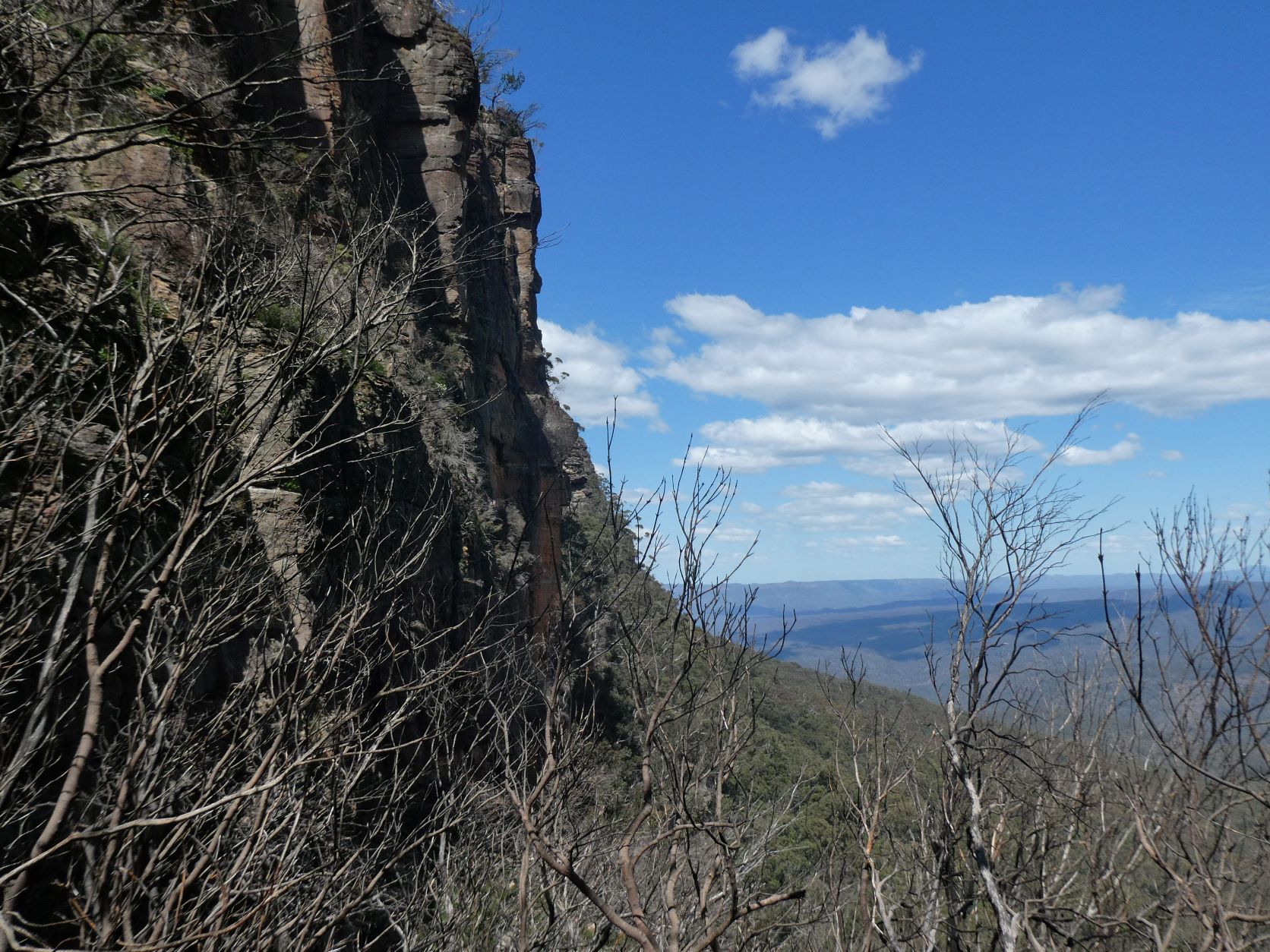
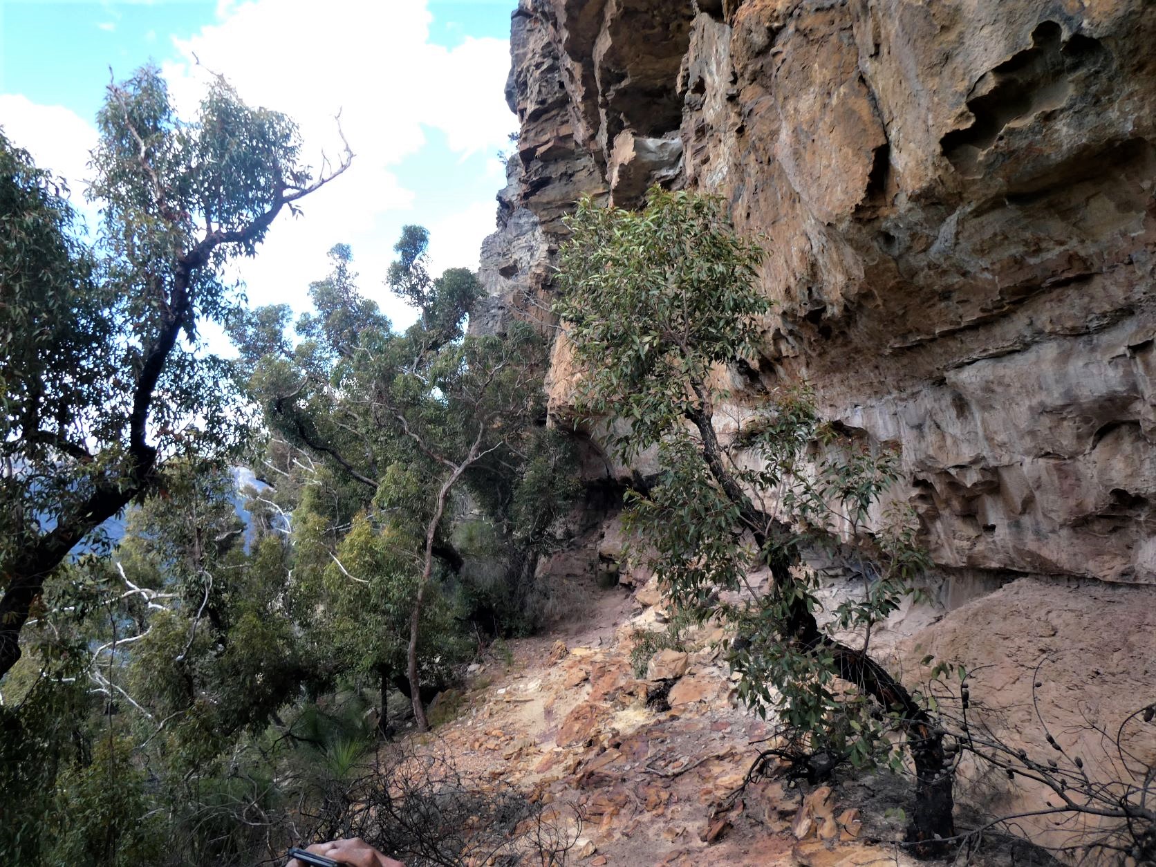
Continuing to struggle through the dense scrub led to the top of Toorak Gully - the obvious break in the cliff line. Toorak Gully is at least 50m wide at the top and has an imposing buttress in the middle of it close the top. The vertical cliffs continue on both sides right to its’ base where it tapers to around 30m wide.
Descending steeply to the East of the buttress firstly over many fallen trees, then steeply over loose dirt and looser rocks to the true bottom of the cliffs.
Tempting as it is to contour South, doing so too early would lead to impassable ledges near the base of the imposing cliffs towards Point Repulse.
Overhang Pass/Blarney Pass
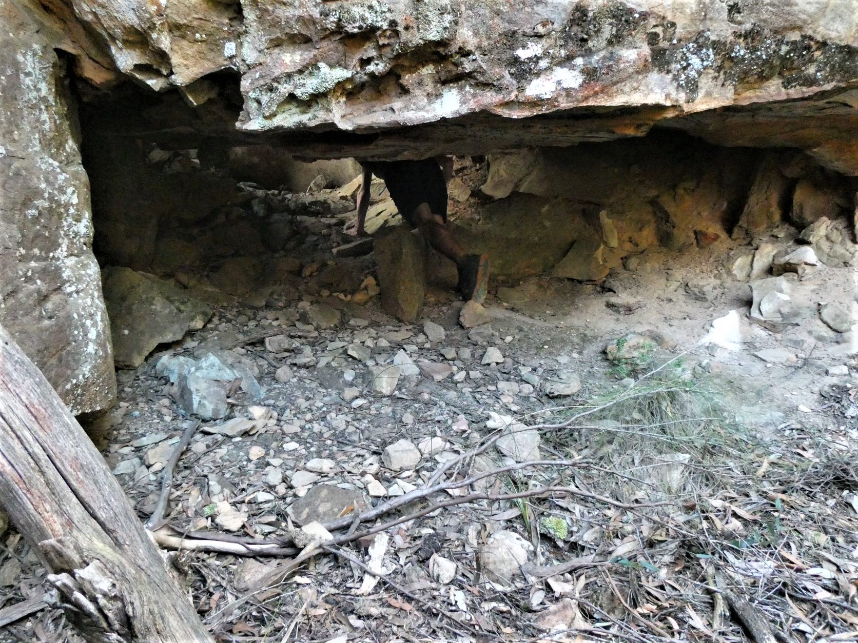
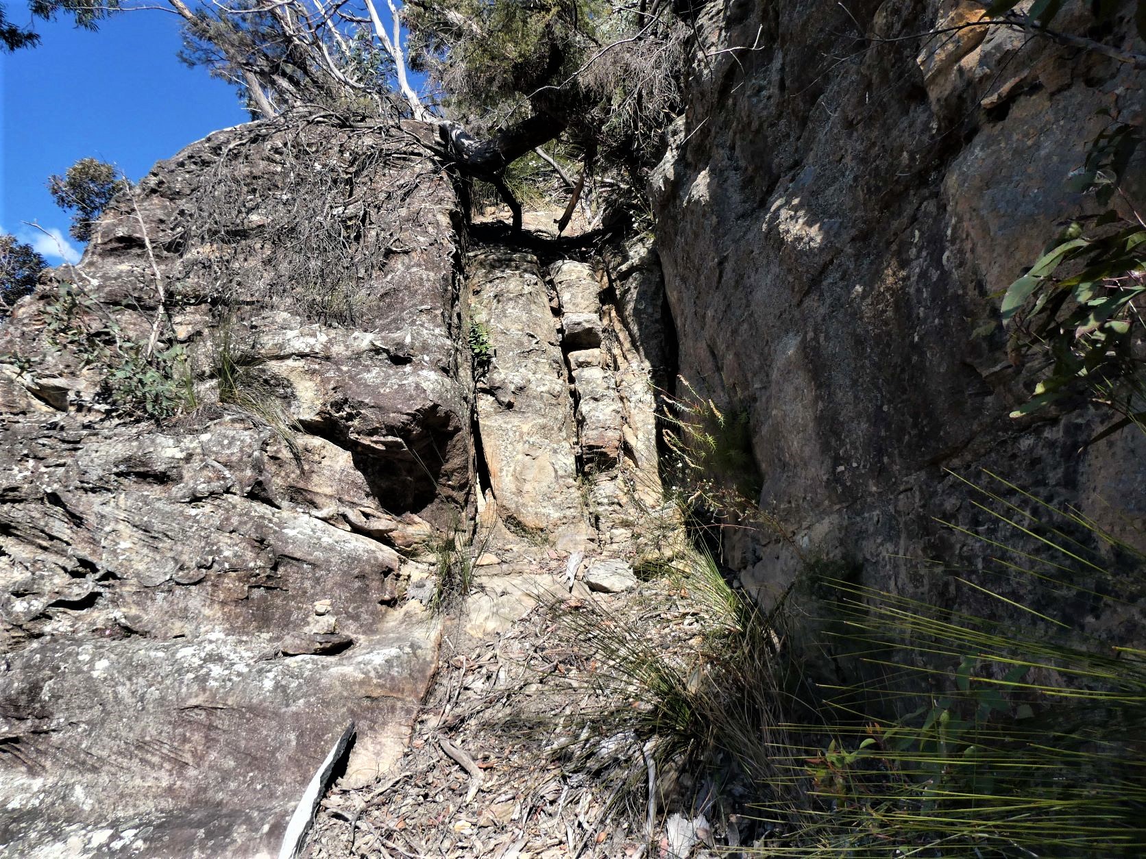
Regardless, about 300 meters of fairly steep and loose, but not especially vegetated slopes led South to bluffs. Ascending very steeply using all limbs through the scattered bluffs tending North and sticking to the cliff base finds a blind gully surrounded by 3m rock challenges that could probably be ascended with assistance from below.
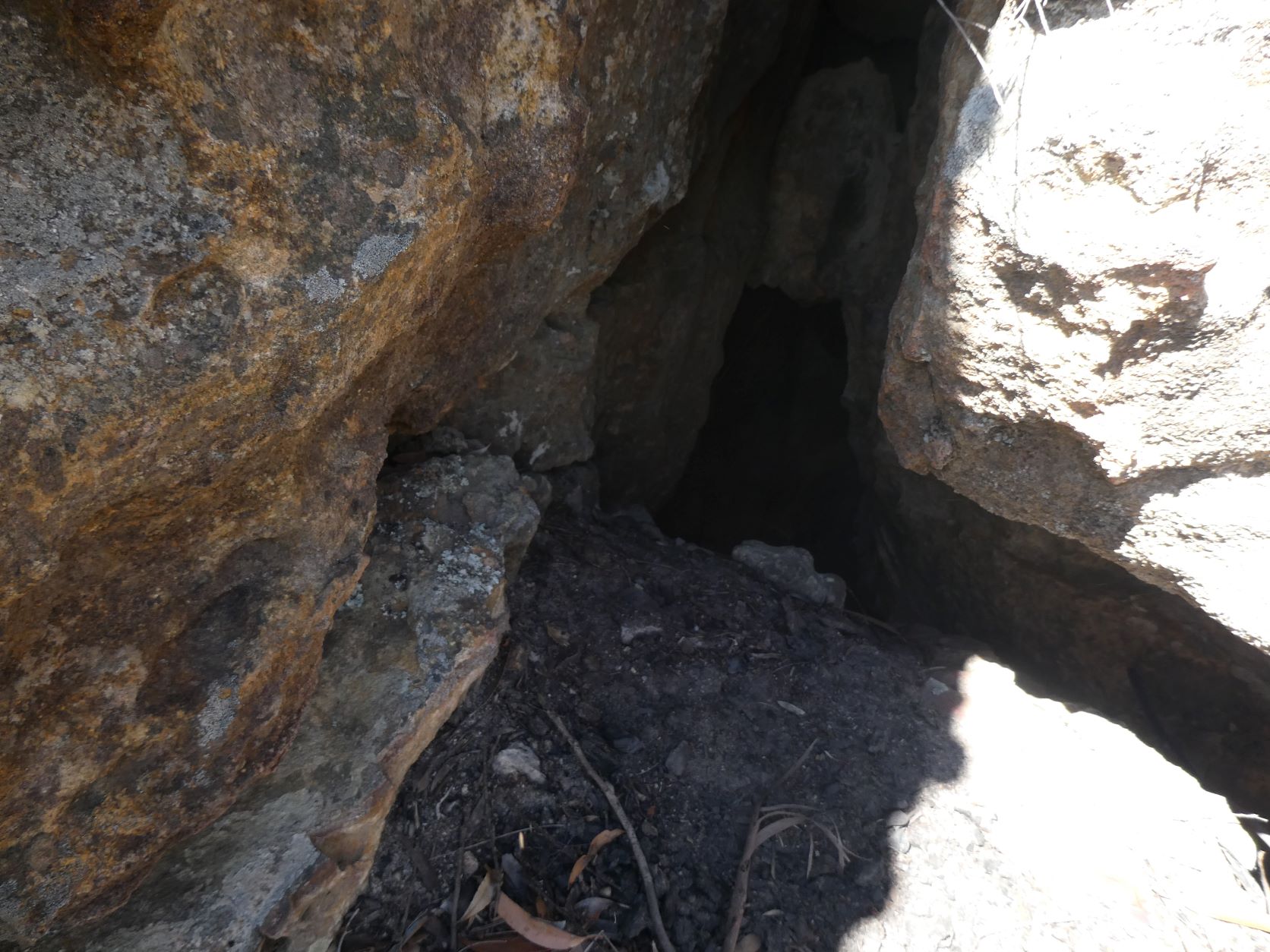
However, none of this is necessary, as the huge low chockstone has light behind it and a brief crawl under it leads to the next ascent of steep loose talus and tangled vegetation. This is Overhang Pass.
The next talus section is brief with the plateau almost within reach, just 10m of cliffline to negotiate. There are a few doable options in the immediate vicinity, and probably more available with a little traversing.
The two alternatives chosen were the narrow slot and the easy gully climb.
The narrow tapering slot was followed by an easy chimney ascent. Then an awkward maneuver upwards before a small chockstone reversing direction back above the slot.
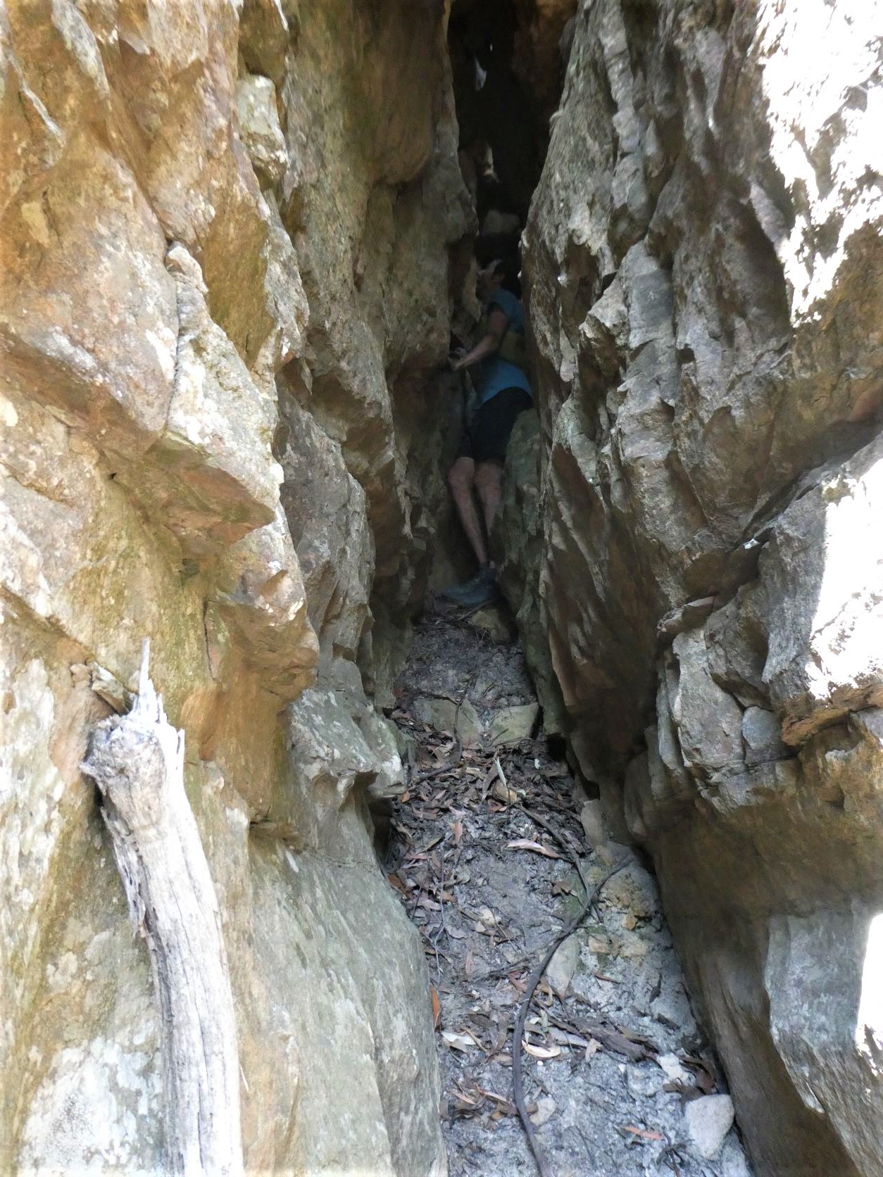
Due to the slots narrowness it was preferable to stay facing the same way which resulted in laying down and slightly sideways to slither through the tiny hole under the next chockstone almost kissing the rock above. Hence the name Blarney Pass.
Larger climbers should not contemplate this slot exit, neither should anyone wearing a backpack or those with anything of value in their left hand pocket. A 6m packhaul is available on the face.
The improbable exit from Blarney Pass would be challenging to locate from above.
The other route was 3m to the North of the slot - an fairly easy climb up a slightly sloping gully with little exposure leads to the same spot as the slot exit. Only 50m horizontal meters remained to gain the narrow Point Repulse ridgeline.
Point Repulse
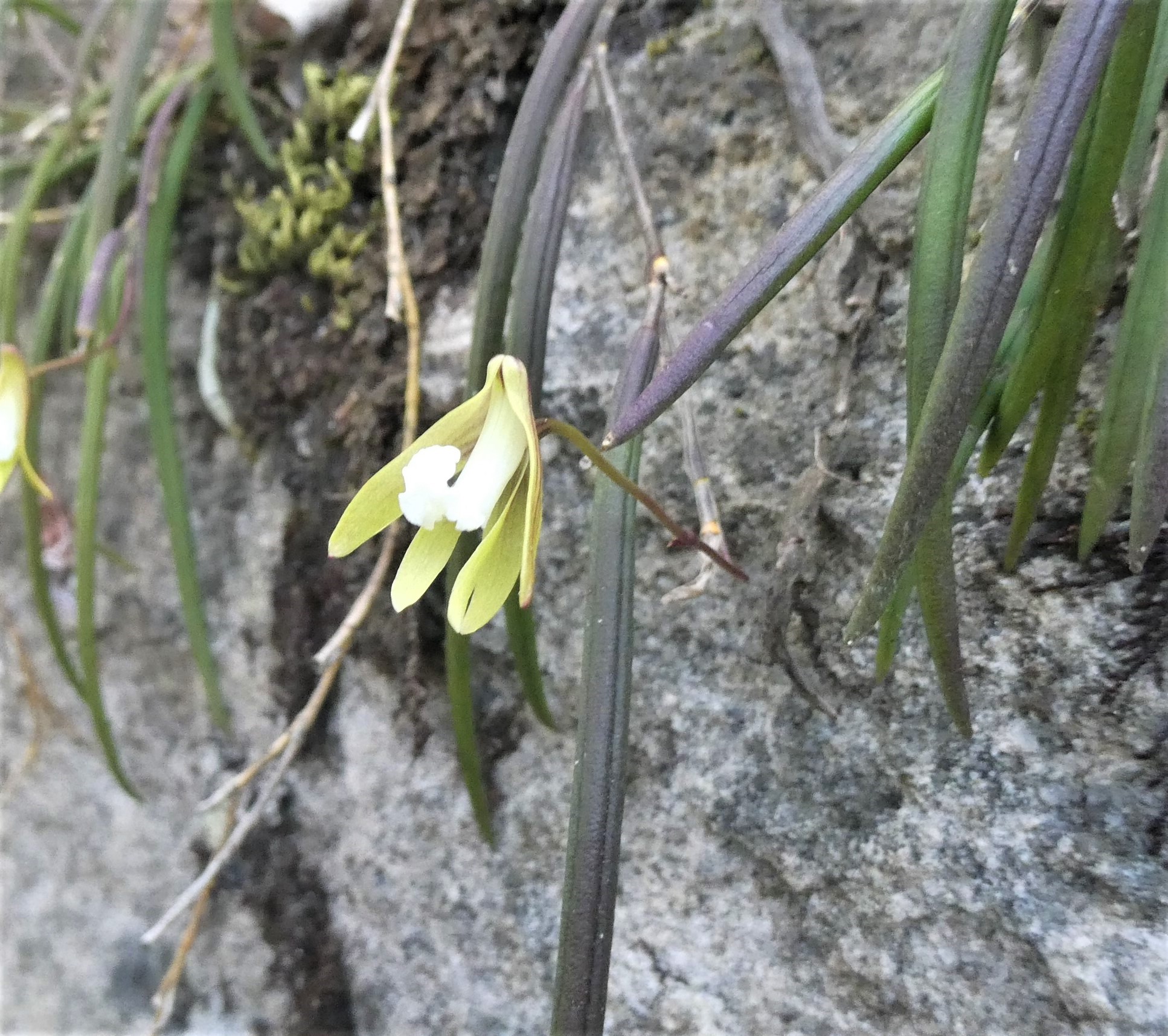
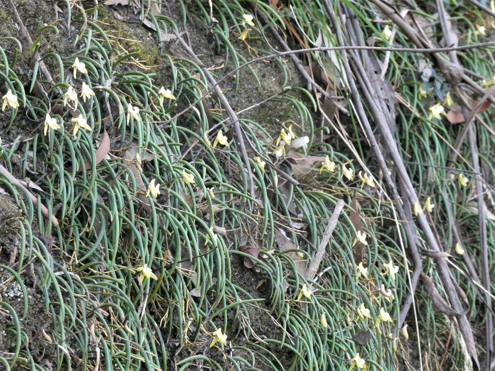
The ridge leads South for 400m to a gentle gully before Point Repulse. Taking this gully to the East and then countouring South past a rock covered in Streaked Rock Orchid (Dendrobium striolatum reclassified to Dockrillia striolatum) in flower.
While photographing the rock orchids, the sound of a significant rockfall immediately below us was heard.
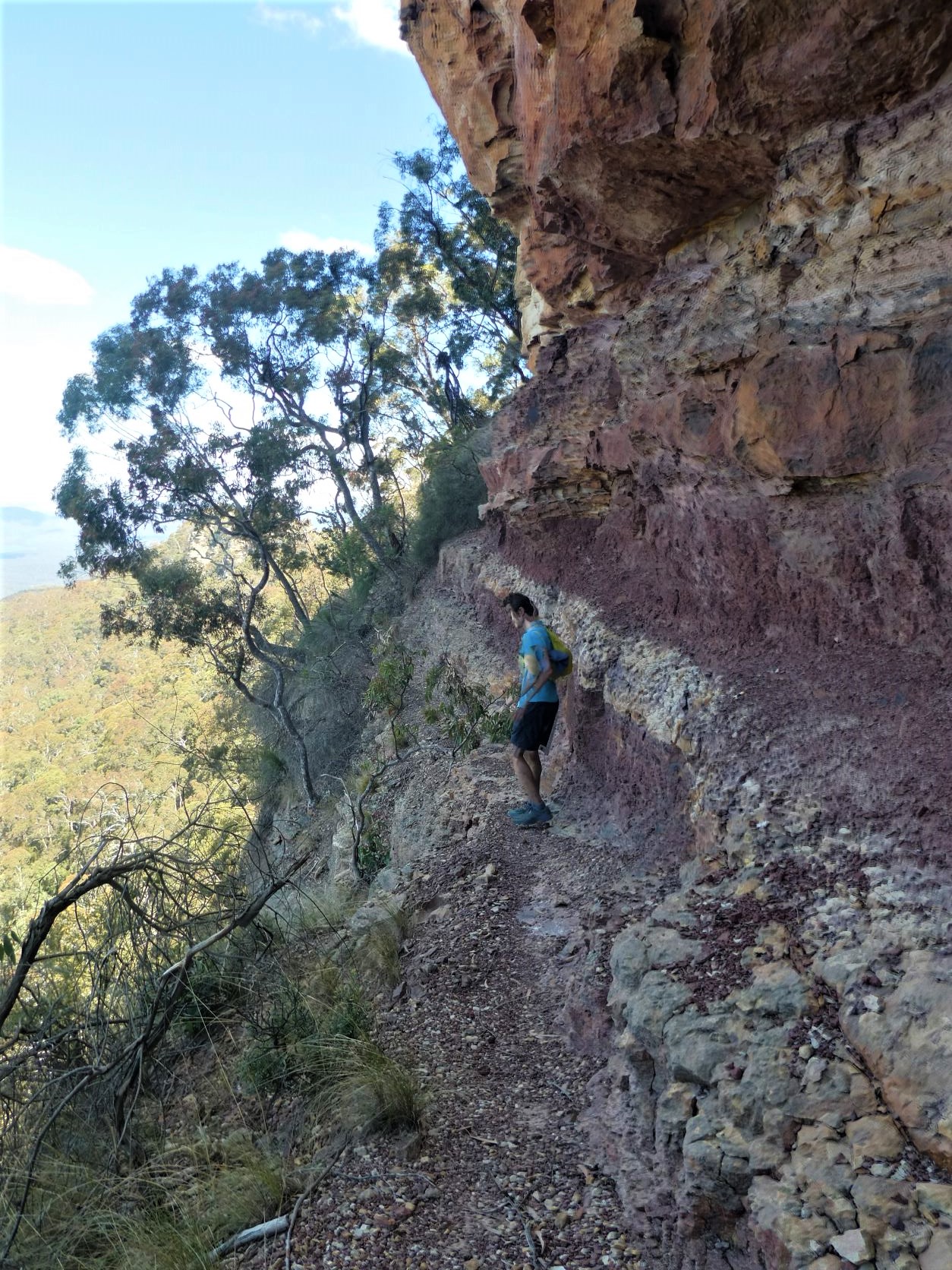
And so quickly moving on to the precipitous and loose Point Repulse Pass. The pass requires confidence and care, especially the last few steps where it tapers to impassable steepness. A few careful steps are required to ascend the crumbling claystone to achieve to the next ledge while still over the significant drop.
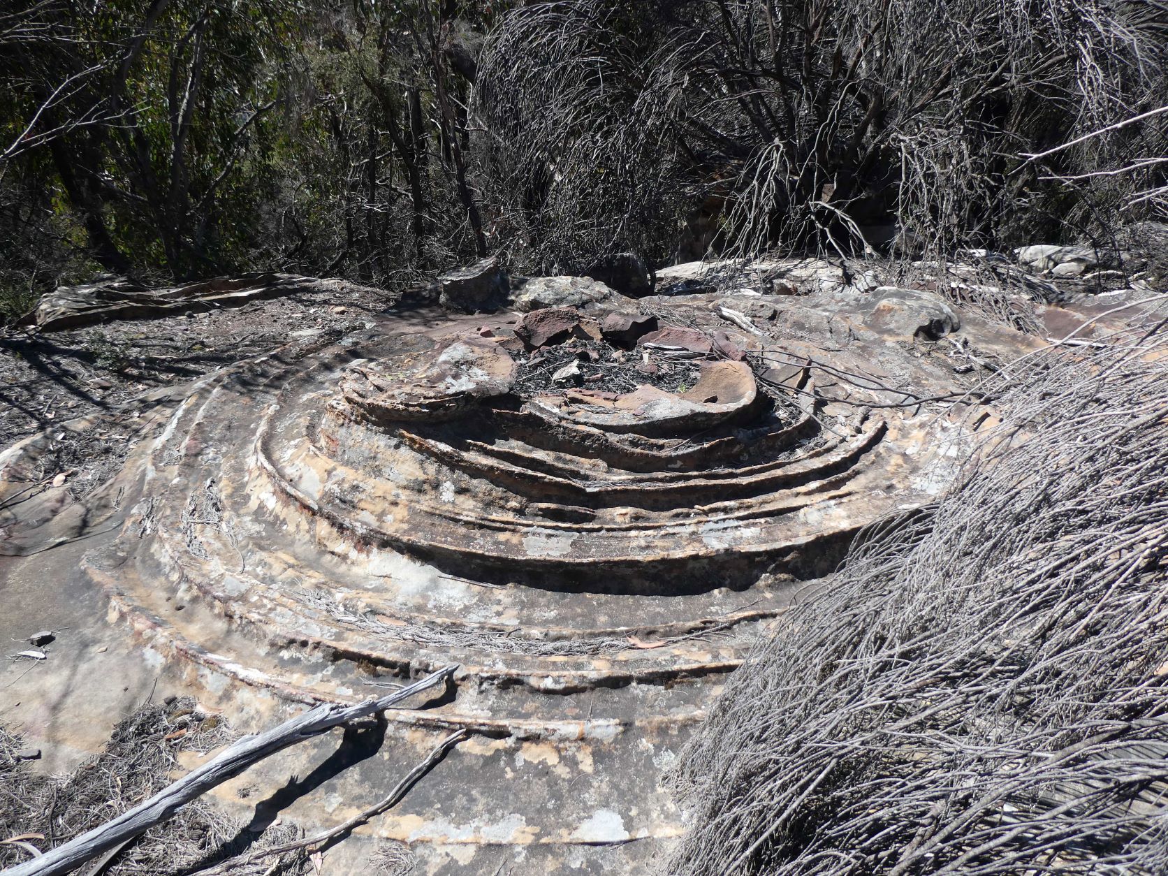
After passing the red cave that marks the end of the pass, the start of the flat ridgeline and a small cairn can be found.
Immediately retracing steps back across the narrow ledge, then along the ridge to Rayfrandell Gully where a refill from a mostly stagnant (and possibly permanent) pool was required, and over the next ridge and into Singajingawell Creek, and finally up to the North face of Mount Solitary. After hitting Miners Pass, a quick descent down the obvious gully…
… followed by a pleasant ledge 150m East under overhanging cliffs peppered with cairns indicating it’s popularity.
Then three or four unlikely descents, some of which were cairned, but some obscured by rock and tree debris.
After touching the talus, it was back up the Pass, and the long slog back across Solitary, Chinamans Gully, Korrowall Knife Edge ensued before eventually reaching the Golden Stairs.
Summary
In all, a total of ten Mount Solitary Passes, with three of them done twice. It’s a big day, only for the masochistic who revel in bush bashing, exposure, navigational and route finding challenges, often precipitous loose ledges, scrambles and climbs with of course lots of mileage and both varieties of elevation.
Stats
A long day -
25km
1800m of ascent
Elapsed 9:00
Care
This is a route that has significant route-finding challenges. Don’t expect to find these passes easily.
All of your party should be particularly comfortable with exposure and be especially sure footed. There are numerous traverses of steep, narrow and loose ledges.
Proficiency with scrambling is also required for some of these passes. A tape is optional, but preferable for some of these passes.
This was a more ambitious trip covering passes in four different areas. Consequently, this route has fallback options are several points. However, some of the individual sections may not be easily reversible and any alternative long trackless exit may not be acceptable.
There is almost water to be found on the plateau, exceptions are at known locations. There is almost none from drips or waterfalls below the clifflines. None of the passes mentioned have any sign of water under normal conditions.