
Undocumented Narrowneck Pass
Narrowneck has a dozen or so named passes and also a few less well known. This Pass is thought to have been visited in 1988 by a well known bushwalker. There have been no known visits after that time, and it has remained undocumented. This trip included another well travelled Pass and a quick visit to its logbook.
Narrowneck has a dozen or so named passes and also a few less well known. This Pass is known to have been visited several times in 1988 & 89 by a well known local bushwalker taking the West to East route. There have been no known visits after that time, and it has remained undocumented. This trip included another well travelled Pass and a quick visit to its logbook.
The route synopsis -
- walk or cycle down Narrowneck for several kilometers
- descend steeply into the creek and follow it downstream almost to the falls
- ascend easily on the true right to find the ledge
- follow the ledge around to the big cave
- ascend the steep slope to the back of the cave
- find the narrow ledge out that leads to a blind corner
- step easily around the corner above a significant drop
- follow the steep chocolate ledge around to the well known Pass and then the plateau
- head WNW towards the swamp and Narrowneck firetrail
- cross the swamp where it narrows and head back up to the ridge
Route
Aerial view of the whole route. Note that the GPS tends to bounce around when close to cliffs, so some of this route needs to be treated with caution. It’s often impossible to tell which ledge the route is actually on.
Names and specific detail are deliberately omitted.
Long Range Ledge Photos
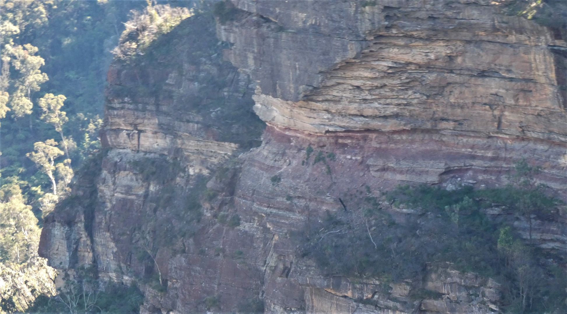
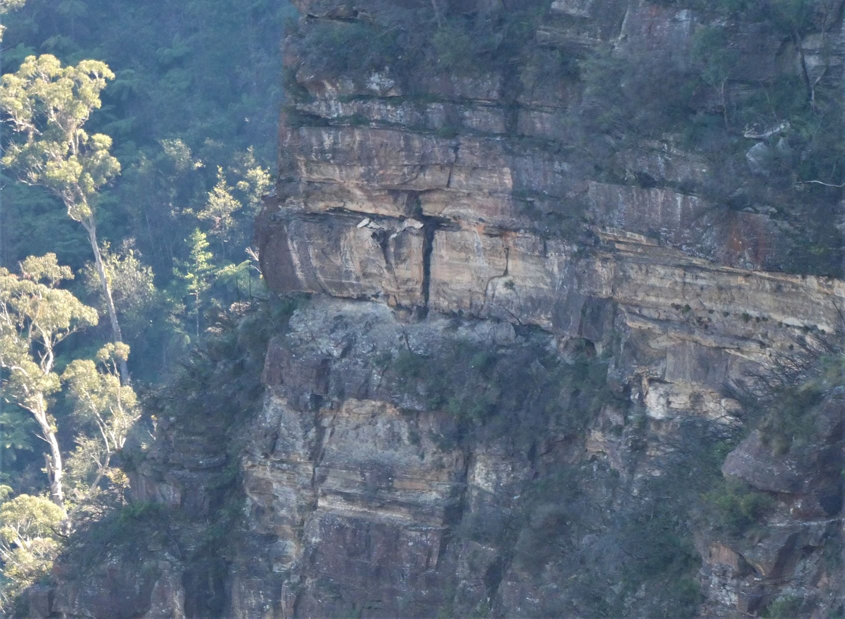
These four long range photos are taken from South of the ledge. They show how exposed and impossible it looks.
The Big Hole.
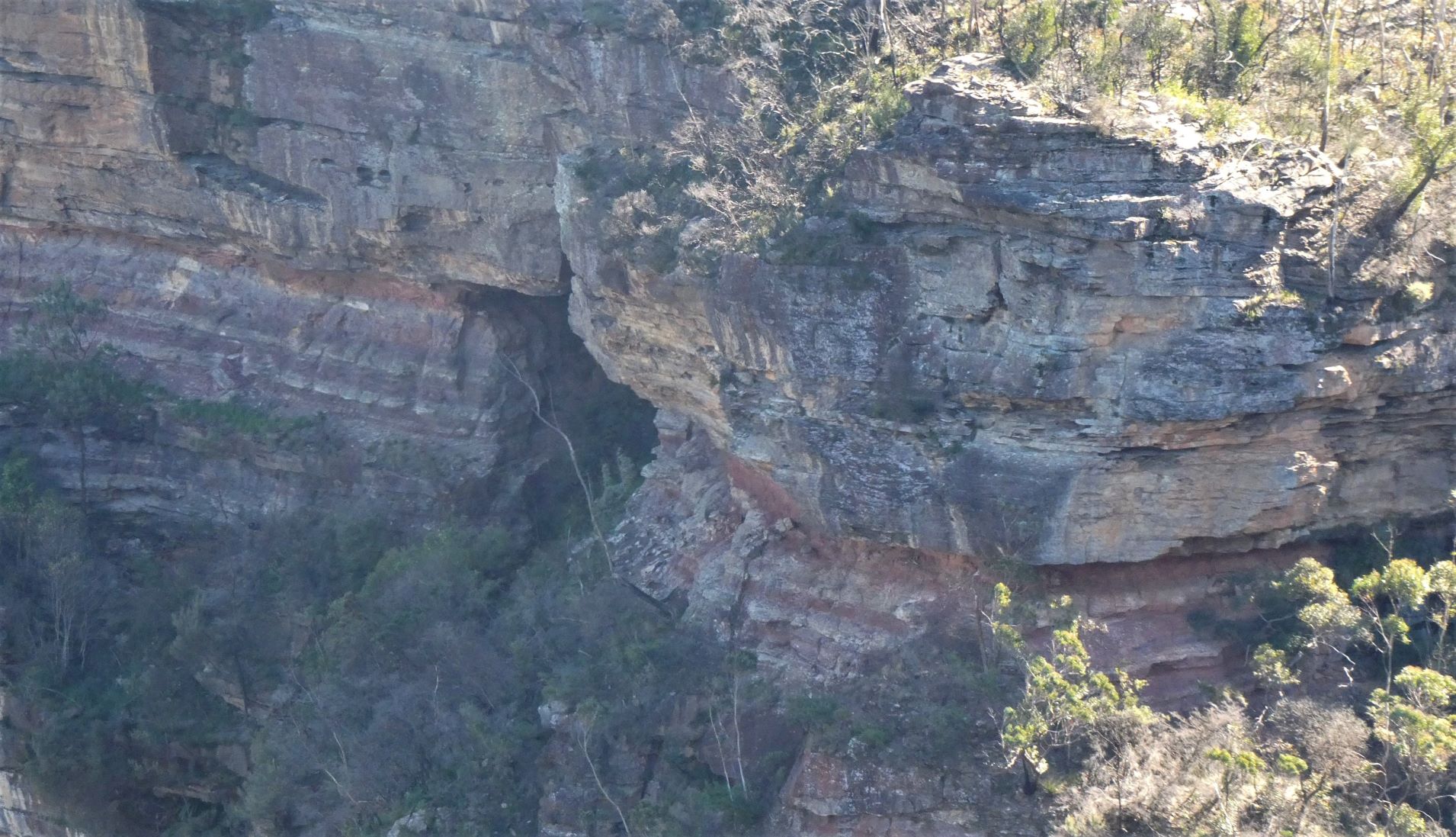
West of the Big Hole.
And further West.
Route Description and Photos
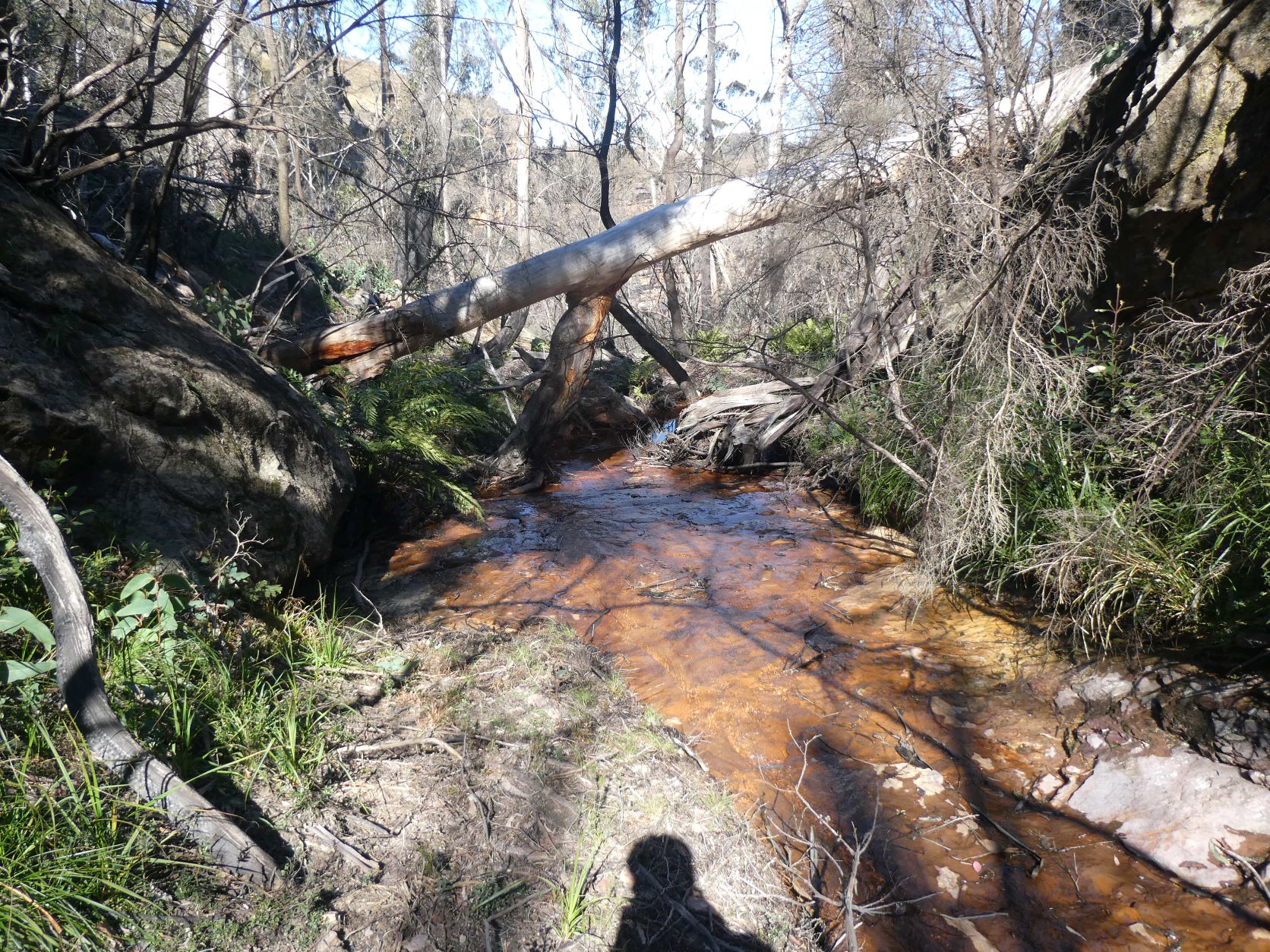
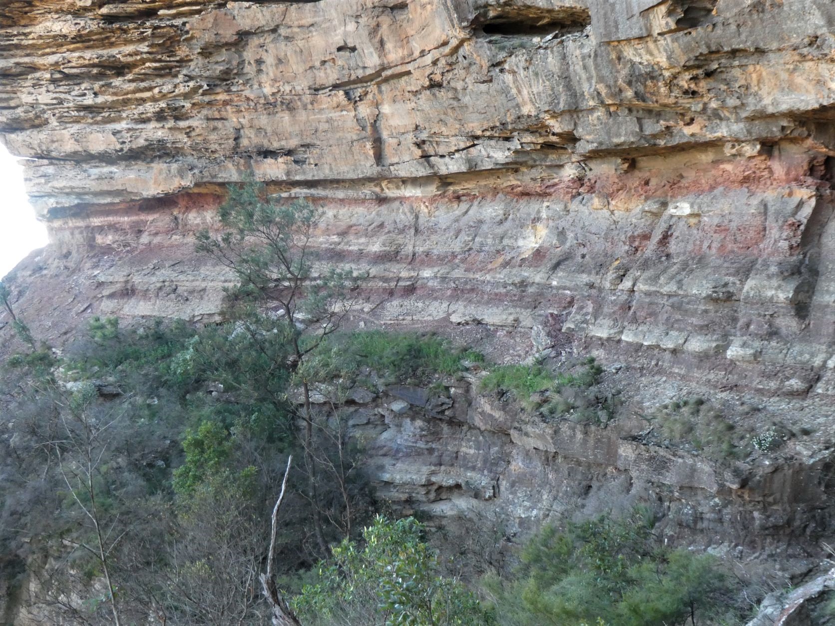
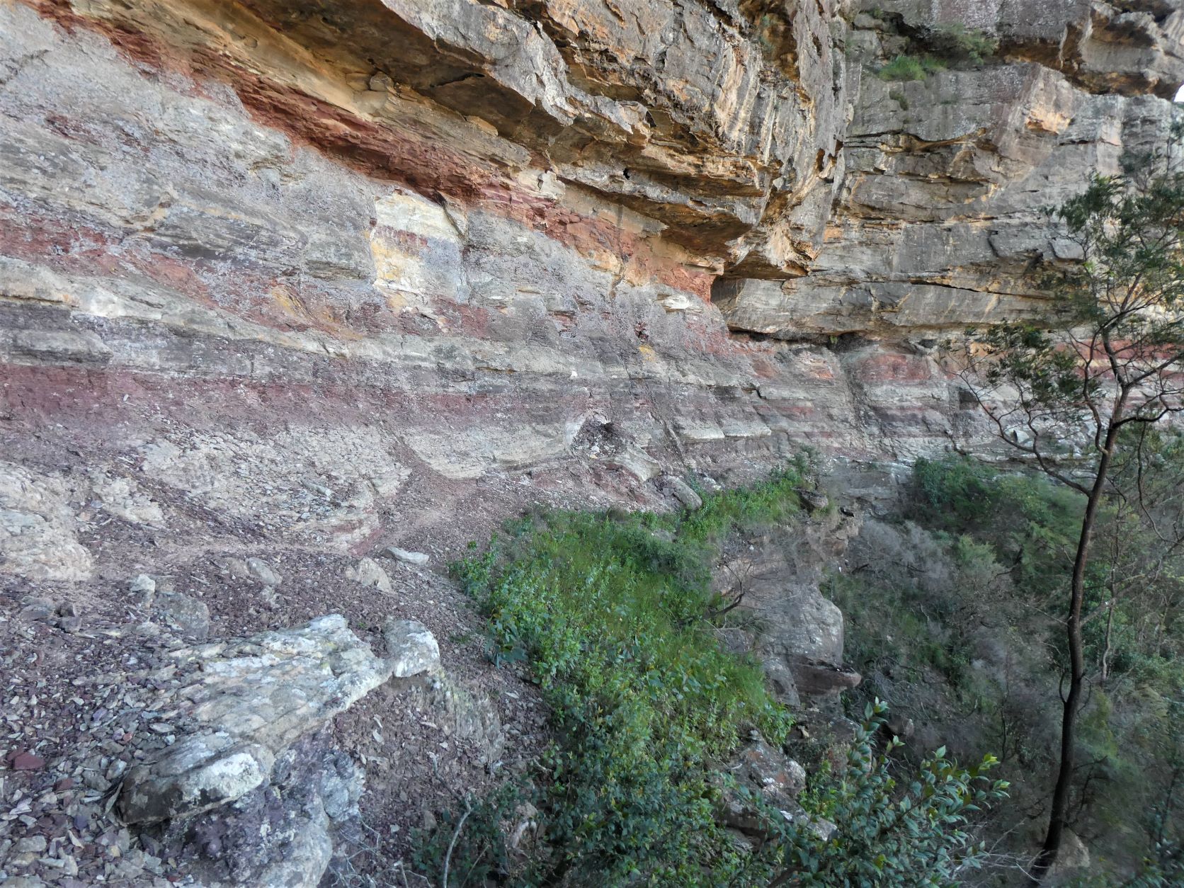
Descend steeply through the bush to the creek. It runs over the flat band of Mount York Claystone resulting in a golden brown effect in the sunshine.
The route follows it downstream with only some difficulty almost to the lip of the first leap.
It was windy and the falls were blowing the spray back up.
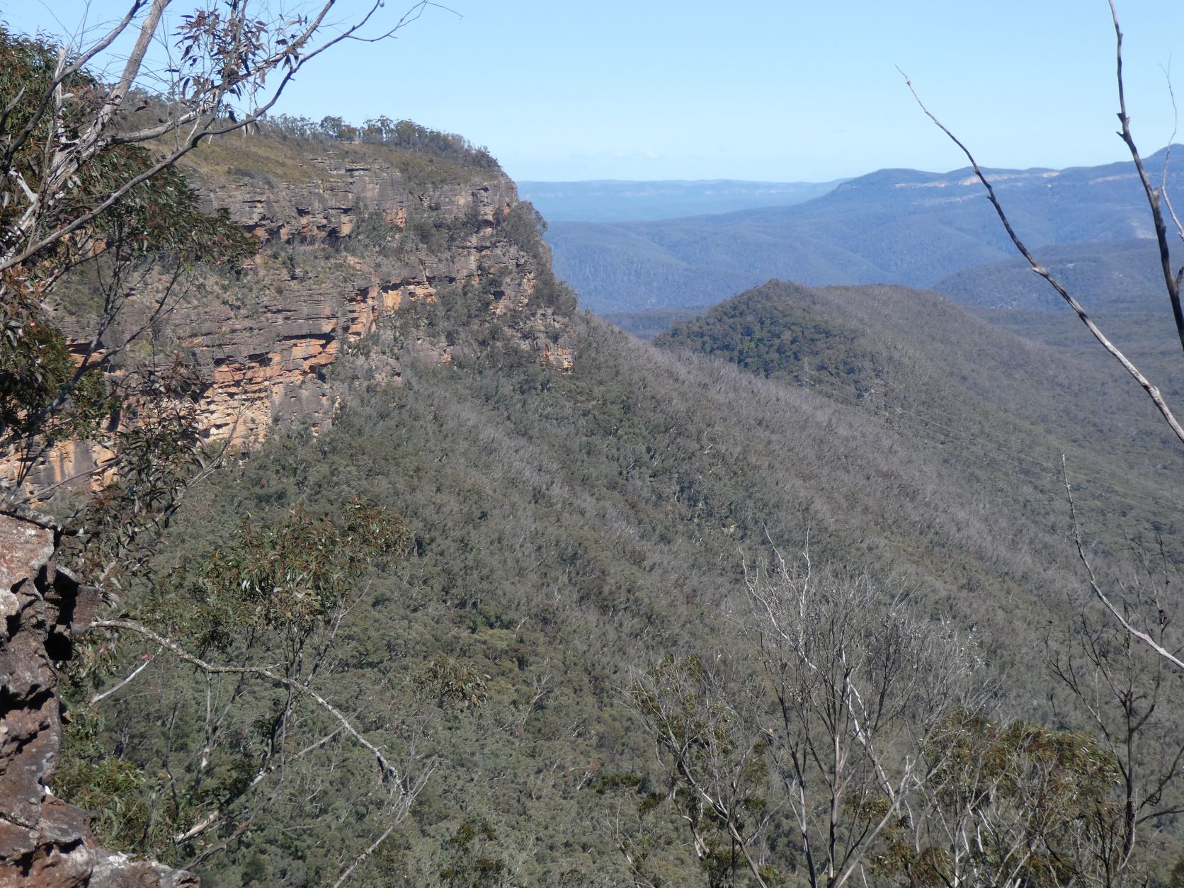
After ascending a little from of the creek to the West, there is a pleasant unobstructed view towards Mount Derbert.
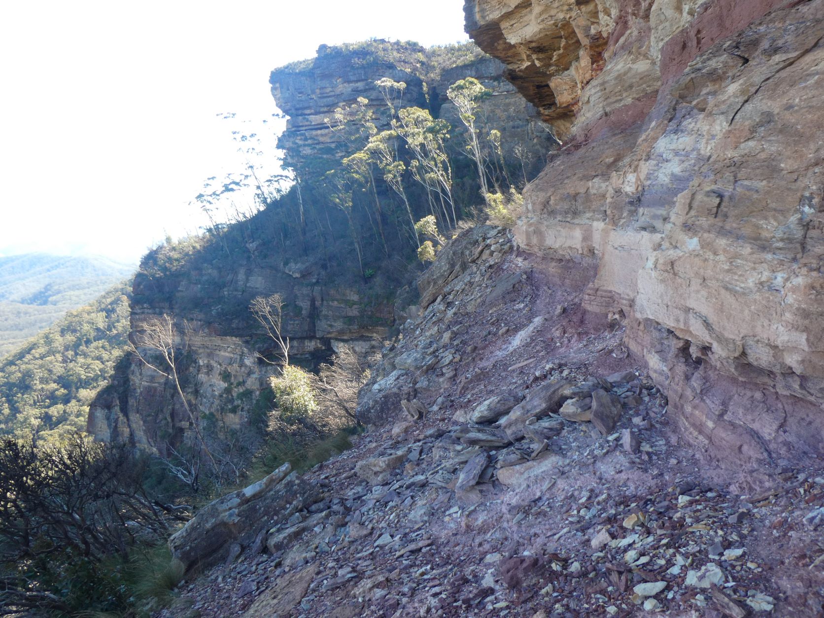
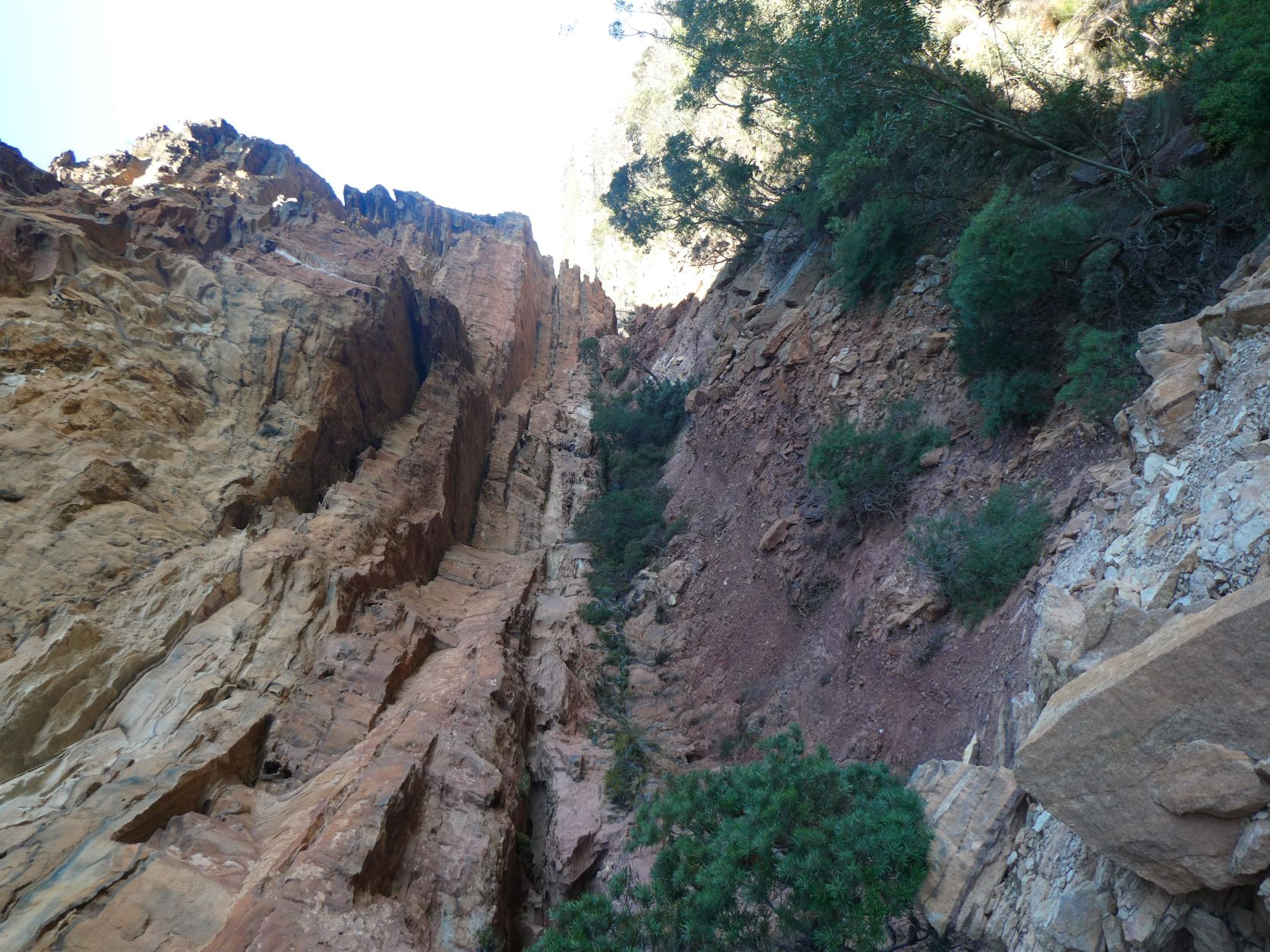
And then the first ledge begins. Straightforward with no feeling of exposure.
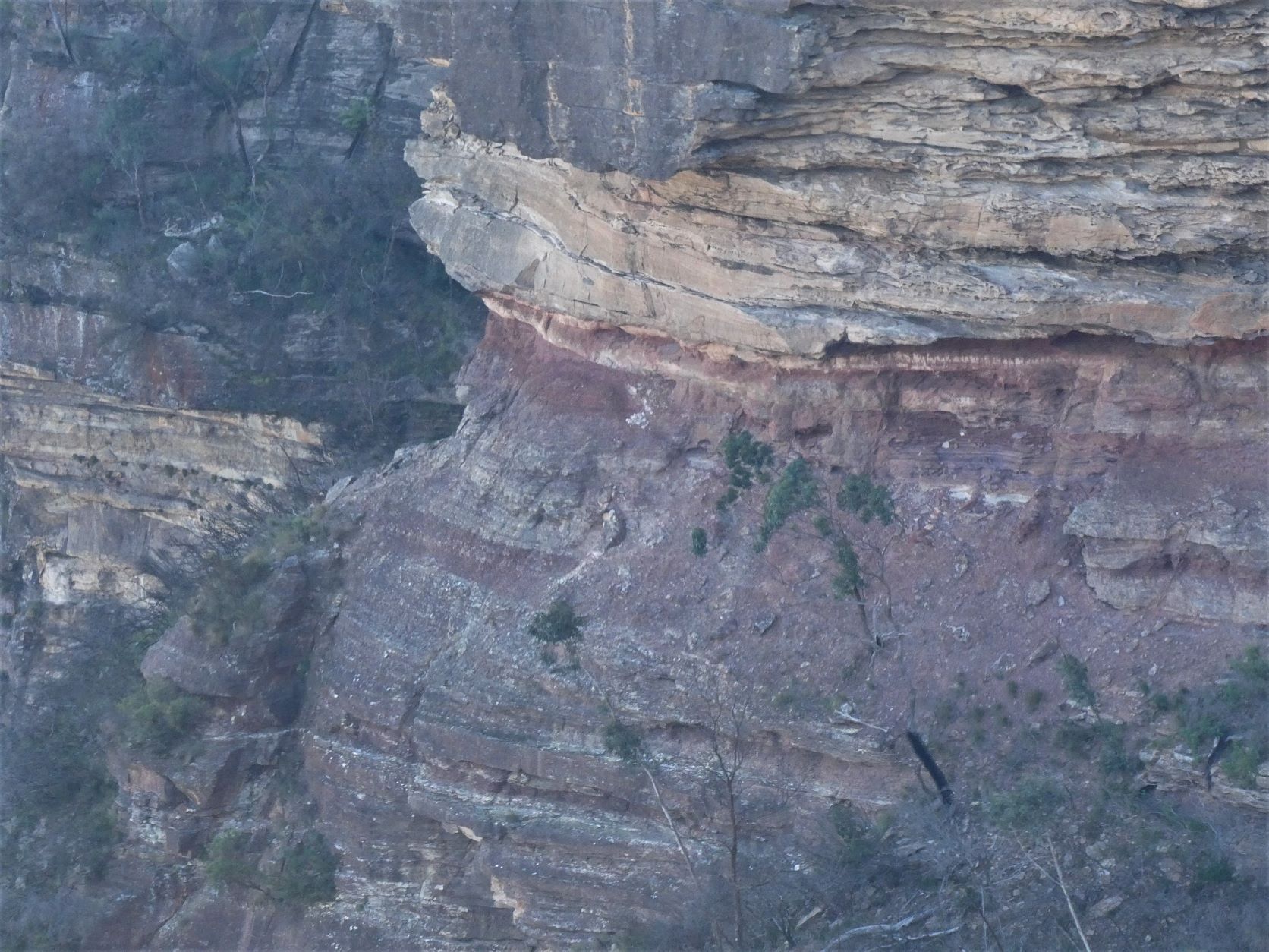
It leads easily to the big hole. A possible descent to the talus was briefly explored down to the next ledge below, however it stops abruptly. The long range photos also shows that it doesn’t ‘go’.
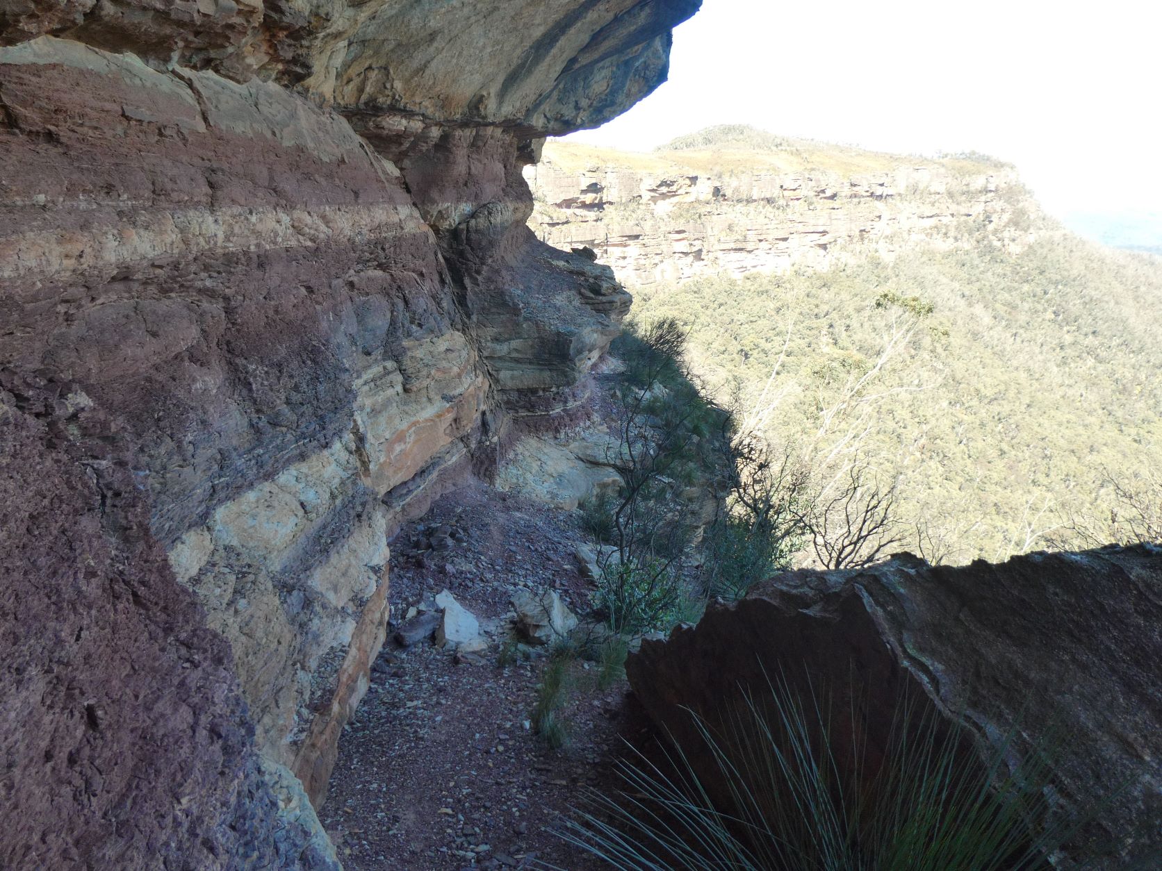
Returning to the original ledge, there’s a good view of the ledge to be followed beyond the Big Hole.
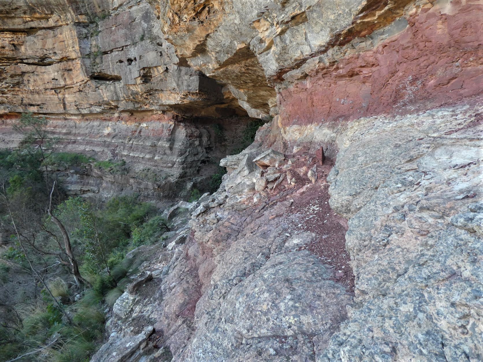
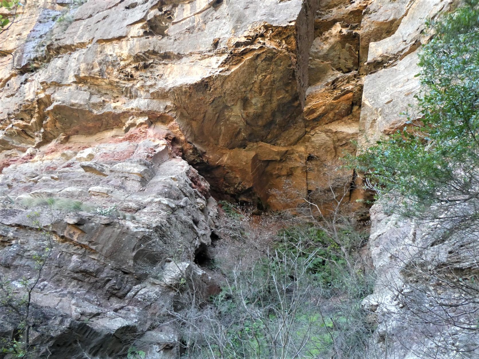
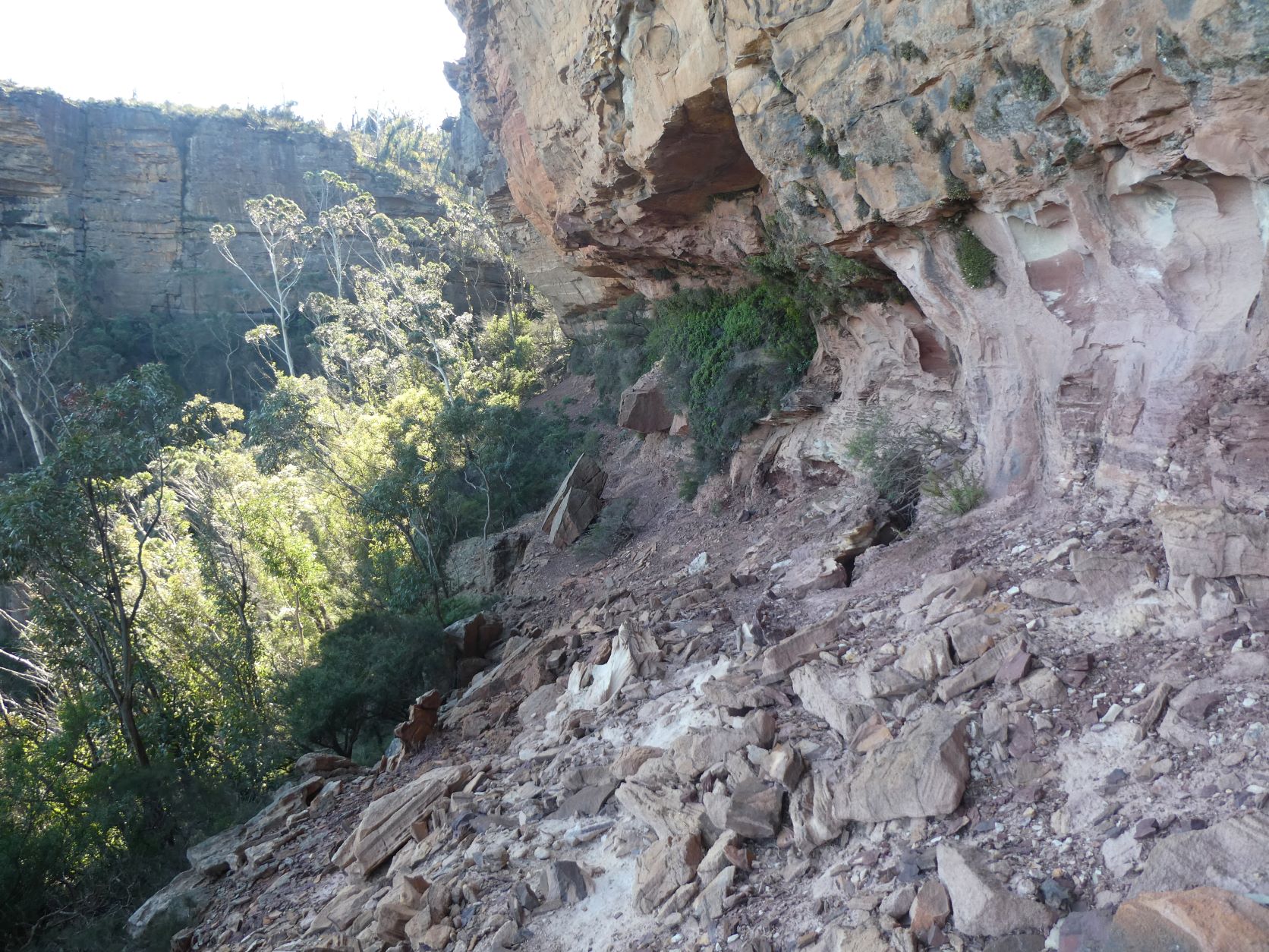
Traverse easily into the Big Hole, and then ascend steeply up the light vegetation to the back.
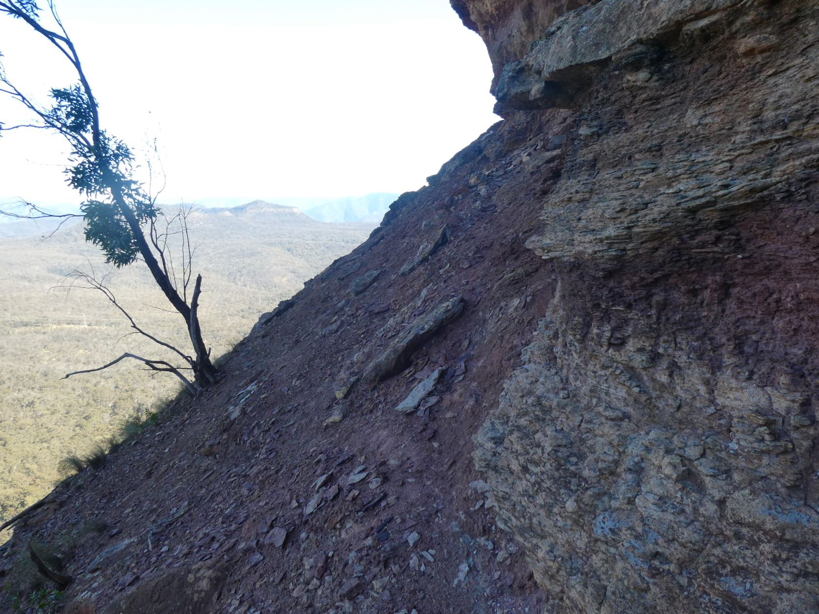
Looking up at the roof of the Big Hole, the exit ledge can be seen at the left. The exit ledge is not especially narrow, however it does require a couple of confident and steady steps (with good handholds) to get around the blind corner, as there is a small but significant drop below.
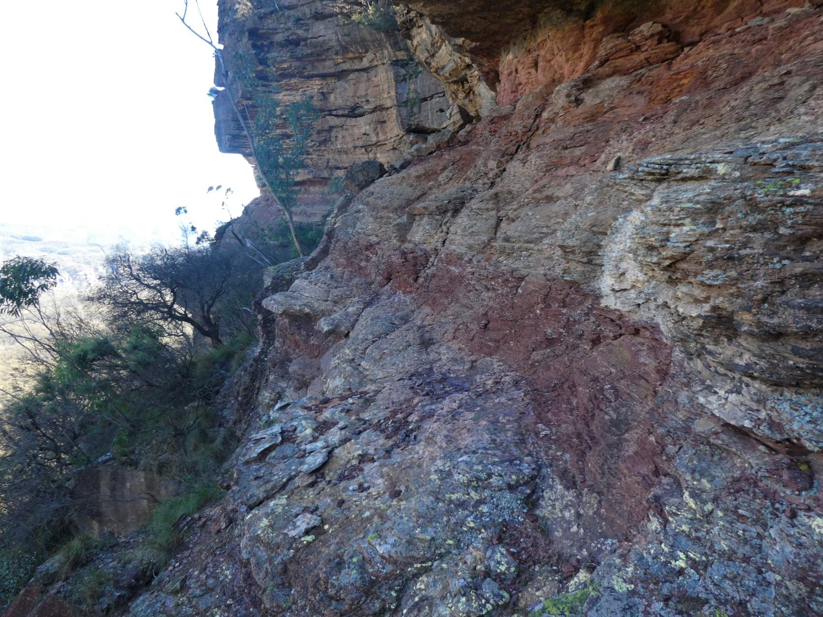
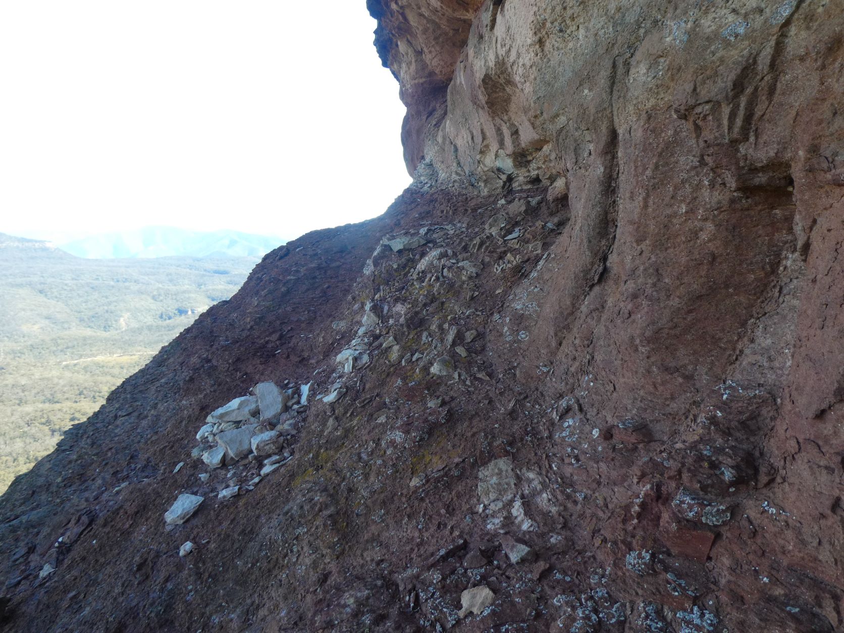
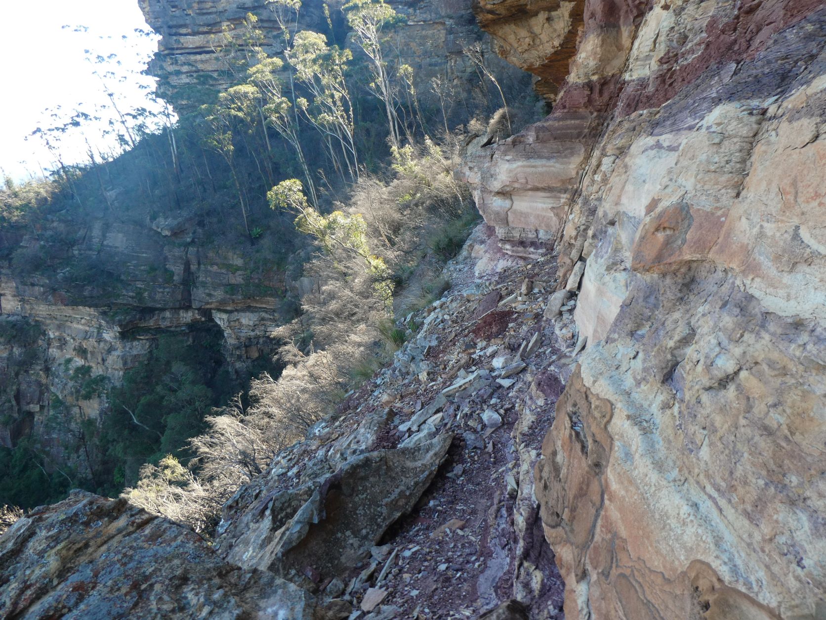
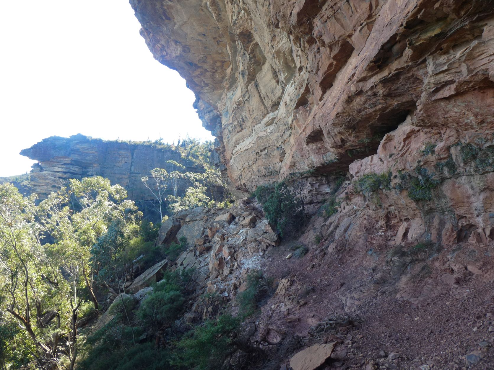
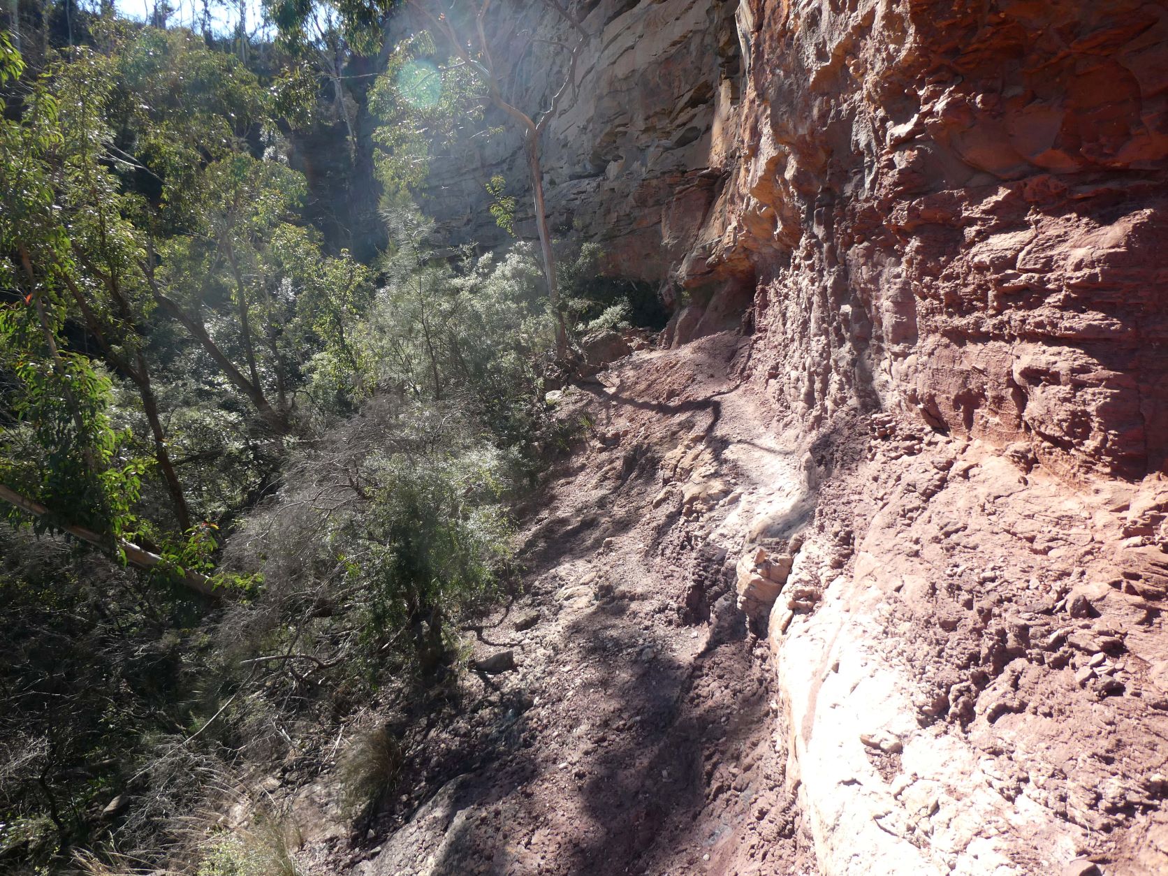
After rounding the blind corner (it looks blind from the other side too) there are more ledges that require care. There is little protection from a misstep for prolonged sections of the next few hundred meters.
There are signs of wildlife visitations on this ledge - a faint animal pad is just visible for much of the remainder of the ledge. However, no droppings were seen until the exit gully.
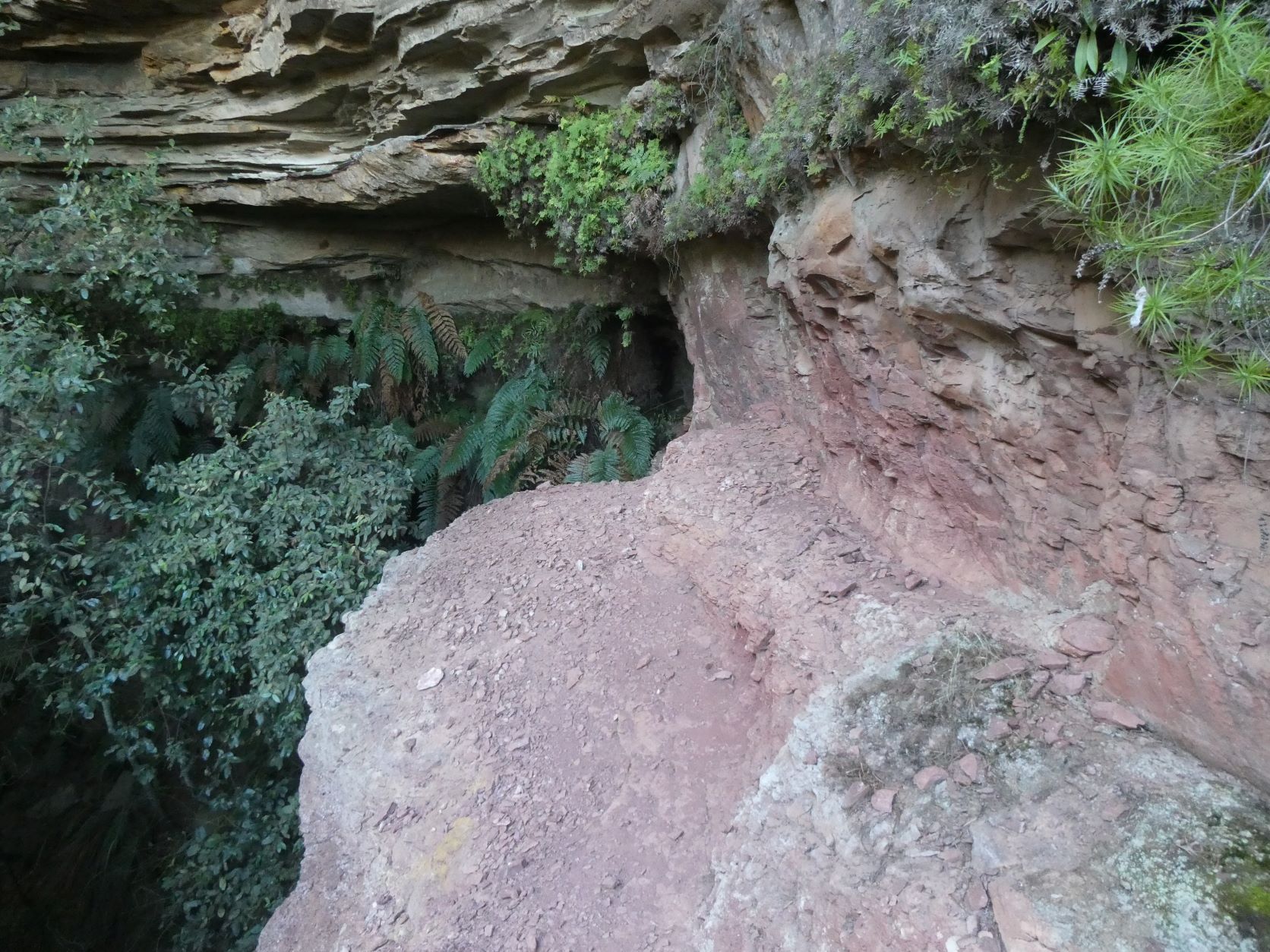
This didn’t feel nearly as steep when negotiating it. Note that the horizon is horizontal - no camera trickery!
More exposure with little chance of recovery from a slip.
Same corner from the opposite side.
The last section that requires the sure-footedness of a mountain goat…
…except for these bits.
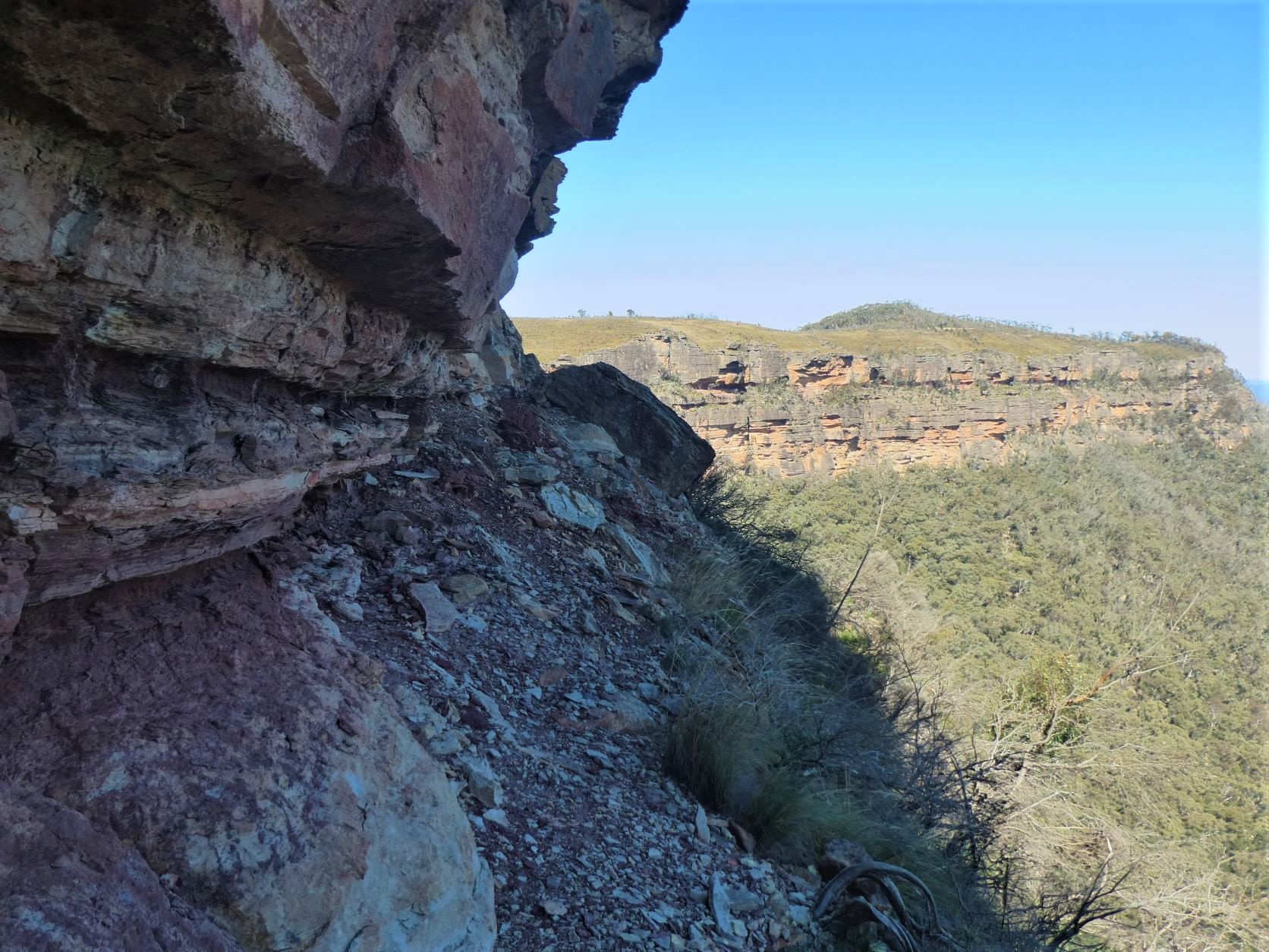
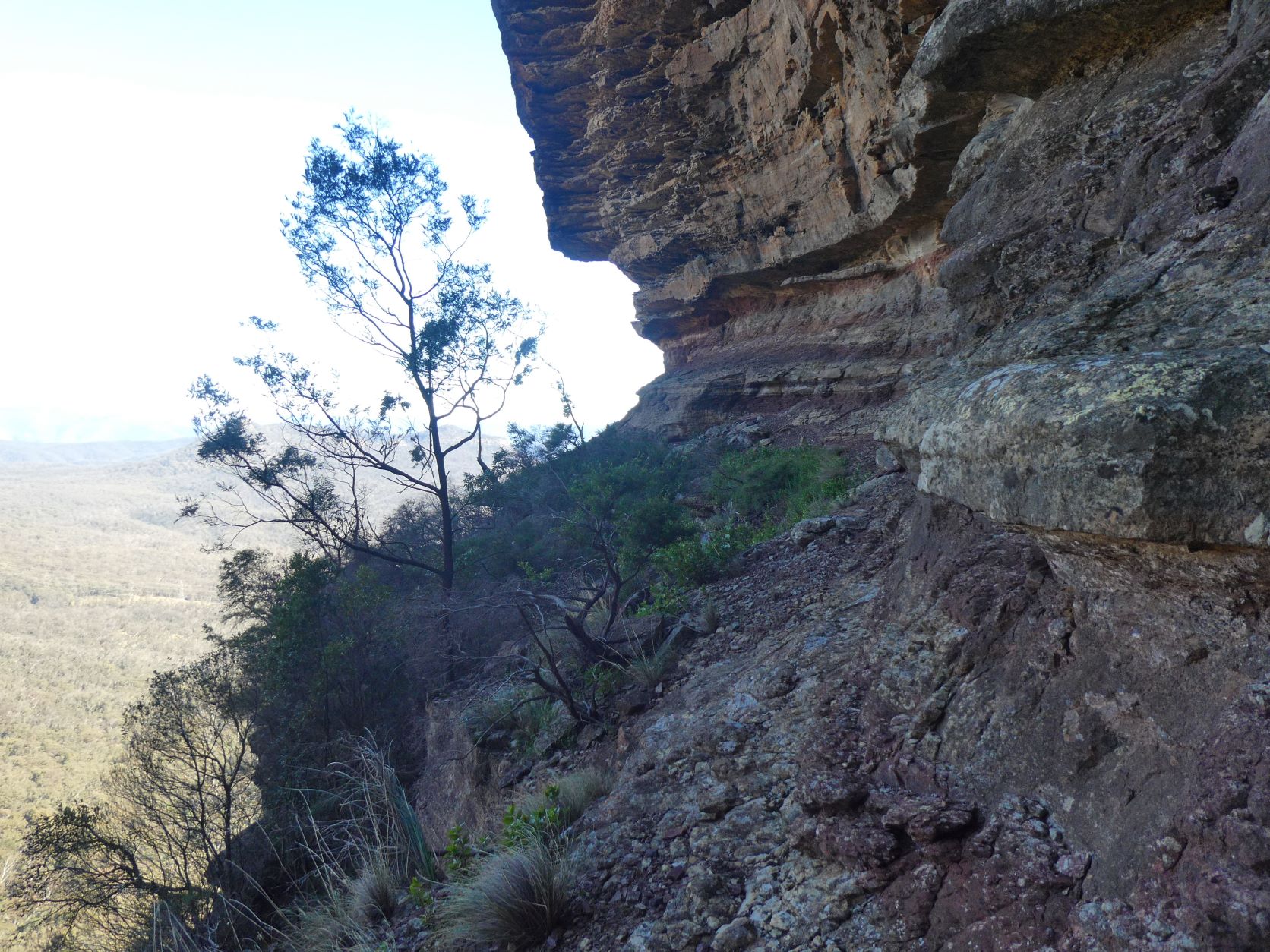
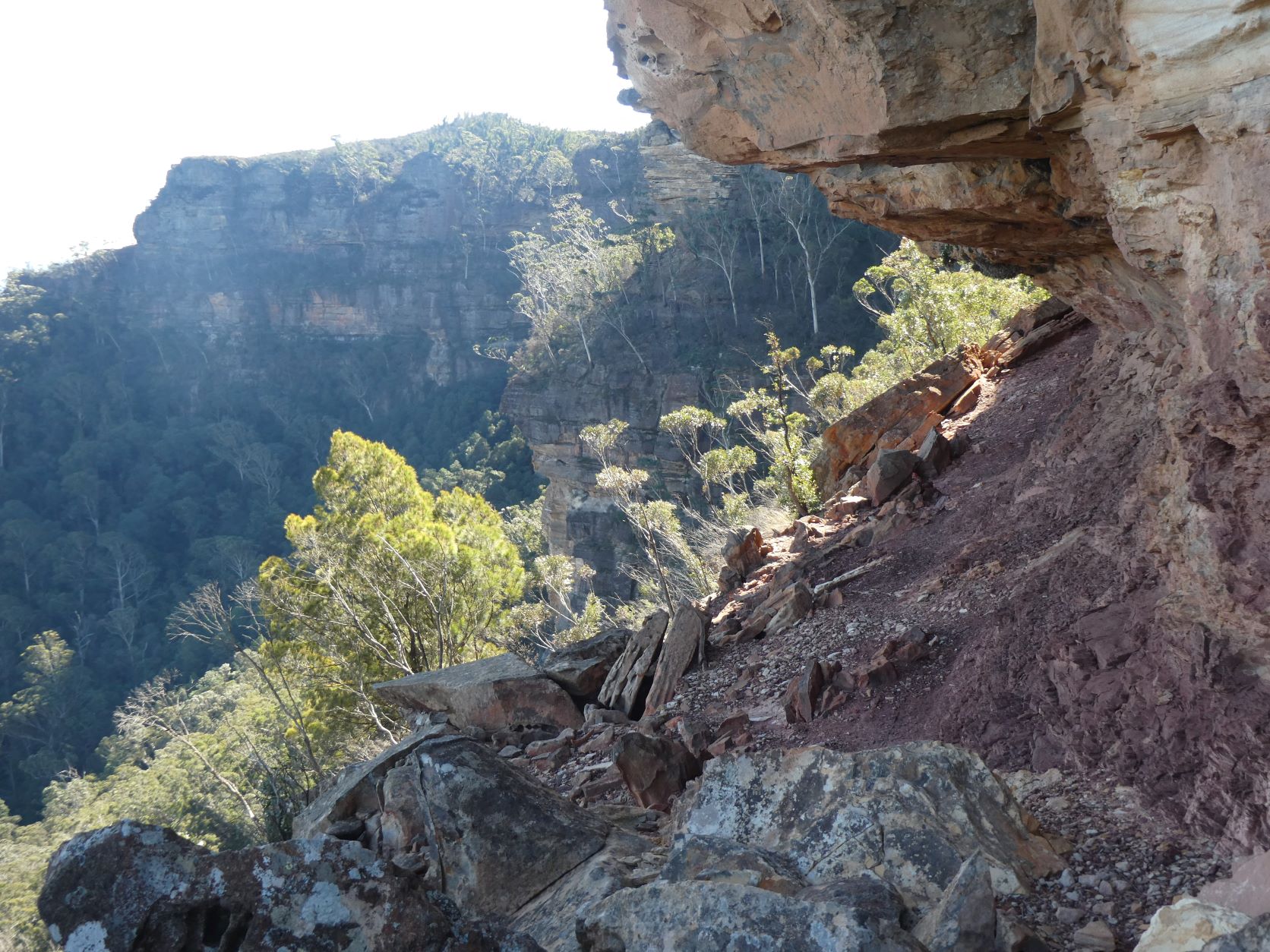
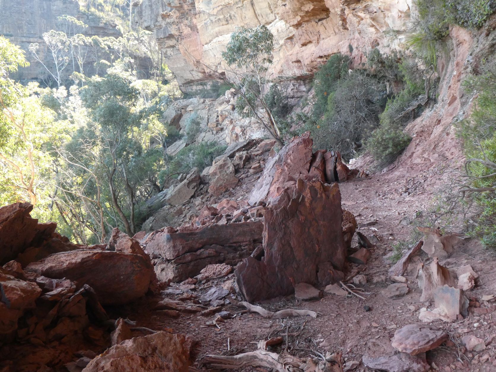
Soon after it started to get ‘normal’ although the ledge is still 100m above the talus. There’s plenty of protection against any slip for the remainder.
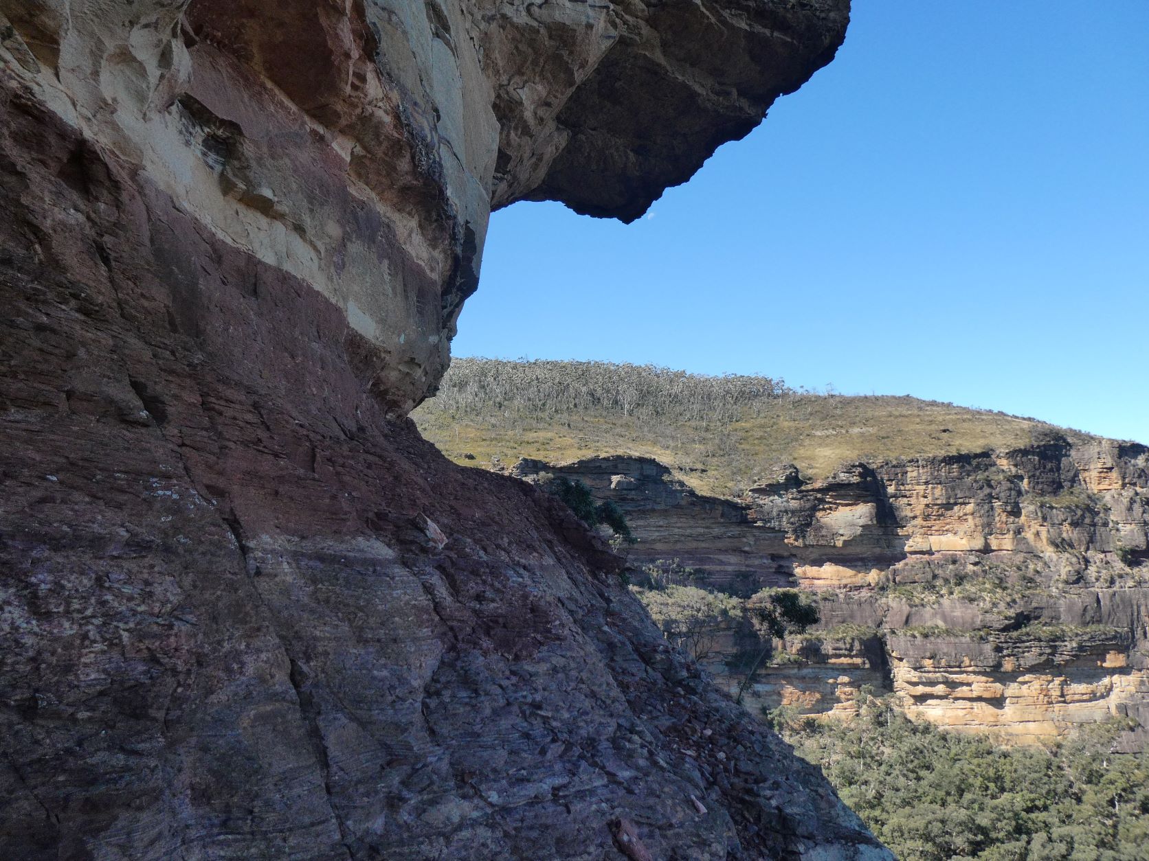
Eventually the Head appears into view. The exit to the plateau is getting closer.
The exit is this side of that pointy looking rock.
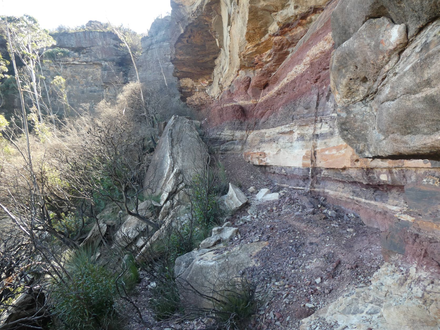
And after a short lunch at the exit gully, it’s easy to continue on along the well used section for 10 minutes towards the log book at the well known Pass. This is of course optional.
And finally to the exit from the ledge to get back to the talus. The logbook is easily missed - it’s on a high ledge buried under an obvious cairn, about 15m East this spot.
Retracing your footsteps is the quick return Narrowneck.
The complete route from Narrowneck firetrail to the well known Pass is straightforward with mostly minimal exposure, despite the above photos. Care is necessary. It is easily done in either direction. It is hard to get lost.
There’s little point taking a rope or tape - they are not required. And anyway - its a loose shale ledge has nothing to anchor off.
Stats
6.0km
300m of ascent.
Elapsed 2:00
Care
This is a route that has few route-finding and navigational challenges. There are no fallback alternatives and every section is reversible.
All of your party should be comfortable with exposure and be especially sure footed, particularly when traversing the multitude of steep, narrow and loose ledges.
A single pole or stout stick is particularly handy to provide a modicum of extra stability on the ledges to test footings.
And finally, this is not a Pass to be attempted on a wet or windy day.