
Copeland Pass - Eastern Route,
Today we took the much trickier Eastern Route, and returned up the nose from the South.
As a local, we’ve done Copeland Pass many times, but always chosen the easier Western Route.
Today we took the much trickier Eastern Route, and returned up the nose from the South.
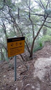
Leaving the car at Sublime Point Car Park, we headed under the bridge, down the slippery pine needles and past a newish sign reminding us how dangerous bush-walking actually is.
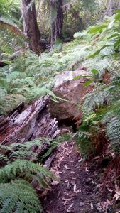
Copeland Pass - scary stuff
We went down the familiar descents, through the keyhole and beyond… almost to the climbers ledge. At the point when you can see the ridge above you and a 10m flat rock ahead, take the left fork up about 5m…
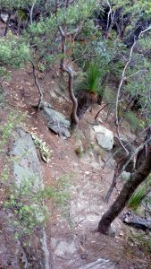
Copeland Pass - the right fork leads to the climbers ledge (West Route), the left fork lead upwards to flat rock and the S & E routes.
…and then S to the flat rock with 2 minimalist boulders for a spectacular 270 degree view of the Jamison and Kedumba valleys, Mt Solitary, Narrowneck, Kings Tableland, bits of Kanangra and a neck straining view of the apparently impossible route you’ve just descended.
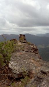
Sublime Point - the large flat lunch rock with speccy views in all directions. Mt Solitary is beyond…
After a cup of tea, drop of the E side of the rock & through an easy keyhole and follow the ramp down for 10 m.
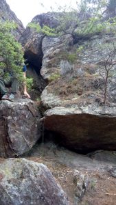
Copeland Pass - Keyhole below Flat Rock
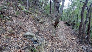
At this point turn hard left and head N for around 70m keeping close to the cliff. Apparently there is a track, but it’s v. faint and anyway - it’s covered with leaf litter. The ‘track’ then heads steeply down over the talus slope - it’s mostly a case of picking your way through the bits that aren’t precipitous & have a modicum of living branches to hang onto. When you get to the 20m cliff line head N for about 100m and keep an eye out for the next gully. At some point you’ll see the greener rain-forest below and a lack of trees with an under-story of ferns. Head steeply down towards them - this is where you’ll find a few lawyer vines and blackberries… and Lindemans track.
I would suggest that any track notes you come across that claim there is a track - even a faint or vague one - are overly optimistic. There is an occasional few meters of flattened leaves, and fewer than average body height branches; however, once you reach the steeper talus slope, just follow anything that works for you.
Copeland Pass meets Lindemans Pass at this rock & fallen tree
IF you should choose to ascend using this route - it easily found from Lindemans Track. The start point is around 400m from the cairn at the nose, Lindemans passes between the rotten fallen tree and the boulder - simply head up through the ferns, lawyer vines and blackberries, ascend the 60 degree slopes covered with slippery leaves, and loose dirt, navigate through a couple of precipitous cliff lines bearing S when at all possible and job done.
However, we chose to return via an easier route - at Lindemans we turned right and headed towards the nose of Sublime Point - Lindemans is mostly pleasant & easy walking.
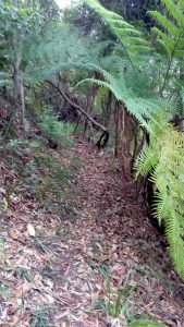
Lindemans Pass - another pleasant section
The cairn marking the Southern Route up the nose was obvious - as was the easy track back up through the keyhole and then back to the flat rock for lunch.
Cairn marking where Lindemans meets the South route up Copeland Pass
Alternatively, continue on to the Western route up Copeland - it’s slightly easier (& more boring) than this route.